Category:Locator maps of Qatar
Subcategories
This category has the following 2 subcategories, out of 2 total.
!
B
- Bilateral maps of Qatar (133 F)
Media in category "Locator maps of Qatar"
The following 27 files are in this category, out of 27 total.
-
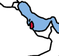
 Al Zubarah.png 554 × 638; 43 KB
-
 Katar cb.png 193 × 182; 5 KB
-
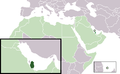 Location Qatar AW.png 385 × 238; 9 KB
-
 LocationQatar.png 250 × 115; 7 KB
-
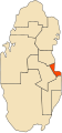
 Map of Al-Shahaniya Municipality.png 2,000 × 1,900; 236 KB
-
 QA-01.svg 942 × 2,005; 23 KB
-
 QA-02.svg 942 × 2,005; 23 KB
-
 QA-03.svg 942 × 2,005; 23 KB
-
 QA-04.svg 942 × 2,005; 23 KB
-
 QA-05.svg 942 × 2,005; 23 KB
-
 QA-06.svg 942 × 2,005; 23 KB
-
 QA-07.svg 942 × 2,005; 23 KB
-
 QA-08.svg 942 × 2,005; 23 KB
-
 QA-09.svg 942 × 2,005; 23 KB
-
 QA-10.svg 942 × 2,005; 23 KB
-
 Qatar - Location Map (2013) - QAT - UNOCHA.svg 800 × 800; 670 KB
-
 Qatar-Ad Dawhah.png 1,000 × 2,063; 89 KB
-
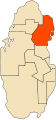
 Qatar-Al Ghuwariyah.png 1,000 × 2,063; 89 KB
-
 Qatar-Al Jumaliyah.png 1,000 × 2,063; 91 KB
-
 Qatar-Al Khawr.png 1,000 × 2,063; 91 KB
-
 Qatar-Al Wakrah.png 1,000 × 2,063; 91 KB
-
 Qatar-Ar Rayyan.png 1,000 × 2,063; 91 KB
-
 Qatar-Jariyan al Batnah.png 1,000 × 2,063; 91 KB
-
 Qatar-Madinat ash Shamal.png 1,000 × 2,063; 91 KB
-
 Qatar-Umm Salal.png 1,000 × 2,063; 91 KB
-
 World Factbook (1982) Qatar.jpg 589 × 588; 81 KB
-
 موقع الزبارة.png 521 × 600; 87 KB


_-_QAT_-_UNOCHA.svg)


_Qatar.jpg)
