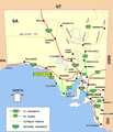
Category:Locator maps of South Australia
States of Australia: New South Wales · Queensland · South Australia · Victoria · Western Australia
Internal territories of Australia: Northern Territory
External territories of Australia: Ashmore and Cartier Islands · Christmas Island · Cocos (Keeling) Islands · Coral Sea Islands · Heard Island and McDonald Islands · Norfolk Island
Internal territories of Australia: Northern Territory
External territories of Australia: Ashmore and Cartier Islands · Christmas Island · Cocos (Keeling) Islands · Coral Sea Islands · Heard Island and McDonald Islands · Norfolk Island
Media in category "Locator maps of South Australia"
The following 49 files are in this category, out of 49 total.
-
Arno Baymap.png 533 × 600; 31 KB
-
Ash-Wed-fires-SA.png 584 × 756; 48 KB
-
Aus SA map.png 328 × 352; 26 KB
-
Australie méridionale copie.png 515 × 599; 121 KB
-
Bordertown location map in South Australia.PNG 800 × 931; 52 KB
-
Burra location map in South Australia.PNG 800 × 931; 51 KB
-
Ceduna location map in South Australia.PNG 800 × 931; 52 KB
-
Cleve Map.png 533 × 600; 31 KB
-
Coober pedy location map in South Australia.PNG 800 × 931; 52 KB
-
Darke Peak Map.png 533 × 600; 32 KB
-
Elliston location map in South Australia.PNG 800 × 931; 52 KB
-
Glendambo location map in South Australia.PNG 800 × 931; 52 KB
-
Hawker.PNG 800 × 931; 52 KB
-
Innamincka location map in South Australia.PNG 800 × 931; 52 KB
-
Lac Alexandrina.png 910 × 755; 53 KB
-
Lyndthurst location map in South Australia.PNG 800 × 931; 52 KB
-
Marla location map in South Australia.PNG 800 × 931; 51 KB
-
Marree location map in South Australia.PNG 800 × 931; 51 KB
-
Mid North region, South Australia.png 1,812 × 2,105; 653 KB
-
Mount Gambier, Australie méridionale.png 515 × 599; 121 KB
-
Mt gambier location map in South Australia.PNG 800 × 931; 52 KB
-
Murray bridge location map in South Australia.PNG 800 × 931; 52 KB
-
Murray Bridge, australie méridionale.png 515 × 599; 121 KB
-
Oodnadatta location map in South Australia.PNG 800 × 931; 52 KB
-
Oodnadatta Track.png 800 × 931; 82 KB
-
Parrachilna location map in South Australia.PNG 800 × 931; 52 KB
-
Pasky.png 482 × 482; 35 KB
-
Peterborough location map in South Australia.PNG 800 × 931; 52 KB
-
Pinnaroo location map in South Australia.PNG 800 × 931; 52 KB
-
Port Augusta locator-MJC.png 563 × 476; 15 KB
-
Port augusta location map in South Australia.PNG 800 × 931; 52 KB
-
Port Augusta, Australie méridionale.png 515 × 599; 121 KB
-
Port lincoln location map in South Australia.PNG 800 × 931; 52 KB
-
Port Lincoln; Australie méridionale.png 515 × 599; 120 KB
-
Port pirie location map in South Australia.PNG 800 × 931; 51 KB
-
Port Pirie.JPG 554 × 410; 27 KB
-
Renmark location map in South Australia.PNG 800 × 931; 52 KB
-
Roxby downs location map in South Australia.PNG 800 × 931; 52 KB
-
Sellicks map.jpg 516 × 599; 30 KB
-
Snowtown map with Aust.jpg 300 × 548; 31 KB
-
SouthAustraliaRoads.png 799 × 929; 21 KB
-
SouthAustraliaRoadsblinmanwilpena.png 799 × 929; 46 KB
-
Streaky Bay location.png 516 × 600; 101 KB
-
Victor Harbor, Australie Méridionale (carte).png 515 × 599; 123 KB
-
Whyalla location map in South Australia.PNG 800 × 931; 51 KB
-
Woomera location map in South Australia.PNG 800 × 931; 51 KB
-
Wudinna location map in South Australia.PNG 800 × 931; 52 KB
-
Wudinna, Australie méridionale..png 515 × 599; 121 KB
-
YankalillaLocus2.png 533 × 600; 30 KB


