Category:Locator maps of South Scotland constituency for the 2011 Scottish Parliament
Media in category "Locator maps of South Scotland constituency for the 2011 Scottish Parliament"
The following 22 files are in this category, out of 22 total.
-
 South Scotland (numbered) 2011.PNG 2,338 × 1,654; 132 KB
-
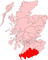
 South Scotland (Scottish Parliament electoral region).png 2,000 × 2,491; 553 KB
-
 South Scotland (Scottish Parliament) - numbered.svg 336 × 262; 76 KB
-
 Ayr (constituency) 2011.png 2,338 × 1,654; 49 KB
-
 Ayr (Scottish Parliament constituency).svg 336 × 262; 71 KB
-
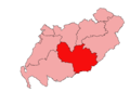
 Carrick, Cumnock and Doon Valley (constituency) 2011.png 2,338 × 1,654; 50 KB
-

-
 Clydesdale (constituency) 2011.png 2,338 × 1,654; 50 KB
-
 Clydesdale (Scottish Parliament constituency).svg 336 × 262; 72 KB
-
 Dumfries and Galloway 2011.svg 599 × 746; 809 KB
-
 Dumfriesshire (constituency) 2011.png 2,338 × 1,654; 49 KB
-
 Dumfriesshire (Scottish Parliament constituency).svg 336 × 262; 71 KB
-
 East Lothian (constituency) 2011.png 2,338 × 1,654; 49 KB
-
 East Lothian (Scottish Parliament constituency).svg 336 × 262; 71 KB
-
 Ettrick, Roxburgh and Berwickshire (constituency) 2011.png 2,338 × 1,654; 50 KB
-

-
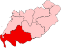
 Galloway and West Dumfries (constituency) 2011.png 2,338 × 1,654; 49 KB
-
 Galloway and West Dumfries (Scottish Parliament constituency).svg 336 × 262; 71 KB
-
 Kilmarnock and Irvine Valley (constituency) 2011.png 2,338 × 1,654; 49 KB
-
 Kilmarnock and Irvine Valley (Scottish Parliament constituency).svg 336 × 262; 71 KB
-
 Midlothian South, Tweeddale and Lauderdale (constituency) 2011.png 2,338 × 1,654; 50 KB
-

_2011.PNG)
.png)
_-_numbered.svg)
_2011.png)
.svg)
_2011.png)
.svg)
_2011.png)
.svg)

_2011.png)
.svg)
_2011.png)
.svg)
_2011.png)
.svg)
_2011.png)
.svg)
_2011.png)
.svg)
_2011.png)
.svg)