Category:Locator maps of arrondissements of Allier to 2016
Media in category "Locator maps of arrondissements of Allier to 2016"
The following 10 files are in this category, out of 10 total.
-
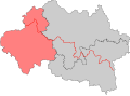
 Allier - Montluçon arrondissement.svg 512 × 373; 12 KB
-
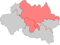
 Allier - Moulins arrondissement.svg 512 × 373; 12 KB
-
 Allier - Vichy arrondissement.svg 512 × 373; 12 KB
-
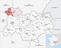
 Map arrondissement code 031.svg 873 × 640; 460 KB
-
 Map arrondissement code 032.svg 873 × 640; 460 KB
-
 Map arrondissement code 033.svg 873 × 640; 460 KB
-
 Locator map of Arrondissement Montluçon 2016.png 2,500 × 1,995; 1.5 MB
-
 Locator map of Arrondissement Moulins 2016.png 2,500 × 1,995; 1.5 MB
-
 Locator map of Arrondissement Vichy 2016.png 2,500 × 1,995; 1.5 MB
-
 Vichy (Arrondissement) Plan.svg 601 × 436; 101 KB


_Plan.svg)