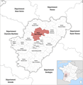
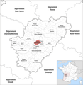
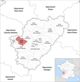
Category:Locator maps of cantons of Charente to 2017
Media in category "Locator maps of cantons of Charente to 2017"
The following 19 files are in this category, out of 19 total.
-
Locator map of Kanton Angoulême-1.png 2,500 × 2,573; 1.06 MB
-
Locator map of Kanton Angoulême-2.png 2,500 × 2,573; 1.06 MB
-
Locator map of Kanton Angoulême-3.png 2,500 × 2,573; 1.06 MB
-
Locator map of Kanton Boixe-et-Manslois.png 2,500 × 2,573; 1.07 MB
-
Locator map of Kanton Boëme-Échelle.png 2,500 × 2,573; 1.07 MB
-
Locator map of Kanton Charente-Bonnieure.png 2,500 × 2,573; 1.07 MB
-
Locator map of Kanton Charente-Champagne.png 2,500 × 2,573; 1.07 MB
-
Locator map of Kanton Charente-Nord.png 2,500 × 2,573; 1.07 MB
-
Locator map of Kanton Charente-Sud.png 2,500 × 2,573; 1.07 MB
-
Locator map of Kanton Charente-Vienne.png 2,500 × 2,573; 1.07 MB
-
Locator map of Kanton Cognac-1.png 2,500 × 2,573; 1.06 MB
-
Locator map of Kanton Cognac-2.png 2,500 × 2,573; 1.06 MB
-
Locator map of Kanton Gond-Pontouvre.png 2,500 × 2,573; 1.06 MB
-
Locator map of Kanton Jarnac.png 2,500 × 2,573; 1.07 MB
-
Locator map of Kanton La Couronne.png 2,500 × 2,573; 1.06 MB
-
Locator map of Kanton Touvre-et-Braconne.png 2,500 × 2,573; 1.06 MB
-
Locator map of Kanton Tude-et-Lavalette.png 2,500 × 2,573; 1.07 MB
-
Locator map of Kanton Val de Nouère.png 2,500 × 2,573; 1.07 MB
-
Locator map of Kanton Val de Tardoire.png 2,500 × 2,573; 1.07 MB


