Category:Locator maps of communities in Newport, Wales
Media in category "Locator maps of communities in Newport, Wales"
The following 29 files are in this category, out of 29 total.
-
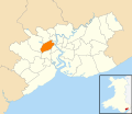 Wales Newport Community Allt-yr-Yn map.svg 512 × 443; 416 KB
-
 Wales Newport Community Alway map.svg 512 × 443; 416 KB
-
 Wales Newport Community Beechwood map.svg 512 × 443; 416 KB
-
 Wales Newport Community Bettws map.svg 512 × 443; 416 KB
-
 Wales Newport Community Bishton map.svg 512 × 443; 416 KB
-
 Wales Newport Community Caerleon map.svg 512 × 443; 416 KB
-
 Wales Newport Community Coedkernew map.svg 512 × 443; 416 KB
-
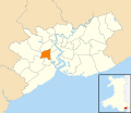 Wales Newport Community Gaer map.svg 512 × 443; 416 KB
-
 Wales Newport Community Goldcliff map.svg 512 × 443; 416 KB
-
 Wales Newport Community Graig map.svg 512 × 443; 416 KB
-
 Wales Newport Community Langstone map.svg 512 × 443; 416 KB
-
 Wales Newport Community Liswerry map.svg 512 × 443; 416 KB
-
 Wales Newport Community Llanvaches map.svg 512 × 443; 416 KB
-
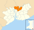
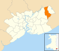
 Wales Newport Community Llanwern map.svg 512 × 443; 416 KB
-
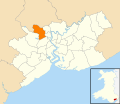
 Wales Newport Community Malpas map.svg 512 × 443; 416 KB
-
 Wales Newport Community Marshfield map.svg 512 × 443; 416 KB
-
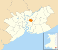
 Wales Newport Community Michaelstone-y-Fedw map.svg 512 × 443; 416 KB
-
 Wales Newport Community Nash map.svg 512 × 443; 416 KB
-
 Wales Newport Community Penhow map.svg 512 × 443; 416 KB
-
 Wales Newport Community Pillgwenlly map.svg 512 × 443; 416 KB
-
 Wales Newport Community Redwick map.svg 512 × 443; 416 KB
-
 Wales Newport Community Ringland map.svg 512 × 443; 416 KB
-
 Wales Newport Community Rogerstone map.svg 512 × 443; 416 KB
-
 Wales Newport Community Shaftesbury map.svg 512 × 443; 416 KB
-
 Wales Newport Community St Julians map.svg 512 × 443; 416 KB
-
 Wales Newport Community Stow Hill map.svg 512 × 443; 416 KB
-
 Wales Newport Community Tredegar Park map.svg 512 × 443; 416 KB
-
 Wales Newport Community Victoria map.svg 512 × 443; 416 KB
-
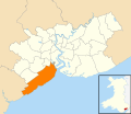 Wales Newport Community Wentlooge map.svg 512 × 443; 416 KB


