Category:Locator maps of counties of Illinois

States of the United States: Alabama · Alaska · Arizona · Arkansas · California · Colorado · Connecticut · Delaware · Florida · Georgia · Hawaii · Idaho · Illinois · Indiana · Iowa · Kansas · Kentucky · Louisiana · Maine · Maryland · Massachusetts · Michigan · Minnesota · Mississippi · Missouri · Montana · Nebraska · Nevada · New Hampshire · New Jersey · New Mexico · New York · North Carolina · North Dakota · Ohio · Oklahoma · Oregon · Pennsylvania · Rhode Island · South Carolina · South Dakota · Tennessee · Texas · Utah · Vermont · Virginia · Washington · West Virginia · Wisconsin · Wyoming
| NO WIKIDATA ID FOUND! Search for Locator maps of counties of Illinois on Wikidata | |
| Upload media |
English: Locator maps for counties in Illinois.
Media in category "Locator maps of counties of Illinois"
The following 200 files are in this category, out of 220 total.
(previous page) (next page)-
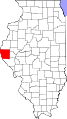
 Adams County Illinois.png 167 × 300; 22 KB
-
 Alexander County Illinois.png 167 × 300; 22 KB
-
 Bond County Illinois.png 167 × 300; 17 KB
-
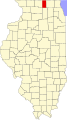
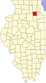
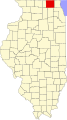
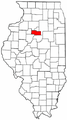
 Boone County Illinois.png 167 × 300; 19 KB
-
 Brown County Illinois.png 167 × 300; 21 KB
-
 Bureau County Illinois.png 167 × 300; 20 KB
-
 Calhoun County Illinois.png 167 × 300; 20 KB
-
 Carroll County Illinois.png 167 × 300; 22 KB
-
 Cass County Illinois.png 167 × 300; 20 KB
-
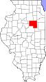
 Champaign County Illinois.png 167 × 300; 21 KB
-
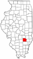
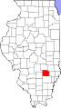
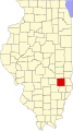
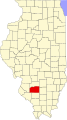
 Christian County Illinois.png 167 × 300; 21 KB
-
 Clark County Illinois.png 167 × 300; 20 KB
-
 Clay County Illinois.png 167 × 300; 19 KB
-
 Clinton County Illinois.png 167 × 300; 19 KB
-
 Coles County Illinois.png 167 × 300; 20 KB
-
 Cook County Illinois.png 167 × 300; 22 KB
-
 Crawford County Illinois.png 167 × 300; 22 KB
-
 Cumberland County Illinois.png 167 × 300; 17 KB
-
 De Witt County Illinois.png 167 × 300; 20 KB
-
 Dekalb County Illinois.png 167 × 300; 18 KB
-
 Douglas County Illinois.png 167 × 300; 18 KB
-

-

-

-

-
 Dupage County Illinois.png 167 × 300; 20 KB
-
 Edgar County Illinois.png 167 × 300; 21 KB
-
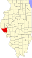
 Edwards County Illinois.png 167 × 300; 18 KB
-
 Edwards County, IL - Albion Precinct.png 417 × 784; 14 KB
-
 Effingham County Illinois.png 167 × 300; 21 KB
-
 Fayette County Illinois.png 167 × 300; 19 KB
-
 Ford County Illinois.png 167 × 300; 18 KB
-
 Franklin County Illinois.png 167 × 300; 21 KB
-
 Fulton County Illinois.png 167 × 300; 21 KB
-
 Gallatin County Illinois.png 167 × 300; 21 KB
-
 Greene County Illinois.png 167 × 300; 21 KB
-
 Grundy County Illinois.png 167 × 300; 21 KB
-
 Hamilton County Illinois.png 167 × 300; 18 KB
-
 Hancock County Illinois.png 167 × 300; 22 KB
-
 Hardin County Illinois.png 167 × 300; 19 KB
-
 Henderson County Illinois.png 167 × 300; 19 KB
-
 Henry County Illinois.png 167 × 300; 21 KB
-
 IL counties four rivers conf.png 336 × 599; 38 KB
-
 Illinois-counties-map.gif 486 × 815; 52 KB
-

-
 Iroquois County Illinois.png 167 × 300; 18 KB
-
 Jackson County Illinois.png 167 × 300; 21 KB
-
 Jasper County Illinois.png 167 × 300; 22 KB
-
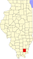
 Jefferson County Illinois.png 167 × 300; 20 KB
-
 Jersey County Illinois.png 167 × 300; 19 KB
-
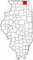
 Jo Daviess County Illinois.png 167 × 300; 21 KB
-
 Johnson County Illinois.png 167 × 300; 21 KB
-
 Kane County Illinois.png 167 × 300; 20 KB
-
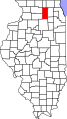
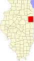
 Kankakee County Illinois.png 167 × 300; 21 KB
-
 Kendall County Illinois.png 167 × 300; 20 KB
-
 Knox County Illinois.png 167 × 300; 20 KB
-
 La Salle County Illinois.png 167 × 300; 21 KB
-
 Lake County Illinois.png 167 × 300; 21 KB
-
-
 Lawrence County Illinois.png 167 × 300; 19 KB
-
 Lee County Illinois.png 167 × 300; 20 KB
-
 Livingston County Illinois.png 167 × 300; 21 KB
-
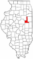
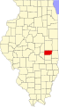
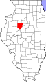
 Logan County Illinois.png 167 × 300; 21 KB
-
 Macon County Illinois.png 167 × 300; 17 KB
-
 Macoupin County Illinois.png 167 × 300; 17 KB
-
 Madison County Illinois.png 167 × 300; 21 KB
-
 Map of Illinois highlighting Adams County.svg 576 × 1,026; 64 KB
-
 Map of Illinois highlighting Alexander County.svg 576 × 1,026; 64 KB
-
 Map of Illinois highlighting Bond County.svg 576 × 1,026; 64 KB
-
 Map of Illinois highlighting Boone County.svg 576 × 1,026; 64 KB
-
 Map of Illinois highlighting Brown County.svg 576 × 1,026; 64 KB
-
 Map of Illinois highlighting Bureau County.svg 576 × 1,026; 64 KB
-
 Map of Illinois highlighting Calhoun County.svg 576 × 1,026; 64 KB
-
 Map of Illinois highlighting Carroll County.svg 576 × 1,026; 64 KB
-
 Map of Illinois highlighting Cass County.svg 576 × 1,026; 64 KB
-
 Map of Illinois highlighting Champaign County.svg 576 × 1,026; 64 KB
-
 Map of Illinois highlighting Christian County.svg 576 × 1,026; 64 KB
-
 Map of Illinois highlighting Clark County.svg 576 × 1,026; 64 KB
-
 Map of Illinois highlighting Clay County.svg 576 × 1,026; 64 KB
-
 Map of Illinois highlighting Clinton County.svg 576 × 1,026; 64 KB
-
 Map of Illinois highlighting Coles County.svg 576 × 1,026; 64 KB
-
 Map of Illinois highlighting Cook County.svg 576 × 1,026; 64 KB
-
 Map of Illinois highlighting Crawford County.svg 576 × 1,026; 64 KB
-
 Map of Illinois highlighting Cumberland County.svg 576 × 1,026; 64 KB
-
 Map of Illinois highlighting DeKalb County.svg 576 × 1,026; 64 KB
-
 Map of Illinois highlighting DeWitt County.svg 576 × 1,026; 64 KB
-
 Map of Illinois highlighting Douglas County.svg 576 × 1,026; 64 KB
-
 Map of Illinois highlighting DuPage County.svg 576 × 1,026; 64 KB
-
 Map of Illinois highlighting Edgar County.svg 576 × 1,026; 64 KB
-
 Map of Illinois highlighting Edwards County.svg 576 × 1,026; 64 KB
-
 Map of Illinois highlighting Effingham County.svg 576 × 1,026; 64 KB
-
 Map of Illinois highlighting Fayette County.svg 576 × 1,026; 64 KB
-
 Map of Illinois highlighting Ford County.svg 576 × 1,026; 64 KB
-
 Map of Illinois highlighting Franklin County.svg 576 × 1,026; 64 KB
-
 Map of Illinois highlighting Fulton County.svg 576 × 1,026; 64 KB
-
 Map of Illinois highlighting Gallatin County.svg 576 × 1,026; 64 KB
-
 Map of Illinois highlighting Greene County.svg 576 × 1,026; 64 KB
-
 Map of Illinois highlighting Grundy County.svg 576 × 1,026; 64 KB
-
 Map of Illinois highlighting Hamilton County.svg 576 × 1,026; 64 KB
-
 Map of Illinois highlighting Hancock County.svg 576 × 1,026; 64 KB
-
 Map of Illinois highlighting Hardin County.svg 576 × 1,026; 64 KB
-
 Map of Illinois highlighting Henderson County.svg 576 × 1,026; 64 KB
-
 Map of Illinois highlighting Henry County.svg 576 × 1,026; 64 KB
-
 Map of Illinois highlighting Iroquois County.svg 576 × 1,026; 64 KB
-
 Map of Illinois highlighting Jackson County.svg 576 × 1,026; 64 KB
-
 Map of Illinois highlighting Jasper County.svg 576 × 1,026; 64 KB
-
 Map of Illinois highlighting Jefferson County.svg 576 × 1,026; 64 KB
-
 Map of Illinois highlighting Jersey County.svg 576 × 1,026; 64 KB
-
 Map of Illinois highlighting Jo Daviess County.svg 576 × 1,026; 64 KB
-
 Map of Illinois highlighting Johnson County.svg 576 × 1,026; 64 KB
-
 Map of Illinois highlighting Kane County.svg 576 × 1,026; 64 KB
-
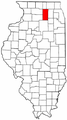
 Map of Illinois highlighting Kankakee County.svg 576 × 1,026; 64 KB
-
 Map of Illinois highlighting Kendall County.svg 576 × 1,026; 64 KB
-
 Map of Illinois highlighting Knox County.svg 576 × 1,026; 64 KB
-
 Map of Illinois highlighting Lake County.svg 576 × 1,026; 64 KB
-
 Map of Illinois highlighting LaSalle County.svg 576 × 1,026; 64 KB
-
 Map of Illinois highlighting Lawrence County.svg 576 × 1,026; 64 KB
-
 Map of Illinois highlighting Lee County.svg 576 × 1,026; 64 KB
-
 Map of Illinois highlighting Livingston County.svg 576 × 1,026; 64 KB
-
 Map of Illinois highlighting Logan County.svg 576 × 1,026; 64 KB
-
 Map of Illinois highlighting Macon County.svg 576 × 1,026; 64 KB
-
 Map of Illinois highlighting Macoupin County.svg 576 × 1,026; 64 KB
-
 Map of Illinois highlighting Madison County.svg 576 × 1,026; 64 KB
-
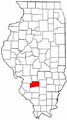
 Map of Illinois highlighting Marion County.svg 576 × 1,026; 64 KB
-
 Map of Illinois highlighting Marshall County.svg 576 × 1,026; 64 KB
-
 Map of Illinois highlighting Mason County.svg 576 × 1,026; 64 KB
-
 Map of Illinois highlighting Massac County.svg 576 × 1,026; 64 KB
-
 Map of Illinois highlighting McDonough County.svg 576 × 1,026; 64 KB
-
 Map of Illinois highlighting McHenry County.svg 576 × 1,026; 64 KB
-
 Map of Illinois highlighting McLean County.svg 576 × 1,026; 64 KB
-
 Map of Illinois highlighting Menard County.svg 576 × 1,026; 64 KB
-
 Map of Illinois highlighting Mercer County.svg 576 × 1,026; 64 KB
-
 Map of Illinois highlighting Monroe County.svg 576 × 1,026; 64 KB
-
 Map of Illinois highlighting Montgomery County.svg 576 × 1,026; 64 KB
-
 Map of Illinois highlighting Morgan County.svg 576 × 1,026; 64 KB
-
 Map of Illinois highlighting Moultrie County.svg 576 × 1,026; 64 KB
-
 Map of Illinois highlighting Ogle County.svg 576 × 1,026; 64 KB
-
 Map of Illinois highlighting Peoria County.svg 576 × 1,026; 64 KB
-
 Map of Illinois highlighting Perry County.svg 576 × 1,026; 64 KB
-
 Map of Illinois highlighting Piatt County.svg 576 × 1,026; 64 KB
-
 Map of Illinois highlighting Pike County.svg 576 × 1,026; 64 KB
-
 Map of Illinois highlighting Pope County.svg 576 × 1,026; 64 KB
-
 Map of Illinois highlighting Pulaski County.svg 576 × 1,026; 64 KB
-
 Map of Illinois highlighting Putnam County.svg 576 × 1,026; 64 KB
-
 Map of Illinois highlighting Randolph County.svg 576 × 1,026; 64 KB
-
 Map of Illinois highlighting Richland County.svg 576 × 1,026; 64 KB
-
 Map of Illinois highlighting Rock Island County.svg 576 × 1,026; 64 KB
-
 Map of Illinois highlighting Saline County.svg 576 × 1,026; 64 KB
-
 Map of Illinois highlighting Sangamon County.svg 576 × 1,026; 64 KB
-
 Map of Illinois highlighting Schuyler County.svg 576 × 1,026; 64 KB
-
 Map of Illinois highlighting Scott County.svg 576 × 1,026; 64 KB
-
 Map of Illinois highlighting Shelby County.svg 576 × 1,026; 64 KB
-
 Map of Illinois highlighting St. Clair County.svg 576 × 1,026; 64 KB
-
 Map of Illinois highlighting Stark County.svg 576 × 1,026; 64 KB
-
 Map of Illinois highlighting Stephenson County.svg 576 × 1,026; 64 KB
-
 Map of Illinois highlighting Tazewell County.svg 576 × 1,026; 64 KB
-
 Map of Illinois highlighting Union County.svg 576 × 1,026; 64 KB
-
 Map of Illinois highlighting Vermilion County.svg 576 × 1,026; 64 KB
-
 Map of Illinois highlighting Wabash County.svg 576 × 1,026; 64 KB
-
 Map of Illinois highlighting Warren County.svg 576 × 1,026; 64 KB
-
 Map of Illinois highlighting Washington County.svg 576 × 1,026; 64 KB
-
 Map of Illinois highlighting Wayne County.svg 576 × 1,026; 64 KB
-
 Map of Illinois highlighting White County.svg 576 × 1,026; 64 KB
-
 Map of Illinois highlighting Whiteside County.svg 576 × 1,026; 64 KB
-
 Map of Illinois highlighting Will County.svg 576 × 1,026; 64 KB
-
 Map of Illinois highlighting Williamson County.svg 576 × 1,026; 64 KB
-
 Map of Illinois highlighting Winnebago County.svg 576 × 1,026; 64 KB
-
 Map of Illinois highlighting Woodford County.svg 576 × 1,026; 64 KB
-
 Map of the counties in the Northern Illinois Conference.png 336 × 599; 42 KB
-
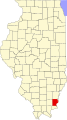
 Marion County Illinois.png 167 × 300; 21 KB
-
 Marshall County Illinois.png 167 × 300; 21 KB
-
 Mason County Illinois.png 167 × 300; 21 KB
-
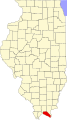
 Massac County Illinois.png 167 × 300; 21 KB
-
 McDonough County Illinois.png 167 × 300; 22 KB
-
 McHenry County Illinois.png 167 × 300; 18 KB
-
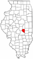
 McLean County Illinois.png 167 × 300; 21 KB
-
 Menard County Illinois.png 167 × 300; 20 KB
-
 Mercer County Illinois.png 167 × 300; 22 KB
-
 Monroe County Illinois.png 167 × 300; 21 KB
-
 Montgomery County Illinois.png 167 × 300; 18 KB
-
 Morgan County Illinois.png 167 × 300; 21 KB
-
 Moultrie County Illinois.png 167 × 300; 21 KB
-
 Northwest 8 Conference.png 336 × 599; 38 KB
-
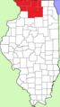
 Northwest Illinois Conference locations.png 336 × 599; 38 KB
-
 Ogle County Illinois.png 167 × 300; 21 KB
-
 Peoria County Illinois.png 167 × 300; 23 KB
-
 Perry County Illinois.png 167 × 300; 19 KB
-
 Piatt County Illinois.png 167 × 300; 20 KB
-
 Pike County Illinois.png 167 × 300; 21 KB
-
 Pope County Illinois.png 167 × 300; 22 KB
-
 Private School League locations.png 336 × 599; 39 KB
-
 Pulaski County Illinois.png 167 × 300; 21 KB
-
 Putnam County Illinois.png 167 × 300; 21 KB
-

-
 Randolph County Illinois.png 167 × 300; 21 KB
-
 Richland County Illinois.png 167 × 300; 18 KB
-
 Rock Island County Illinois.png 167 × 300; 22 KB
-
 Saline County Illinois.png 167 × 300; 21 KB
-
 Sangamon County Illinois.png 167 × 300; 22 KB
-
 Schuyler County Illinois.png 167 × 300; 21 KB


