Category:Locator maps of districts of Zulia (state)
| NO WIKIDATA ID FOUND! Search for Locator maps of districts of Zulia (state) on Wikidata | |
| Upload media |

Subcategories
This category has only the following subcategory.
Media in category "Locator maps of districts of Zulia (state)"
The following 9 files are in this category, out of 9 total.
-
 Distrito Bolívar 1904-1978.PNG 319 × 367; 8 KB
-
 Distrito Bolívar.PNG 319 × 367; 8 KB
-
 Distrito Catatumbo.PNG 319 × 367; 8 KB
-
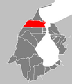
 Distrito Colón 1980-1989.PNG 319 × 367; 8 KB
-
 Distrito Lagunillas.PNG 319 × 367; 8 KB
-
 Distrito Mara.PNG 319 × 367; 8 KB
-
 Distrito Maracaibo.PNG 319 × 367; 8 KB
-
 Distrito Perijá 1904-1927.PNG 319 × 367; 8 KB
-
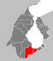
 Distrito Sucre.PNG 319 × 367; 8 KB


