Category:Locator maps of divisions of Bangladesh
| Locator maps of divisions (=8) | |||||||||||||||||||
| Locator maps of districts ("zilas") (=64) | |||||||||||||||||||
| Locator maps of sub-districts ("upazilas") (=495) | Locator maps of city corporations (metropolis) (=12) | ||||||||||||||||||
| Locator maps of unions (rural areas) (=4,571) | Locator maps of municipalities (towns) (=330) | ||||||||||||||||||
Subcategories
This category has only the following subcategory.
!
Media in category "Locator maps of divisions of Bangladesh"
The following 13 files are in this category, out of 13 total.
-
 Chattogram in Bangladesh only boders.svg 1,205 × 1,637; 1.14 MB
-
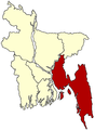
 Chittagong region.png 1,280 × 1,740; 581 KB
-
 Comilla division.png 800 × 1,087; 260 KB
-
 Faridpur Division.png 441 × 599; 118 KB
-
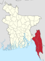
 Location of Chittagong Division in the map of Bangladesh.png 867 × 1,197; 317 KB
-
 LocMap Bangladesh Barisal.png 247 × 337; 29 KB
-
 LocMap Bangladesh Chittangong.png 247 × 337; 29 KB
-
 LocMap Bangladesh Dhaka small.png 247 × 337; 38 KB
-
 LocMap Bangladesh Dhaka.png 247 × 337; 29 KB
-
 LocMap Bangladesh Khulna.png 247 × 337; 29 KB
-
 LocMap Bangladesh Rajshahi.png 247 × 337; 28 KB
-
 LocMap Bangladesh Sylhet.png 247 × 337; 29 KB
-
 Sylhet Division map.png 628 × 876; 33 KB


