Category:Locator maps of former countries of South America (gray and green globe scheme)
Subcategories
This category has only the following subcategory.
Media in category "Locator maps of former countries of South America (gray and green globe scheme)"
The following 7 files are in this category, out of 7 total.
-
 Alto Perú mapa.png 1,000 × 1,000; 44 KB
-
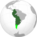
 Federación de los Andes.png 1,816 × 1,620; 219 KB
-
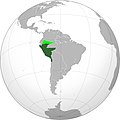 Republic of Peru 1824- 1836 (orthographic proyection).JPG 2,000 × 2,000; 243 KB
-
 Republic of Peru 1824- 1836 (orthographic proyection).png 2,000 × 2,000; 448 KB
-
 Republica Peruana de 1838-1839.png 2,000 × 2,000; 447 KB
-
 Rio-Grandense-Republic-Map.jpg 554 × 554; 75 KB
-
 Virreynato del Perú.svg 722 × 722; 258 KB


.JPG)
.png)


