Category:Locator maps of former parliamentary constituencies of England 1954
Maps of constituencies as created by the First Periodic Review of Westminster constituencies.
Media in category "Locator maps of former parliamentary constituencies of England 1954"
The following 19 files are in this category, out of 19 total.
-
 Beckenham1955Constiuency.svg 137 × 83; 42 KB
-
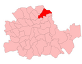
 BethnalGreen1955.png 700 × 550; 26 KB
-
 Bexley1955Constiuency.svg 137 × 83; 42 KB
-
 Billericay1955Constituency.svg 118 × 91; 45 KB
-
 BrentfordChiswick1955Constituency.svg 700 × 739; 31 KB
-
 Bromley1955Constiuency.svg 137 × 83; 42 KB
-
 Chislehurst1955Constiuency.svg 137 × 83; 42 KB
-
 EnfieldWest1955Constituency.svg 700 × 739; 31 KB
-
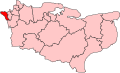
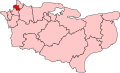
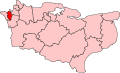
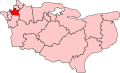
 ErithCrayford1955Constiuency.svg 137 × 83; 42 KB
-
 Feltham1955Constituency.svg 700 × 739; 31 KB
-
 Final Middlesex constituencies (1955-74).svg 633 × 659; 94 KB
-
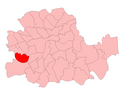 Fulham1955.png 700 × 550; 26 KB
-
 HackneyCentral1955.png 700 × 550; 26 KB
-
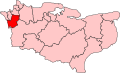
 HammersmithNorth1955.png 700 × 550; 26 KB
-
 Orpington1955Constiuency.svg 137 × 83; 42 KB
-
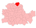 StokeNewingtonHackneyN1955.png 700 × 550; 26 KB
-
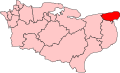 Thanet1955Constiuency.svg 137 × 83; 42 KB
-
 Tonbridge1955Constiuency.svg 137 × 83; 42 KB
-
 Uxbridge1955Constituency.svg 700 × 739; 31 KB


.svg)


