Category:Locator maps of historical provinces of Finland
Countries of Europe: Finland
Subcategories
This category has only the following subcategory.
Media in category "Locator maps of historical provinces of Finland"
The following 62 files are in this category, out of 62 total.
-
 Ahvenanmaa.PNG 162 × 287; 8 KB
-
 Benazko Finlandiantzinakoprobintzia.PNG 318 × 411; 26 KB
-
 Carélie en Finlande au 17e siècle.png 275 × 400; 15 KB
-
 Egentliga-finland terkep.png 275 × 400; 12 KB
-
 Kareliantzinakoprobintzia.PNG 308 × 408; 25 KB
-
 Finlandiako Antzinako Probintzia Suediarrak.PNG 299 × 407; 26 KB
-
 Historical province of Finland Proper in Finland.png 1,957 × 3,429; 291 KB
-
 Historical province of Finland Proper, Finland.svg 1,675 × 2,901; 449 KB
-
 Historical province of Karelia in Finland.png 1,957 × 3,429; 291 KB
-
 Historical province of Karelia, Finland.svg 1,675 × 2,901; 449 KB
-
 Historical province of Laponia in Finland.png 1,957 × 3,429; 292 KB
-
 Historical province of Laponia, Finland.svg 1,675 × 2,901; 449 KB
-
 Historical province of Ostrobothnia in Finland.png 1,957 × 3,429; 292 KB
-
 Historical province of Ostrobothnia, Finland.svg 1,675 × 2,901; 449 KB
-
 Historical province of Satakunta in Finland.png 1,957 × 3,429; 291 KB
-
 Historical province of Satakunta, Finland.svg 1,675 × 2,901; 449 KB
-
 Historical province of Savonia in Finland.png 1,957 × 3,429; 291 KB
-
 Historical province of Savonia, Finland.svg 1,675 × 2,901; 449 KB
-
 Historical province of Tavastia in Finland.png 1,957 × 3,429; 272 KB
-
 Historical province of Tavastia, Finland.svg 1,675 × 2,901; 449 KB
-
 Historical province of Uusimaa in Finland.png 1,957 × 3,429; 291 KB
-
 Historical province of Uusimaa, Finland.svg 1,675 × 2,901; 449 KB
-
 Historical province of Åland in Finland.png 1,957 × 3,429; 292 KB
-
 Historical province of Åland, Finland.svg 1,675 × 2,901; 449 KB
-
 Historische Landschaft Österbotten.png 275 × 400; 13 KB
-
 Häme Tavastia sijainti location.JPG 280 × 406; 16 KB
-
 Häme.PNG 162 × 287; 8 KB
-
 Hämeantzinakoprobintzia.PNG 318 × 411; 26 KB
-
 Karelen terkep.png 275 × 400; 12 KB
-
 Karelia (Historical province of Finland).jpg 250 × 426; 27 KB
-
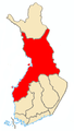
 Karjala.PNG 162 × 287; 8 KB
-
 Laponiantzinakoprobintzia.PNG 308 × 411; 24 KB
-
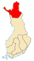 Lappi.PNG 162 × 287; 8 KB
-
 Lounais-Suomen poliisilaitos.svg 1,800 × 3,375; 55 KB
-
 Norra-finland terkep.png 275 × 400; 12 KB
-
 Nyland terkep.png 275 × 400; 12 KB
-
 Pohjanmaa hist.png 180 × 271; 61 KB
-
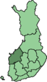
 Pohjanmaa.PNG 162 × 287; 8 KB
-
 Savo sijainti.JPG 280 × 406; 16 KB
-
 Savo.PNG 162 × 287; 8 KB
-
 Savolax terkep.png 275 × 400; 12 KB
-
 Suomi läänit 1997 Häme.png 230 × 400; 3 KB
-
 Suomi läänit 1997 Kuopio.png 230 × 400; 3 KB
-
 Suomi läänit 1997 Kymi.png 230 × 400; 3 KB
-
 Suomi läänit 1997 Mikkeli.png 230 × 400; 3 KB
-
 Suomi läänit 1997 Turku-Pori.png 230 × 400; 3 KB
-
 Suomi läänit 1997 Uusimaa.png 230 × 400; 3 KB
-
 Suomi läänit 1997 Vaasa.png 230 × 400; 3 KB
-
 Svpmap finland proper.png 275 × 400; 17 KB
-
 Svpmap karelia.png 275 × 400; 17 KB
-
 Svpmap nyland.png 275 × 400; 17 KB
-
 Svpmap satakunda.png 275 × 400; 17 KB
-
 Svpmap tavastland.png 275 × 400; 17 KB
-
 Svpmap vaesterbotten-es.png 275 × 400; 15 KB
-
 Svpmap vaesterbotten.png 275 × 400; 12 KB
-
 Svpmap österbotten sv.png 275 × 400; 40 KB
-
 Svpmap österbotten.png 275 × 400; 17 KB
-
 Tavastland terkep.png 275 × 400; 12 KB
-
 Uusimaa en Finlande au 17e siècle.png 275 × 400; 15 KB
-
 Uusimaa.PNG 162 × 287; 8 KB
-
 Varsinais-Suomi historique.png 277 × 400; 16 KB
-
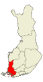
 Varsinais-Suomi.PNG 162 × 287; 8 KB


.jpg)


