Category:Locator maps of islands of Kiribati
Media in category "Locator maps of islands of Kiribati"
The following 13 files are in this category, out of 13 total.
-
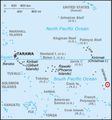
 LocationBanaba.PNG 250 × 158; 5 KB
-
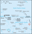
 LocationGilbert.png 250 × 158; 4 KB
-
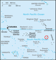
 LocationCantonIsl.png 250 × 158; 7 KB
-
 Kiribati-Caroline-highlighted.fr.png 300 × 322; 51 KB
-
 Kiribati-Caroline-highlighted.PNG 300 × 322; 57 KB
-
 Kiribati-Flint-highlighted.png 330 × 354; 18 KB
-
 Kiribati-Malden-highlighted.png 330 × 354; 18 KB
-
 Kiribati-Starbuck-highlighted.png 330 × 354; 18 KB
-
 Kiribati-Vostok-highlighted.png 330 × 354; 18 KB
-
 LocationLineIslands.PNG 250 × 158; 4 KB
-
 LocationNikumaroro.PNG 250 × 158; 5 KB
-
 LocationOrona.PNG 250 × 158; 5 KB
-
 LocationPhoenix.png 250 × 158; 6 KB


