Category:Locator maps of islands of New Zealand
Media in category "Locator maps of islands of New Zealand"
The following 26 files are in this category, out of 26 total.
-
 LocationCheesemanCurtisIsland.PNG 250 × 158; 5 KB
-
 LocationKermadecIslands.PNG 250 × 158; 6 KB
-
 LocationMacauleyIsland.PNG 250 × 158; 5 KB
-
 NZ-Motutapu.png 589 × 701; 96 KB
-
 New Zealand North Island.png 405 × 590; 10 KB
-
 North Island on the globe.png 1,125 × 1,125; 477 KB
-
 NZ-Arapawa I.png 440 × 497; 32 KB
-
 NZ-Auckland Rangitoto map.png 378 × 423; 28 KB
-
 NZ-D'Urville I.png 440 × 497; 33 KB
-
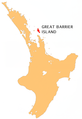 NZ-Gt Barrier I.png 405 × 590; 112 KB
-
 NZ-Kapiti I.png 405 × 590; 114 KB
-
 NZ-L Chalky Island.PNG 617 × 697; 85 KB
-
 NZ-L Cuvier island.PNG 501 × 728; 155 KB
-
 NZ-Matakana I.png 405 × 590; 114 KB
-
 NZ-Rabbit I.png 440 × 497; 32 KB
-
 NZ-Resolution I.png 440 × 497; 33 KB
-
 NZ-Secretary I.png 440 × 497; 33 KB
-
 NZ-ThreeKings.png 449 × 622; 116 KB
-
 NZ-Waiheke I.png 405 × 590; 114 KB
-
 NZ-Whakaari White.png 405 × 590; 104 KB
-
 LocationRaoulIsland.PNG 250 × 158; 5 KB
-
 South Island on the globe.png 1,125 × 1,125; 477 KB
-
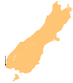
 Stewart Island-Rakiura.png 405 × 590; 13 KB
-
 Vanua levu.PNG 844 × 492; 10 KB
-
 Viti levu.PNG 844 × 492; 11 KB
-
 ZhsubaIslandsMap.png 555 × 356; 73 KB


