Category:Locator maps of islands of the Faroe Islands
Media in category "Locator maps of islands of the Faroe Islands"
The following 25 files are in this category, out of 25 total.
-
 Faroe islands linked by road.png 688 × 1,035; 31 KB
-
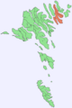
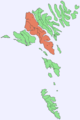
 Faroe map northern isles.png 918 × 1,008; 20 KB
-
 Litla Dimun ayns Ellanyn ny Geyrragh.png 688 × 1,035; 39 KB
-
 Position of Borðoy on Faroe map.png 688 × 1,035; 19 KB
-
 Position of Eysturoy on Faroe map.png 688 × 1,035; 19 KB
-
 Position of Fugloy on Faroe map.png 688 × 1,035; 19 KB
-
 Position of Hestur on Faroe map.png 688 × 1,035; 19 KB
-
 Position of Kalsoy on Faroe map.png 688 × 1,035; 19 KB
-
 Position of Koltur on Faroe map.png 688 × 1,035; 19 KB
-
 Position of Kunoy on Faroe map.png 688 × 1,035; 19 KB
-
 Position of Lítla Dímun on Faroe map.png 688 × 1,035; 19 KB
-
 Position of Mykines on Faroe map.png 688 × 1,035; 19 KB
-
 Position of Mykinesholmur on Faroe map.png 688 × 1,035; 19 KB
-
 Position of Nólsoy on Faroe map.png 688 × 1,035; 19 KB
-
 Position of Sandoy on Faroe map.png 688 × 1,035; 19 KB
-
 Position of Skúvoy on Faroe map.png 688 × 1,035; 19 KB
-
 Position of Streymoy on Faroe map.png 688 × 1,035; 19 KB
-
 Position of Stóra Dímun on Faroe map.png 688 × 1,035; 19 KB
-
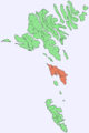
 Position of Suðuroy on Faroe map.png 688 × 1,035; 19 KB
-
 Position of Svínoy on Faroe map.png 688 × 1,035; 19 KB
-
 Position of Tindholmur on Faroe map.png 688 × 1,035; 19 KB
-
 Position of Viðoy on Faroe map.png 688 × 1,035; 19 KB
-
 Position of Vágar on Faroe map.png 688 × 1,035; 19 KB
-
 Sumbiarsteinur map.png 398 × 715; 70 KB
-
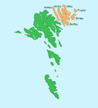
 Utoyggjar in Faroe Islands.svg 775 × 1,000; 138 KB


