Category:Locator maps of municipalities in Kreis Kleve
Media in category "Locator maps of municipalities in Kreis Kleve"
The following 17 files are in this category, out of 17 total.
-
 Bedburg-Hau in KLE.svg 438 × 619; 292 KB
-
 Emmerich am Rhein in KLE.svg 438 × 619; 292 KB
-
 Geldern in KLE.svg 438 × 619; 292 KB
-
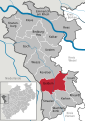
 Goch in KLE.svg 438 × 619; 292 KB
-
 Issum in KLE.svg 438 × 619; 292 KB
-
 Kalkar in KLE.svg 438 × 619; 292 KB
-
 Kerken in KLE.svg 438 × 619; 292 KB
-
 Kevelaer in KLE.svg 438 × 619; 292 KB
-
 Kleve in KLE.svg 438 × 619; 292 KB
-
 Kranenburg in KLE.svg 438 × 619; 292 KB
-
 Municipalities in KLE.svg 438 × 619; 578 KB
-
 Rees in KLE.svg 438 × 619; 292 KB
-
 Rheurdt in KLE.svg 438 × 619; 292 KB
-
 Straelen in KLE.svg 438 × 619; 292 KB
-
 Uedem in KLE.svg 438 × 619; 292 KB
-
 Wachtendonk in KLE.svg 438 × 619; 292 KB
-
 Weeze in KLE.svg 438 × 619; 292 KB


