Category:Locator maps of municipalities in Landkreis Oberallgäu
Media in category "Locator maps of municipalities in Landkreis Oberallgäu"
The following 32 files are in this category, out of 32 total.
-
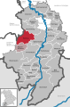
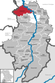 Altusried in OA.svg 590 × 892; 1.39 MB
-
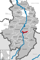
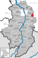
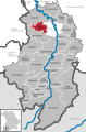
 Bad Hindelang in OA.svg 590 × 892; 1.39 MB
-
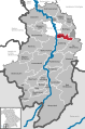
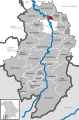
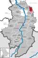
 Balderschwang in OA.svg 590 × 892; 1.39 MB
-
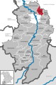
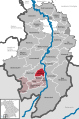
 Betzigau in OA.svg 590 × 892; 1.39 MB
-
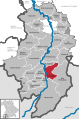
 Blaichach in OA.svg 590 × 892; 1.39 MB
-
 Bolsterlang in OA.svg 590 × 892; 1.39 MB
-
 Buchenberg in OA.svg 590 × 892; 1.39 MB
-
 Burgberg im Allgäu in OA.svg 590 × 892; 1.39 MB
-
 Dietmannsried in OA.svg 590 × 892; 1.39 MB
-
 Durach in OA.svg 590 × 892; 1.39 MB
-
 Fischen im Allgäu in OA.svg 590 × 892; 1.39 MB
-
 Haldenwang in OA.svg 590 × 892; 1.39 MB
-
 Immenstadt im Allgäu in OA.svg 590 × 892; 1.39 MB
-
 Kempter Wald in OA.svg 590 × 892; 1.39 MB
-
 Lauben in OA.svg 590 × 892; 1.39 MB
-
 Missen-Wilhams in OA.svg 590 × 892; 1.39 MB
-
 Municipalities in OA.svg 590 × 892; 1.39 MB
-
 Obermaiselstein in OA.svg 590 × 892; 1.39 MB
-
 Oberstaufen in OA.svg 590 × 892; 1.39 MB
-
 Oberstdorf in OA.svg 590 × 892; 1.39 MB
-
 Ofterschwang in OA.svg 590 × 892; 1.39 MB
-
 Oy-Mittelberg in OA.svg 590 × 892; 1.39 MB
-
 Rettenberg in OA.svg 590 × 892; 1.39 MB
-
 Sonthofen in OA.svg 590 × 892; 1.39 MB
-
 Sulzberg in OA.svg 590 × 892; 1.39 MB
-
 Verwaltungsgemeinschaft Hörnergruppe in OA.svg 590 × 892; 1.39 MB
-
 Verwaltungsgemeinschaft Weitnau in OA.svg 590 × 892; 1.39 MB
-
 Waltenhofen in OA.svg 590 × 892; 1.39 MB
-
 Weitnau in OA.svg 590 × 892; 1.39 MB
-
 Wertach in OA.svg 590 × 892; 1.39 MB
-
 Wiggensbach in OA.svg 590 × 892; 1.39 MB
-
 Wildpoldsried in OA.svg 590 × 892; 1.39 MB


