Category:Locator maps of municipalities in Landkreis Weißenburg-Gunzenhausen
Media in category "Locator maps of municipalities in Landkreis Weißenburg-Gunzenhausen"
The following 37 files are in this category, out of 37 total.
-
 Absberg in WUG.svg 611 × 532; 1.02 MB
-
 Alesheim in WUG.svg 611 × 532; 1.02 MB
-
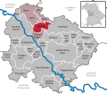
 Bergen in WUG.svg 611 × 532; 1.02 MB
-
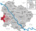
 Burgsalach in WUG.svg 611 × 532; 1.02 MB
-
 Dittenheim in WUG.svg 611 × 532; 1.02 MB
-
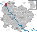
 Ellingen in WUG.svg 611 × 532; 1.02 MB
-
 Ettenstatt in WUG.svg 611 × 532; 1.02 MB
-
 Gnotzheim in WUG.svg 611 × 532; 1.02 MB
-
 Gunzenhausen in WUG.svg 611 × 532; 1.02 MB
-
 Haundorf in WUG.svg 611 × 532; 1.02 MB
-
 Heidenheim in WUG.svg 611 × 532; 1.02 MB
-
 Höttingen in WUG.svg 611 × 532; 1.02 MB
-
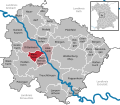
 Karte Landkreis WUG.PNG 622 × 533; 38 KB
-
 Langenaltheim in WUG.svg 611 × 532; 1.02 MB
-
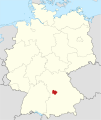
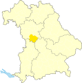
 Locator map WUG in Bavaria.svg 867 × 855; 1,010 KB
-
 Locator map WUG in Germany.svg 1,075 × 1,273; 581 KB
-
 Markt Berolzheim in WUG.svg 611 × 532; 1.02 MB
-
 Meinheim in WUG.svg 611 × 532; 1.02 MB
-
 Muhr am See in WUG.svg 611 × 532; 1.02 MB
-
 Municipalities in WUG.svg 611 × 532; 1.01 MB
-
 Nennslingen in WUG.svg 611 × 532; 1.02 MB
-
 Pappenheim in WUG.svg 611 × 532; 1.02 MB
-
 Pfofeld in WUG.svg 611 × 532; 1.02 MB
-
 Pleinfeld in WUG.svg 611 × 532; 1.02 MB
-
 Polsingen in WUG.svg 611 × 532; 1.02 MB
-
 Raitenbuch in WUG.svg 611 × 532; 1.02 MB
-
 Solnhofen in WUG.svg 611 × 532; 1.02 MB
-
 Theilenhofen in WUG.svg 611 × 532; 1.02 MB
-
 Treuchtlingen in WUG.svg 611 × 532; 1.02 MB
-
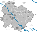
 Verwaltungsgemeinschaft Altmühltal in WUG.svg 611 × 532; 1.02 MB
-
 Verwaltungsgemeinschaft Ellingen in WUG.svg 611 × 532; 1.02 MB
-
 Verwaltungsgemeinschaft Gunzenhausen in WUG.svg 611 × 532; 1.02 MB
-
 Verwaltungsgemeinschaft Hahnenkamm in WUG.svg 611 × 532; 1.02 MB
-
 Verwaltungsgemeinschaft Nennslingen in WUG.svg 611 × 532; 1.02 MB
-
 Weißenburg in Bayern in WUG.svg 611 × 532; 1.02 MB
-
 Westheim in WUG.svg 611 × 532; 1.02 MB
-
 WUG in Bayern.svg 1,227 × 1,236; 311 KB


