Category:Locator maps of municipalities in the Landkreis Hof
Media in category "Locator maps of municipalities in the Landkreis Hof"
The following 65 files are in this category, out of 65 total.
-
 Bad Steben im Landkreis Hof.png 613 × 489; 96 KB
-
 Bad Steben in HO.svg 642 × 501; 1.27 MB
-
 Berg im Landkreis Hof.png 613 × 489; 96 KB
-
 Berg in HO.svg 642 × 501; 1.27 MB
-
 Döhlau im Landkreis Hof.png 613 × 489; 95 KB
-
 Döhlau in HO.svg 642 × 501; 1.27 MB
-
 Feilitzsch im Landkreis Hof.png 613 × 489; 95 KB
-
 Feilitzsch in HO.svg 642 × 501; 1.27 MB
-
 Forst Schwarzenbach a.Wald in HO.svg 642 × 501; 1.27 MB
-
 Gattendorf im Landkreis Hof.png 613 × 489; 95 KB
-
 Gattendorf in HO.svg 642 × 501; 1.27 MB
-
 Gerlaser Forst in HO.svg 642 × 501; 1.27 MB
-
 Germany adm location mapHOFER LAND.svg 512 × 607; 937 KB
-
 Geroldsgrün im Landkreis Hof.png 613 × 489; 96 KB
-
 Geroldsgrün in HO.svg 642 × 501; 1.27 MB
-
 Geroldsgrüner Forst in HO.svg 642 × 501; 1.27 MB
-
 Helmbrechts im Landkreis Hof.png 613 × 489; 95 KB
-
 Helmbrechts in HO.svg 642 × 501; 1.27 MB
-
 Issigau im Landkreis Hof.png 613 × 489; 95 KB
-
 Issigau in HO.svg 642 × 501; 1.27 MB
-
 Konradsreuth im Landkreis Hof.png 613 × 489; 96 KB
-
 Konradsreuth in HO.svg 642 × 501; 1.27 MB
-
 Köditz im Landkreis Hof.png 613 × 489; 96 KB
-
 Köditz in HO.svg 642 × 501; 1.27 MB
-
 Leupoldsgrün im Landkreis Hof.png 613 × 489; 95 KB
-
 Leupoldsgrün in HO.svg 642 × 501; 1.27 MB
-
 Lichtenberg im Landkreis Hof.png 613 × 489; 95 KB
-
 Lichtenberg in HO.svg 642 × 501; 1.27 MB
-
 Map of Landkreis Hof.png 611 × 486; 68 KB
-
 Martinlamitzer Forst-Nord in HO.svg 642 × 501; 1.27 MB
-
 Municipalities in HO.svg 642 × 501; 1.27 MB
-
 Münchberg im Landkreis Hof.png 613 × 489; 95 KB
-
 Münchberg in HO.svg 642 × 501; 1.27 MB
-
 Naila im Landkreis Hof.png 613 × 489; 96 KB
-
 Naila in HO.svg 642 × 501; 1.27 MB
-
 Oberkotzau im Landkreis Hof.png 613 × 489; 96 KB
-
 Oberkotzau in HO.svg 642 × 501; 1.27 MB
-
 Regnitzlosau im Landkreis Hof.png 613 × 489; 96 KB
-
 Regnitzlosau in HO.svg 642 × 501; 1.27 MB
-
 Rehau im Landkreis Hof.png 613 × 489; 96 KB
-
 Rehau in HO.svg 642 × 501; 1.27 MB
-
 Schauenstein im Landkreis Hof.png 613 × 489; 96 KB
-
 Schauenstein in HO.svg 642 × 501; 1.27 MB
-
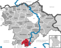
 Schwarzenbach am Wald im Landkreis Hof.png 613 × 489; 96 KB
-
 Schwarzenbach am Wald in HO.svg 642 × 501; 1.27 MB
-
 Schwarzenbach an der Saale im Landkreis Hof.png 613 × 489; 95 KB
-
 Schwarzenbach an der Saale in HO.svg 642 × 501; 1.27 MB
-
 Selbitz im Landkreis Hof.png 613 × 489; 96 KB
-
 Selbitz in HO.svg 642 × 501; 1.27 MB
-
 Sparneck im Landkreis Hof.png 613 × 489; 95 KB
-
 Sparneck in HO.svg 642 × 501; 1.27 MB
-
 Stammbach im Landkreis Hof.png 613 × 489; 94 KB
-
 Stammbach in HO.svg 642 × 501; 1.27 MB
-
 Trogen im Landkreis Hof.png 613 × 489; 95 KB
-
 Trogen in HO.svg 642 × 501; 1.27 MB
-
 Töpen im Landkreis Hof.png 613 × 489; 95 KB
-
 Töpen in HO.svg 642 × 501; 1.27 MB
-
 Verwaltungsgemeinschaft Feilitzsch in HO.svg 642 × 501; 1.27 MB
-
 Verwaltungsgemeinschaft Lichtenberg in HO.svg 642 × 501; 1.27 MB
-
 Verwaltungsgemeinschaft Schauenstein in HO.svg 642 × 501; 1.27 MB
-
 Verwaltungsgemeinschaft Sparneck in HO.svg 642 × 501; 1.27 MB
-
 Weißdorf im Landkreis Hof.png 613 × 489; 95 KB
-
 Weißdorf in HO.svg 642 × 501; 1.27 MB
-
 Zell im Fichtelgebirge in HO.svg 642 × 501; 1.27 MB
-
 Zell im Landkreis Hof.png 613 × 489; 95 KB


