Category:Locator maps of municipalities of Antwerp (province)
Provinces of Belgium: Province of Antwerp · Brussels-Capital Region · East Flanders · Flemish Brabant · Hainaut · Limburg · Province of Liege · Province of Namur · Walloon Brabant · West Flanders
Media in category "Locator maps of municipalities of Antwerp (province)"
The following 146 files are in this category, out of 146 total.
-
 Aartselaar Antwerp Belgium Map.svg 987 × 742; 2.85 MB
-
 AartselaarLocatie.png 270 × 203; 5 KB
-
 Antwerpen Antwerp Belgium Map.svg 987 × 742; 2.85 MB
-
 AntwerpenGemeenten.png 270 × 203; 9 KB
-
 AntwerpenLocatie.png 270 × 203; 5 KB
-
 Arendonk Antwerp Belgium Map.svg 987 × 742; 2.85 MB
-
 ArendonkLocatie.png 270 × 203; 5 KB
-
 Baarle-Hertog Antwerp Belgium Map.svg 987 × 742; 2.85 MB
-
 Baarle-HertogLocatie.png 270 × 203; 5 KB
-
 Balen Antwerp Belgium Map.svg 987 × 742; 2.85 MB
-
 BalenLocatie.png 270 × 203; 5 KB
-
 Beerse Antwerp Belgium Map.svg 987 × 742; 2.85 MB
-
 BeerseLocatie.png 270 × 203; 5 KB
-
 Berlaar Antwerp Belgium Map.svg 987 × 742; 2.85 MB
-
 BerlaarLocatie.png 270 × 203; 5 KB
-
 Boechout Antwerpen Belgium Map.svg 987 × 742; 2.85 MB
-
 BoechoutLocatie.png 270 × 203; 5 KB
-
 Bonheiden Antwerp Belgium Map.svg 987 × 742; 2.85 MB
-
 BonheidenLocatie.png 270 × 203; 5 KB
-
 Boom Antwerp Belgium Map.svg 987 × 742; 2.85 MB
-
 BoomLocatie.png 270 × 203; 5 KB
-
 Bornem Antwerp Belgium Map.svg 987 × 742; 2.85 MB
-
 BornemLocatie.png 270 × 203; 5 KB
-
 Borsbeek Antwerp Belgium Map.svg 987 × 742; 2.85 MB
-
 BorsbeekLocatie.png 270 × 203; 5 KB
-
 Brasschaat Antwerp Belgium Map.svg 987 × 742; 2.85 MB
-
 BrasschaatLocatie.png 270 × 203; 5 KB
-
 Brecht Antwerp Belgium Map.svg 987 × 742; 2.85 MB
-
 BrechtLocatie.png 270 × 203; 5 KB
-
 Dessel Antwerp Belgium Map.svg 987 × 742; 2.85 MB
-
 DesselLocatie.png 270 × 203; 5 KB
-
 Duffel Antwerp Belgium Map.svg 987 × 742; 2.85 MB
-
 DuffelLocatie.png 270 × 203; 5 KB
-
 Edegem Antwerp Belgium Map.svg 987 × 742; 2.85 MB
-
 EdegemLocatie.png 270 × 203; 5 KB
-
 Essen Antwerp Belgium Map.svg 987 × 742; 2.85 MB
-
 EssenLocatie.png 270 × 203; 5 KB
-
 Geel Antwerp Belgium Map.svg 987 × 742; 2.85 MB
-
 GeelLocatie.png 270 × 203; 5 KB
-
 Grobbendonk Antwerp Belgium Map.svg 987 × 742; 2.85 MB
-
 GrobbendonkLocatie.png 270 × 203; 5 KB
-
 Heist-op-den-Berg Antwerp Belgium Map.svg 987 × 742; 2.85 MB
-
 Heist-op-den-BergLocatie.png 270 × 203; 5 KB
-
 Hemiksem Antwerp Belgium Map.svg 987 × 742; 2.85 MB
-
 HemiksemLocatie.png 270 × 203; 5 KB
-
 Herentals Antwerp Belgium Map.svg 987 × 742; 2.85 MB
-
 HerentalsLocatie.png 270 × 203; 5 KB
-
 Herenthout Antwerp Belgium Map.svg 987 × 742; 2.85 MB
-
 HerenthoutLocatie.png 270 × 203; 5 KB
-
 Herselt Antwerp Belgium Map.svg 987 × 742; 2.85 MB
-
 HerseltLocatie.png 270 × 203; 5 KB
-
 Hoogstraten Antwerp Belgium Map.svg 987 × 742; 2.85 MB
-
 HoogstratenLocatie.png 270 × 203; 5 KB
-
 Hove Antwerp Belgium Map.svg 987 × 742; 2.85 MB
-
 HoveLocatie.png 270 × 203; 5 KB
-
 Hulshout Antwerp Belgium Map.svg 987 × 742; 2.85 MB
-
 HulshoutLocatie.png 270 × 203; 5 KB
-
 Kalmthout Antwerp Belgium Map.svg 987 × 742; 2.85 MB
-
 KalmthoutLocatie.png 270 × 203; 5 KB
-
 Kapellen Antwerp Belgium Map.svg 987 × 742; 2.85 MB
-
 KapellenLocatie.png 270 × 203; 5 KB
-
 Kasterlee Antwerp Belgium Map.svg 987 × 742; 2.85 MB
-
 KasterleeLocatie.png 270 × 203; 5 KB
-
 Kontich Antwerp Belgium Map.svg 987 × 742; 2.85 MB
-
 KontichLocatie.png 270 × 203; 5 KB
-
 Laakdal Antwerp Belgium Map.svg 987 × 742; 2.85 MB
-
 LaakdalLocatie.png 270 × 203; 5 KB
-
 Lier Antwerp Belgium Map.svg 987 × 742; 2.85 MB
-
 LierLocatie.png 270 × 203; 5 KB
-
 Lille Antwerp Belgium Map.svg 987 × 742; 2.85 MB
-
 LilleLocatie.png 270 × 203; 5 KB
-
 Lint Antwerp Belgium Map.svg 987 × 742; 2.85 MB
-
 LintLocatie.png 270 × 203; 5 KB
-
 Malle Antwerp Belgium Map.svg 987 × 742; 2.85 MB
-
 MalleLocatie.png 270 × 203; 5 KB
-
 Map of Antwerpen in belgium-viol-reddot-t.png 399 × 335; 10 KB
-
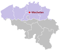 Map of Mechelen in belgium-viol-reddot-t.png 399 × 335; 9 KB
-
 Mechelen Antwerp Belgium Map.svg 987 × 742; 2.85 MB
-
 MechelenLocatie.png 270 × 203; 5 KB
-
 Meerhout Antwerp Belgium Map.svg 987 × 742; 2.85 MB
-
 MeerhoutLocatie.png 270 × 203; 5 KB
-
 Merksplas Antwerp Belgium Map.svg 987 × 742; 2.85 MB
-
 MerksplasLocatie.png 270 × 203; 5 KB
-
 Mol Antwerp Belgium Map.svg 987 × 742; 2.85 MB
-
 MolLocatie.png 270 × 203; 5 KB
-
 Mortsel Antwerp Belgium Map.svg 987 × 742; 2.85 MB
-
 MortselLocatie.png 270 × 203; 5 KB
-
 Municipalities Antwerp Belgium Map - Number.svg 987 × 742; 3.14 MB
-
 Municipalities Antwerp Belgium Map.svg 987 × 742; 2.85 MB
-
 Niel Antwerp Belgium Map.svg 987 × 742; 2.85 MB
-
 NielLocatie.png 270 × 203; 5 KB
-
 Nijlen Antwerp Belgium Map.svg 987 × 742; 2.85 MB
-
 NijlenLocatie.png 270 × 203; 5 KB
-
 Olen Antwerp Belgium Map.svg 987 × 742; 2.85 MB
-
 OlenLocatie.png 270 × 203; 5 KB
-
 Oud-Turnhout Antwerp Belgium Map.svg 987 × 742; 2.85 MB
-
 Oud-TurnhoutLocatie.png 270 × 203; 5 KB
-
 Putte Antwerp Belgium Map.svg 987 × 742; 2.85 MB
-
 PutteLocatie.png 270 × 203; 5 KB
-
 Puurs Antwerp Belgium Map.svg 966 × 726; 2.52 MB
-
 Puurs-Sint-Amands Antwerp Belgium Map.svg 987 × 742; 2.85 MB
-
 PuursLocatie.png 270 × 203; 5 KB
-
 Ranst Antwerp Belgium Map.svg 987 × 742; 2.85 MB
-
 RanstLocatie.png 270 × 203; 5 KB
-
 Ravels Antwerp Belgium Map.svg 987 × 742; 2.85 MB
-
 RavelsLocatie.png 270 × 203; 5 KB
-
 Retie Antwerp Belgium Map.svg 987 × 742; 2.85 MB
-
 RetieLocatie.png 270 × 203; 5 KB
-
 Rijkevorsel Antwerp Belgium Map.svg 987 × 742; 2.85 MB
-
 RijkevorselLocatie.png 270 × 203; 5 KB
-
 Rumst Antwerp Belgium Map.svg 987 × 742; 2.85 MB
-
 RumstLocatie.png 270 × 203; 5 KB
-
 Schelle Antwerp Belgium Map.svg 987 × 742; 2.85 MB
-
 SchelleLocatie.png 270 × 203; 5 KB
-
 Schilde Antwerp Belgium Map.svg 987 × 742; 2.85 MB
-
 SchildeLocatie.png 270 × 203; 5 KB
-
 Schoten Antwerp Belgium Map.svg 987 × 742; 2.85 MB
-
 SchotenLocatie.png 270 × 203; 5 KB
-
 Sint-Amands Antwerp Belgium Map.svg 966 × 726; 2.52 MB
-
 Sint-AmandsLocatie.png 270 × 203; 5 KB
-
 Sint-Katelijne-Waver Antwerp Belgium Map.svg 987 × 742; 2.85 MB
-
 Sint-Katelijne-WaverLocatie.png 270 × 203; 5 KB
-
 Stabroek Antwerp Belgium Map.svg 987 × 742; 2.85 MB
-
 StabroekLocatie.png 270 × 203; 5 KB
-
 Turnhout Antwerp Belgium Map.svg 987 × 742; 2.85 MB
-
 TurnhoutLocatie.png 270 × 203; 5 KB
-
 Vorselaar Antwerp Belgium Map.svg 987 × 742; 2.85 MB
-
 VorselaarLocatie.png 270 × 203; 5 KB
-
 Vosselaar Antwerp Belgium Map.svg 987 × 742; 2.85 MB
-
 VosselaarLocatie.png 270 × 203; 5 KB
-
 Westerlo Antwerp Belgium Map.svg 987 × 742; 2.85 MB
-
 WesterloLocatie.png 270 × 203; 5 KB
-
 Wijnegem Antwerp Belgium Map.svg 987 × 742; 2.85 MB
-
 WijnegemLocatie.png 270 × 203; 5 KB
-
 Willebroek Antwerp Belgium Map.svg 987 × 742; 2.85 MB
-
 WillebroekLocatie.png 270 × 203; 5 KB
-
 Wommelgem Antwerp Belgium Map.svg 987 × 742; 2.85 MB
-
 WommelgemLocatie.png 270 × 203; 5 KB
-
 Wuustwezel Antwerp Belgium Map.svg 987 × 742; 2.85 MB
-
 WuustwezelLocatie.png 270 × 203; 5 KB
-
 Zandhoven Antwerp Belgium Map.svg 987 × 742; 2.85 MB
-
 ZandhovenLocatie.png 270 × 203; 5 KB
-
 Zoersel Antwerp Belgium Map.svg 987 × 742; 2.85 MB
-
 ZoerselLocatie.png 270 × 203; 5 KB
-
 Zwijndrecht Antwerp Belgium Map.svg 987 × 742; 2.85 MB
-
 Zwijndrecht-B-Locatie.png 270 × 203; 5 KB


