Category:Locator maps of neighborhoods in Ghent
Media in category "Locator maps of neighborhoods in Ghent"
The following 15 files are in this category, out of 15 total.
-
 AfsneeLocation.svg 452 × 459; 132 KB
-
 DesteldonkLocation.svg 452 × 459; 133 KB
-
 DrongenLocation.svg 452 × 459; 135 KB
-
 GentbruggeLocation.svg 452 × 459; 133 KB
-
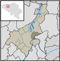
 GentLocation.svg 452 × 459; 136 KB
-
 GentMap.svg 452 × 459; 87 KB
-
 LedebergLocation.svg 452 × 459; 132 KB
-
 MariakerkeLocation.svg 452 × 459; 132 KB
-
 MendonkLocation.svg 452 × 459; 133 KB
-
 OostakkerLocation.svg 452 × 459; 133 KB
-
 Sint-AmandsbergLocation.svg 452 × 459; 133 KB
-
 Sint-Denijs-WestremLocation.svg 452 × 459; 133 KB
-
 Sint-Kruis-WinkelLocation.svg 452 × 459; 133 KB
-
 WondelgemLocation.svg 452 × 459; 132 KB
-
 ZwijnaardeLocation.svg 452 × 459; 133 KB


