Category:Locator maps of neighborhoods in Montferland
Media in category "Locator maps of neighborhoods in Montferland"
The following 30 files are in this category, out of 30 total.
-

-

-
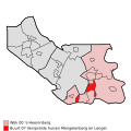
 Map - NL - Montferland - Wijk 00 's-Heerenberg - Buurt 02 Zeddam.svg 375 × 375; 29 KB
-

-
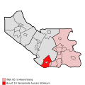
 Map - NL - Montferland - Wijk 00 's-Heerenberg - Buurt 04 Braamt.svg 375 × 375; 29 KB
-

-

-
-

-

-
-
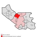
 Map - NL - Montferland - Wijk 00 's-Heerenberg.svg 625 × 575; 11 KB
-
 Map - NL - Montferland - Wijk 01 Brakel - Buurt 00 Beek.svg 375 × 375; 29 KB
-
 Map - NL - Montferland - Wijk 01 Brakel - Buurt 01 Kilder.svg 375 × 375; 29 KB
-
 Map - NL - Montferland - Wijk 01 Brakel - Buurt 02 Loerbeek.svg 375 × 375; 29 KB
-
-

-

-

-
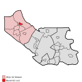
 Map - NL - Montferland - Wijk 01 Brakel.svg 625 × 575; 11 KB
-
 Map - NL - Montferland - Wijk 02 Didam - Buurt 00 Didam-Zuid.svg 375 × 375; 29 KB
-
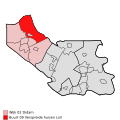
 Map - NL - Montferland - Wijk 02 Didam - Buurt 01 Didam-Noord.svg 375 × 375; 29 KB
-
 Map - NL - Montferland - Wijk 02 Didam - Buurt 02 Loil.svg 375 × 375; 29 KB
-
 Map - NL - Montferland - Wijk 02 Didam - Buurt 03 Nieuw-Dijk.svg 375 × 375; 29 KB
-

-

-

-

-
-
 Map - NL - Montferland - Wijk 02 Didam.svg 625 × 575; 11 KB


