Category:Locator maps of neighborhoods in Overschie
Media in category "Locator maps of neighborhoods in Overschie"
The following 11 files are in this category, out of 11 total.
-
 Map - NL - Rotterdam - Wijk 04 Overschie - Buurt 51 Kleinpolder.svg 375 × 375; 78 KB
-
 Map - NL - Rotterdam - Wijk 04 Overschie - Buurt 52 Noord-Kethel.svg 375 × 375; 78 KB
-
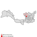
 Map - NL - Rotterdam - Wijk 04 Overschie - Buurt 54 Schieveen.svg 375 × 375; 78 KB
-
 Map - NL - Rotterdam - Wijk 04 Overschie - Buurt 55 Zestienhoven.svg 375 × 375; 78 KB
-
 Map - NL - Rotterdam - Wijk 04 Overschie - Buurt 56 Overschie.svg 375 × 375; 78 KB
-
 Map - NL - Rotterdam - Wijk 04 Overschie - Buurt 57 Landzicht.svg 375 × 375; 78 KB
-
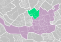
 Map - NL - Rotterdam - Wijk 04 Overschie.svg 625 × 575; 34 KB
-
 Rotterdamse wijken-landzicht.PNG 890 × 606; 32 KB
-
 Rotterdamse wijken-overschie.PNG 890 × 606; 71 KB
-
 Rotterdamse wijken-stadsdeel overschie.PNG 890 × 606; 33 KB
-
 Rotterdamse wijken-zestienhoven.PNG 890 × 606; 71 KB


