Category:Locator maps of parliamentary constituencies of Belfast
These maps have been out of date since the 2010 election!
Media in category "Locator maps of parliamentary constituencies of Belfast"
The following 12 files are in this category, out of 12 total.
-
 BelfastEast2024Constituency.svg 512 × 410; 213 KB
-
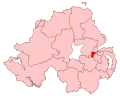
 BelfastEastConstituency.svg 779 × 635; 135 KB
-
 BelfastNorth2024Constituency.svg 512 × 410; 213 KB
-
 BelfastNorthConstituency.svg 779 × 635; 135 KB
-
 BelfastNorthUKParliamentConstituency.png 280 × 225; 7 KB
-
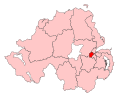
 BelfastSouthConstituency.svg 779 × 635; 135 KB
-
 BelfastSouthMidDown2024Constituency.svg 512 × 410; 213 KB
-
 BelfastSouthUKParliamentConstituency.png 280 × 225; 7 KB
-
 BelfastWest2024Constituency.svg 512 × 410; 213 KB
-
 BelfastWestConstituency.svg 779 × 635; 135 KB
-
 BelfastWestUKParliamentConstituency.png 280 × 225; 7 KB
-
 NorthernIrelandParliamentaryConstituenciesNumbered.svg 280 × 225; 105 KB


