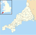
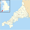
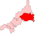
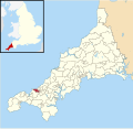
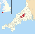
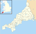
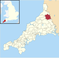
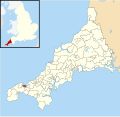
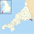
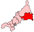
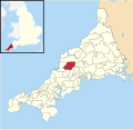
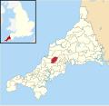
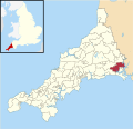
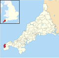
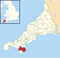
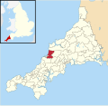
Category:Locator maps of parliamentary constituencies of Cornwall
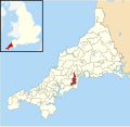
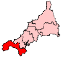
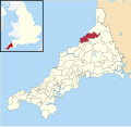
Maps of Parliamentary constituencies in Cornwall.
Media in category "Locator maps of parliamentary constituencies of Cornwall"
The following 139 files are in this category, out of 139 total.
-
 Altarnun electoral division map 2013.svg 1,227 × 1,190; 1.6 MB
-
 Bodmin St Leonard electoral division map 2013.svg 1,227 × 1,190; 1.6 MB
-
 Bodmin St Mary's electoral division map 2013.svg 1,227 × 1,190; 1.6 MB
-
 Bodmin St Petroc electoral division map 2013.svg 1,227 × 1,190; 1.6 MB
-
 Bodmin1974Constituency.svg 144 × 137; 21 KB
-
 Breage, Germoe and Sithney electoral division map 2013.svg 1,227 × 1,190; 1.6 MB
-
 Bude electoral division map 2013.svg 1,227 × 1,190; 1.6 MB
-
 Bugle electoral division map 2013.svg 1,227 × 1,190; 1.6 MB
-
 Callington electoral division map 2013.svg 1,227 × 1,190; 1.6 MB
-
 Camborne Pendarves electoral division map 2013.svg 1,227 × 1,190; 1.6 MB
-
 Camborne Roskear electoral division map 2013.svg 1,227 × 1,190; 1.6 MB
-
 Camborne Trelowarren electoral division map 2013.svg 1,227 × 1,190; 1.6 MB
-
 Camborne Treslothan electoral division map 2013.svg 1,227 × 1,190; 1.6 MB
-
 Camborne Treswithian electoral division map 2013.svg 1,227 × 1,190; 1.6 MB
-
 CamborneRedruth2007Constituency.svg 207 × 193; 155 KB
-
 Camelford electoral division map 2013.svg 1,227 × 1,190; 1.6 MB
-
 Carharrack, Gwennap and St Day electoral division map 2013.svg 1,227 × 1,190; 1.6 MB
-
 Chacewater, Kenwyn and Baldhu electoral division map 2013.svg 1,227 × 1,190; 1.6 MB
-
 Constantine, Mawnan and Budock electoral division map 2013.svg 1,227 × 1,190; 1.6 MB
-
 Cornwall UK mainland electoral division map (blank).svg 1,224 × 1,187; 2.09 MB
-
 Cornwall UK mainland electoral division map 2013 (blank).svg 1,224 × 1,187; 1.65 MB
-
 CornwallParliamentaryConstituencies2007.svg 207 × 193; 96 KB
-
 CornwallParliamentaryConstituenciesNumbered.svg 200 × 190; 14 KB
-
 CornwallParliamentaryConstituenciesNumbered2005.png 1,000 × 950; 77 KB
-
 Crowan and Wendron electoral division map 2013.svg 1,227 × 1,190; 1.6 MB
-
 Falmouth Arwenack electoral division map 2013.svg 1,227 × 1,190; 1.6 MB
-
 Falmouth Boslowick electoral division map 2013.svg 1,227 × 1,190; 1.6 MB
-
 Falmouth Penwerris electoral division map 2013.svg 1,227 × 1,190; 1.6 MB
-
 Falmouth Smithick electoral division map 2013.svg 1,227 × 1,190; 1.6 MB
-
 Falmouth Trescobeas electoral division map 2013.svg 1,227 × 1,190; 1.6 MB
-
 FalmouthCamborneConstituency.svg 200 × 190; 11 KB
-
 Feock and Playing Place electoral division map 2013.svg 1,227 × 1,190; 1.6 MB
-
 Four Lanes electoral division map 2013.svg 1,227 × 1,190; 1.6 MB
-
 Fowey and Tywardreath electoral division map 2013.svg 1,227 × 1,190; 1.6 MB
-
 Grenville and Stratton electoral division map 2013.svg 1,227 × 1,190; 1.6 MB
-
 Gulval and Heamoor electoral division map 2013.svg 1,227 × 1,190; 1.6 MB
-
 Gunnislake and Calstock electoral division map 2013.svg 1,227 × 1,190; 1.6 MB
-
 Gwinear-Gwithian and St Erth electoral division map 2013.svg 1,227 × 1,190; 1.6 MB
-
 Hayle North electoral division map 2013.svg 1,227 × 1,190; 1.6 MB
-
 Hayle South electoral division map 2013.svg 1,227 × 1,190; 1.6 MB
-
 Helston North electoral division map 2013.svg 1,227 × 1,190; 1.6 MB
-
 Helston South electoral division map 2013.svg 1,227 × 1,190; 1.6 MB
-
 Illogan electoral division map 2013.svg 1,227 × 1,190; 1.6 MB
-
 Ladock, St Clement and St Erme electoral division map 2013.svg 1,227 × 1,190; 1.6 MB
-
 Lanivet and Blisland electoral division map 2013.svg 1,227 × 1,190; 1.6 MB
-
 Lanner and Stithians electoral division map 2013.svg 1,227 × 1,190; 1.6 MB
-
 Launceston Central electoral division map 2013.svg 1,227 × 1,190; 1.6 MB
-
 Launceston North and North Petherwin electoral division map 2013.svg 1,227 × 1,190; 1.6 MB
-
 Launceston South electoral division map 2013.svg 1,227 × 1,190; 1.6 MB
-
 Lelant and Carbis Bay electoral division map 2013.svg 1,227 × 1,190; 1.6 MB
-
 Liskeard East electoral division map 2013.svg 1,227 × 1,190; 1.6 MB
-
 Liskeard North electoral division map 2013.svg 1,227 × 1,190; 1.6 MB
-
 Liskeard West and Dobwalls electoral division map 2013.svg 1,227 × 1,190; 1.6 MB
-
 Looe East electoral division map 2013.svg 1,227 × 1,190; 1.6 MB
-
 Looe West, Lansallos and Lanteglos electoral division map 2013.svg 1,227 × 1,190; 1.6 MB
-
 Lostwithiel electoral division map 2013.svg 1,227 × 1,190; 1.6 MB
-
 Ludgvan electoral division map 2013.svg 1,227 × 1,190; 1.6 MB
-
 Lynher electoral division map 2013.svg 1,227 × 1,190; 1.6 MB
-
 Mabe, Perranarworthal and St Gluvias electoral division map 2013.svg 1,227 × 1,190; 1.6 MB
-
 Marazion and Perranuthnoe electoral division map 2013.svg 1,227 × 1,190; 1.6 MB
-
 Menheniot electoral division map 2013.svg 1,227 × 1,190; 1.6 MB
-
 Mevagissey electoral division map 2013.svg 1,227 × 1,190; 1.6 MB
-
 Mount Charles electoral division map 2013.svg 1,227 × 1,190; 1.6 MB
-
 Mount Hawke and Portreath electoral division map 2013.svg 1,227 × 1,190; 1.6 MB
-
 Mullion and Grade-Ruan electoral division map 2013.svg 1,227 × 1,190; 1.6 MB
-
 Newlyn and Goonhavern electoral division map 2013.svg 1,227 × 1,190; 1.6 MB
-
 Newlyn and Mousehole electoral division map 2013.svg 1,227 × 1,190; 1.6 MB
-
 Newquay Central electoral division map 2013.svg 1,227 × 1,190; 1.6 MB
-
 Newquay Pentire electoral division map 2013.svg 1,227 × 1,190; 1.6 MB
-
 Newquay Treloggan electoral division map 2013.svg 1,227 × 1,190; 1.6 MB
-
 Newquay Tretherras electoral division map 2013.svg 1,227 × 1,190; 1.6 MB
-
 Newquay Treviglas electoral division map 2013.svg 1,227 × 1,190; 1.6 MB
-
 NorthCornwall2007Constituency.svg 207 × 193; 155 KB
-
 NorthCornwallConstituency.svg 200 × 190; 11 KB
-
 Padstow electoral division map 2013.svg 1,227 × 1,190; 1.6 MB
-
 Par and St Blazey Gate electoral division map 2013.svg 1,227 × 1,190; 1.6 MB
-
 Penryn East and Mylor electoral division map 2013.svg 1,227 × 1,190; 1.6 MB
-
 Penryn West electoral division map 2013.svg 1,227 × 1,190; 1.6 MB
-
 Penwithick and Boscoppa electoral division map 2013.svg 1,227 × 1,190; 1.6 MB
-
 Penzance Central electoral division map 2013.svg 1,227 × 1,190; 1.6 MB
-
 Penzance East electoral division map 2013.svg 1,227 × 1,190; 1.6 MB
-
 Penzance Promenade electoral division map 2013.svg 1,227 × 1,190; 1.6 MB
-
 Perranporth electoral division map 2013.svg 1,227 × 1,190; 1.6 MB
-
 Pool and Tehidy electoral division map 2013.svg 1,227 × 1,190; 1.6 MB
-
 Porthleven and Helston West electoral division map 2013.svg 1,227 × 1,190; 1.6 MB
-
 Poundstock electoral division map 2013.svg 1,227 × 1,190; 1.6 MB
-
 Probus, Tregony and Grampound electoral division map 2013.svg 1,227 × 1,190; 1.6 MB
-
 Rame Peninsula electoral division map 2013.svg 1,227 × 1,190; 1.6 MB
-
 Redruth Central electoral division map 2013.svg 1,227 × 1,190; 1.6 MB
-
 Redruth North electoral division map 2013.svg 1,227 × 1,190; 1.6 MB
-
 Redruth South electoral division map 2013.svg 1,227 × 1,190; 1.6 MB
-
 Roche electoral division map 2013.svg 1,227 × 1,190; 1.6 MB
-
 Roseland electoral division map 2013.svg 1,227 × 1,190; 1.6 MB
-
 Saltash East electoral division map 2013.svg 1,227 × 1,190; 1.6 MB
-
 Saltash North electoral division map 2013.svg 1,227 × 1,190; 1.6 MB
-
 Saltash South electoral division map 2013.svg 1,227 × 1,190; 1.6 MB
-
 Saltash West electoral division map 2013.svg 1,227 × 1,190; 1.6 MB
-
 SouthEastCornwall2007Constituency.svg 207 × 193; 155 KB
-
 SouthEastCornwallConstituency.svg 200 × 190; 11 KB
-
 St Agnes electoral division map 2013.svg 1,227 × 1,190; 1.6 MB
-
 St Austell Bay electoral division map 2013.svg 1,227 × 1,190; 1.6 MB
-
 St Austell Bethel electoral division map 2013.svg 1,227 × 1,190; 1.6 MB
-
 St Austell Gover electoral division map 2013.svg 1,227 × 1,190; 1.6 MB
-
 St Austell Poltair electoral division map 2013.svg 1,227 × 1,190; 1.6 MB
-
 St Blazey electoral division map 2013.svg 1,227 × 1,190; 1.6 MB
-
 St Buryan electoral division map 2013.svg 1,227 × 1,190; 1.6 MB
-
 St Cleer electoral division map 2013.svg 1,227 × 1,190; 1.6 MB
-
 St Columb Major electoral division map 2013.svg 1,227 × 1,190; 1.6 MB
-
 St Dennis and Nanpean electoral division map 2013.svg 1,227 × 1,190; 1.6 MB
-
 St Dominick, Harrowbarrow and Kelly Bray electoral division map 2013.svg 1,227 × 1,190; 1.6 MB
-
 St Enoder electoral division map 2013.svg 1,227 × 1,190; 1.6 MB
-
 St Germans and Landulph electoral division map 2013.svg 1,227 × 1,190; 1.6 MB
-
 St Issey and St Tudy electoral division map 2013.svg 1,227 × 1,190; 1.6 MB
-
 St Ives East electoral division map 2013.svg 1,227 × 1,190; 1.6 MB
-
 St Ives West electoral division map 2013.svg 1,227 × 1,190; 1.6 MB
-
 St Just in Penwith electoral division map 2013.svg 1,227 × 1,190; 1.6 MB
-
 St Keverne and Meneage electoral division map 2013.svg 1,227 × 1,190; 1.6 MB
-
 St Mawgan and Colan electoral division map 2013.svg 1,227 × 1,190; 1.6 MB
-
 St Mewan electoral division map 2013.svg 1,227 × 1,190; 1.6 MB
-
 St Minver and St Endellion electoral division map 2013.svg 1,227 × 1,190; 1.6 MB
-
 St Stephen-in-Brannel electoral division map 2013.svg 1,227 × 1,190; 1.6 MB
-
 St Teath and St Breward electoral division map 2013.svg 1,227 × 1,190; 1.6 MB
-
 StAustellNewquay2007Constituency.svg 207 × 193; 155 KB
-
 StIves2007Constituency.svg 207 × 193; 155 KB
-
 StIvesConstituency.svg 200 × 190; 11 KB
-
 Stokeclimsland electoral division map 2013.svg 1,227 × 1,190; 1.6 MB
-
 Threemilestone and Gloweth electoral division map 2013.svg 1,227 × 1,190; 1.6 MB
-
 Tintagel electoral division map 2013.svg 1,227 × 1,190; 1.6 MB
-
 Torpoint East electoral division map 2013.svg 1,227 × 1,190; 1.6 MB
-
 Torpoint West electoral division map 2013.svg 1,227 × 1,190; 1.6 MB
-
 Trelawny electoral division map 2013.svg 1,227 × 1,190; 1.6 MB
-
 Truro Boscawen electoral division map 2013.svg 1,227 × 1,190; 1.6 MB
-
 Truro Redannick electoral division map 2013.svg 1,227 × 1,190; 1.6 MB
-
 Truro Tregolls electoral division map 2013.svg 1,227 × 1,190; 1.6 MB
-
 Truro Trehaverne electoral division map 2013.svg 1,227 × 1,190; 1.6 MB
-
 TruroFalmouth2007Constituency.svg 207 × 193; 155 KB
-
 TruroStAustellConstituency.svg 200 × 190; 11 KB
-
 Wadebridge East electoral division map 2013.svg 1,227 × 1,190; 1.6 MB
-
 Wadebridge West electoral division map 2013.svg 1,227 × 1,190; 1.6 MB


.svg)
.svg)