Category:Locator maps of parliamentary constituencies of Shropshire
Maps of Parliamentary constituencies in Shropshire.
Media in category "Locator maps of parliamentary constituencies of Shropshire"
The following 15 files are in this category, out of 15 total.
-
 Ludlow2007Constituency.svg 212 × 237; 139 KB
-
 LudlowConstituency.svg 191 × 215; 38 KB
-
 NorthShropshire2007Constituency.svg 212 × 237; 139 KB
-
 NorthShropshireConstituency.svg 191 × 215; 38 KB
-
 ShrewsburyAtcham2007Constituency.svg 212 × 237; 139 KB
-
 ShrewsburyAtchamConstituency.svg 191 × 215; 38 KB
-
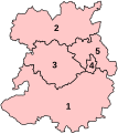 ShropshireConstituenciesNumbered.svg 191 × 215; 40 KB
-
 ShropshireConstituenciesNumbered2005.png 1,000 × 1,126; 117 KB
-
 ShropshireParliamentaryConstituencies2007.svg 212 × 237; 84 KB
-
 ShropshireParliamentaryConstituency1950Results.svg 87 × 98; 21 KB
-
 ShropshireParliamentaryConstituency1955Results.svg 87 × 98; 21 KB
-
 Telford2007Constituency.svg 212 × 237; 139 KB
-
 TelfordConstituency.svg 191 × 215; 38 KB
-
 TheWrekin2007Constituency.svg 212 × 237; 139 KB
-
 WrekinConstituency.svg 191 × 215; 38 KB


