Category:Locator maps of regions of Taiwan
中文(臺灣):臺灣各地區位置圖
Subcategories
This category has the following 3 subcategories, out of 3 total.
C
V
Media in category "Locator maps of regions of Taiwan"
The following 26 files are in this category, out of 26 total.
-
 1950-07 Taiwan plan.svg 1,200 × 1,700; 91 KB
-
 EYCC Location Map.png 417 × 549; 44 KB
-
 EYEC Location Map.png 417 × 549; 35 KB
-
 Kaohsiung metropolitan 1991 definition.svg 750 × 1,375; 301 KB
-
 Kaohsiung metropolitan CPA definition.svg 750 × 1,375; 301 KB
-
 Metropolitan areas in Taiwan.svg 960 × 1,300; 1.39 MB
-
 ROC first-order divisions.png 2,000 × 2,824; 156 KB
-
 Subdivision types of the Republic of China (2015).png 425 × 600; 43 KB
-
 Tainan metropolitan.svg 875 × 975; 317 KB
-
 Taiwan Formosan.svg 619 × 842; 938 KB
-
 Taiwan ROC political division map Chiayi Metropolitan.svg 850 × 1,200; 124 KB
-
 Taiwan ROC political division map Taipei metropoliten area(2016).svg 850 × 1,200; 110 KB
-
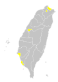
 Taiwan subdivisions, registration for gay couples - March 2019.svg 850 × 1,200; 116 KB
-
 Taiwan——2014.5.10.png 807 × 1,109; 149 KB
-
 Taoyuan metropolitan.png 556 × 454; 87 KB
-
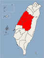
 中彰投.png 1,016 × 1,221; 151 KB
-
 中華民國台灣地理區劃大臺北地區.svg 850 × 1,200; 115 KB
-
 中華民國地理區劃臺北都會區.svg 850 × 1,200; 115 KB
-
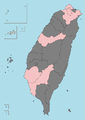
 北北基宜.png 1,016 × 1,221; 151 KB
-
 原住民族地區16族分布圖.jpg 1,081 × 1,531; 368 KB
-
 大臺北地區區域圖.svg 1,016 × 1,222; 431 KB
-
 桃竹苗.png 1,016 × 1,221; 150 KB
-
 花東.png 1,016 × 1,221; 151 KB
-
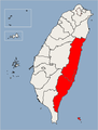
 雲嘉南.png 1,016 × 1,221; 151 KB
-
 高屏.png 1,016 × 1,221; 151 KB
-
 高屏澎.png 1,016 × 1,221; 151 KB


.png)


.svg)


