Category:Locator maps of territories of the Holy Roman Empire (1250)
Media in category "Locator maps of territories of the Holy Roman Empire (1250)"
The following 19 files are in this category, out of 19 total.
-
 Bishopric of Ratzeburg locator map (1250).svg 990 × 780; 3.14 MB
-
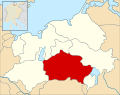
 Bishopric of Schwerin locator map (1250).svg 990 × 780; 3.14 MB
-
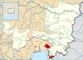 County of Gorizia locator map (1250).svg 3,120 × 2,280; 3.57 MB
-
 County of Savoy locator map (1250).svg 2,200 × 3,000; 3.61 MB
-
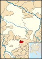
 County of Schaunberg locator map (1250).svg 3,120 × 2,280; 3.57 MB
-
 County of Schaunberg.svg 1,785 × 1,000; 124 KB
-
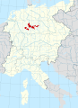
 County of Schwerin locator map (1250).svg 990 × 780; 3.14 MB
-
 County of Tecklenburg locator map (1250).svg 1,435 × 1,460; 3.4 MB
-
 County of Wernigerode locator map (1250).svg 1,080 × 1,530; 3.49 MB
-
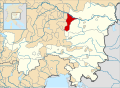
 Duchy of Austria locator map (1250).svg 3,120 × 2,280; 3.53 MB
-
 Duchy of Carniola locator map (1250).svg 3,120 × 2,280; 3.52 MB
-
 Karte Österreich ob der Enns mit Grafschaft Schaunberg.png 1,211 × 1,067; 272 KB
-
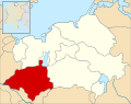
 Landgraviate of Thuringia locator map (1250).svg 7,000 × 9,593; 3.2 MB
-
 Lordship of Mecklenburg locator map (1250).svg 990 × 780; 3.14 MB
-
 Lordship of Parchim locator map (1250).svg 990 × 780; 3.14 MB
-
 Lordship of Rostock locator map (1250).svg 990 × 780; 3.14 MB
-
 Lordship of Werle locator map (1250).svg 990 × 780; 3.14 MB
-
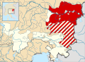
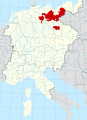 Margraviate of Brandenburg locator map (1250).svg 7,000 × 9,593; 3.23 MB
-
 Patriarchate of Aquileia locator map (1250).svg 1,615 × 925; 3.23 MB
.svg)
.svg)
.svg)
.svg)
.svg)

.svg)
.svg)
.svg)
.svg)
.svg)

.svg)
.svg)
.svg)
.svg)
.svg)
.svg)
.svg)