Category:Locator maps of the Land of Valencia
Autonomous communities of Spain: Andalusia · Aragon · Asturias · Balearic Islands · Basque Autonomous Community · Canary Islands · Cantabria · Castile and León · Castilla–La Mancha · Catalonia · Extremadura · Galicia · Community of Madrid · Region of Murcia · Navarre · La Rioja · Valencian Community · Autonomous cities: Ceuta · Melilla

Subcategories
This category has the following 5 subcategories, out of 5 total.
C
Media in category "Locator maps of the Land of Valencia"
The following 19 files are in this category, out of 19 total.
-
 Localització de la Comunitat Valenciana respecte a Espanya.svg 686 × 518; 501 KB
-
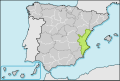
 Localización Comunidad Valenciana.png 467 × 394; 13 KB
-
 Location of Valencia.png 1,388 × 972; 117 KB
-
 Locator map of Valenciana.png 250 × 157; 5 KB
-
 Spain Valencia.png 2,000 × 2,000; 131 KB
-
 Comunitat valenciana respecte espanya.svg 700 × 643; 448 KB
-
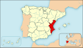
 ES Valencia City Location.png 305 × 176; 8 KB
-
 España CCAA provincias gris naranja C.Valenciana.svg 578 × 374; 608 KB
-
 España CCAA provincias grises C.Valenciana.svg 578 × 374; 608 KB
-
 Localització del País Valencià.png 306 × 204; 3 KB
-
 Localització país valencià països catalans.svg 1,164 × 1,176; 625 KB
-
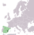 LocationValenciaInEurope.png 415 × 422; 39 KB
-
 LocationValencianCountryInEurope.jpg 800 × 840; 52 KB
-
 Mapa territorios España.svg 545 × 365; 1.3 MB
-
 Mapa territorios España2.svg 3,300 × 1,885; 1.9 MB
-
 País Valencià respecte espanya.svg 700 × 643; 448 KB
-
 Regne valencia wikipedia.svg 875 × 961; 1.33 MB
-
 Valencia Province, Spain - location.png 256 × 233; 21 KB
-
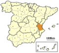
 Valencia Region, Spain - location.png 256 × 233; 21 KB


