Category:Lochboisdale
village in the Outer Hebrides, Scotland, UK .jpg) | |||||
| Upload media | |||||
| Instance of | |||||
|---|---|---|---|---|---|
| Location |
| ||||
 | |||||
Deutsch: Lochboisdale ( Gälisch: Loch Baghasdail) ist mit etwa 1100 Einwohnern das wichtigste Bevölkerungszentrum der Insel South Uist, Äußere Hebriden, Schottland.
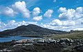
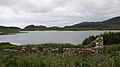
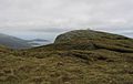
English: Lochboisdale is the main population centre on the island of South Uist, Outer Hebrides, Scotland.
Media in category "Lochboisdale"
The following 100 files are in this category, out of 100 total.
-
 Almost there............ - geograph.org.uk - 843152.jpg 640 × 360; 46 KB
-
 Anchorage at Lochboisdale - geograph.org.uk - 1438056.jpg 640 × 473; 116 KB
-
 Approaching Lochboisdale - geograph.org.uk - 2561072.jpg 1,920 × 2,560; 2.26 MB
-
 Approaching Lochboisdale - geograph.org.uk - 3024410.jpg 640 × 480; 257 KB
-

-
 Bagh Dubh, Loch Baghasdail - geograph.org.uk - 2876760.jpg 4,320 × 3,240; 2.34 MB
-
 Bagh Dubh, Loch Baghasdail - geograph.org.uk - 2876766.jpg 4,320 × 3,240; 2.3 MB
-
 Boats moored in Lochboisdale - geograph.org.uk - 3092704.jpg 1,280 × 960; 1.46 MB
-
 Campervan embarking at Lochboisdale - geograph.org.uk - 2609605.jpg 1,600 × 1,200; 565 KB
-
 Car Ferry on Loch Baghasdail - geograph.org.uk - 2561983.jpg 2,560 × 1,920; 1.46 MB
-
 Departing Lochboisdale - geograph.org.uk - 2561953.jpg 2,560 × 1,920; 2 MB
-
 Ferry manoeuvring into Lochboisdale - geograph.org.uk - 1521370.jpg 640 × 480; 63 KB
-
 Ferry terminal, Loch Boisdale - geograph.org.uk - 938093.jpg 640 × 420; 75 KB
-
 Garden and Picnic Area - geograph.org.uk - 1374726.jpg 640 × 480; 98 KB
-
 Gleann dail bho Tuath path - geograph.org.uk - 656768.jpg 640 × 480; 92 KB
-
 Gleann dail bho Tuath path - geograph.org.uk - 656798.jpg 640 × 480; 83 KB
-
 Leaving Lochboisdale - geograph.org.uk - 3065753.jpg 3,271 × 2,244; 1.52 MB
-
 Leaving Lochboisdale - geograph.org.uk - 942762.jpg 640 × 432; 82 KB
-
 Lobster pots.JPG 3,648 × 2,736; 4.17 MB
-
 Loch Baghasdail - geograph.org.uk - 2876754.jpg 4,320 × 3,240; 2.21 MB
-
 Lochboisdale - Loch Baghasdail Harbour - geograph.org.uk - 6726960.jpg 1,600 × 900; 823 KB
-
 Lochboisdale Ferry Terminal - geograph.org.uk - 2609588.jpg 1,600 × 1,200; 503 KB
-
 Lochboisdale fishing nets.JPG 3,648 × 2,736; 4.05 MB
-
 Lochboisdale harbour - geograph.org.uk - 2537160.jpg 2,048 × 1,536; 1 MB
-
 Lochboisdale Harbour construction - geograph.org.uk - 4203105.jpg 1,600 × 1,169; 434 KB
-
 Lochboisdale Harbour construction - geograph.org.uk - 4203108.jpg 1,600 × 1,200; 478 KB
-
 Lochboisdale Hotel - geograph.org.uk - 1374724.jpg 640 × 480; 75 KB
-
 Lochboisdale Pier - geograph.org.uk - 3105109.jpg 640 × 425; 100 KB
-
 Lochboisdale pier - geograph.org.uk - 500501.jpg 640 × 480; 75 KB
-
 Lochboisdale, Bàgh Dubh - geograph.org.uk - 3210149.jpg 640 × 480; 66 KB
-
 Lochboisdale, St. Peter’s Youth Club - geograph.org.uk - 3210152.jpg 640 × 480; 74 KB
-

-
 Lochboisdale02LB.jpg 4,608 × 3,456; 3.85 MB
-
 Main Street, Lochboisdale - geograph.org.uk - 1521373.jpg 640 × 480; 40 KB
-
 Mooring in the half-light, Lochboisdale - geograph.org.uk - 2017938.jpg 3,072 × 2,304; 821 KB
-
 Near Gasaigh, Loch Baghasdail - geograph.org.uk - 2561059.jpg 2,560 × 1,920; 1.93 MB
-
 New pontoons at Lochboisdale - geograph.org.uk - 5435052.jpg 800 × 600; 90 KB
-

-
 Ordnance Survey One-Inch Sheet 32 Lochboisdale & Eriskay, Published 1947.jpg 12,207 × 9,316; 7.81 MB
-
 Path towards Gleann dail bho Tuath - geograph.org.uk - 656751.jpg 640 × 480; 87 KB
-
 Permit fishing only - geograph.org.uk - 5115832.jpg 1,600 × 1,200; 802 KB
-
 Picnic Area, Lochboisdale - geograph.org.uk - 1374727.jpg 640 × 480; 86 KB
-
 Pier at Lochboisdale - geograph.org.uk - 2763235.jpg 640 × 433; 44 KB
-
 Poll Creadha - geograph.org.uk - 3199686.jpg 640 × 360; 228 KB
-
 Pontoons at Lochboisdale Harbour - geograph.org.uk - 5564358.jpg 1,024 × 768; 141 KB
-

-
 Promontory and bay Loch Boisdale - geograph.org.uk - 911696.jpg 640 × 433; 102 KB
-
 Rush hour - Lochboisdale. - geograph.org.uk - 15982.jpg 640 × 452; 48 KB
-
 Satellite dishes, Lochboisdale - geograph.org.uk - 1374717.jpg 640 × 480; 65 KB
-
 Seaweed Mulch - geograph.org.uk - 1374728.jpg 640 × 480; 148 KB
-
 Shops, Housing and Lobster Pots - geograph.org.uk - 1374714.jpg 640 × 480; 65 KB
-
 South Uist banner Lochboisdale from the ferry.JPG 2,100 × 300; 108 KB
-
 Sunset Over Lochboisdale - geograph.org.uk - 3024419.jpg 640 × 480; 281 KB
-
 The A865 road through Lochboisdale (geograph 4245080).jpg 640 × 480; 138 KB
-
 The end of the road at South Lochboisdale, South Uist - geograph.org.uk - 2538583.jpg 2,048 × 1,536; 980 KB
-
 The Lochboisdale Hotel - geograph.org.uk - 3065766.jpg 4,000 × 2,000; 1.39 MB
-
 The new marina at Lochboisdale - geograph.org.uk - 4542102.jpg 1,800 × 1,013; 1.14 MB
-

-
 View of Lochboisdale - geograph.org.uk - 1521383.jpg 640 × 480; 91 KB
-
 Water plant near Lochboisdale - geograph.org.uk - 843120.jpg 640 × 360; 50 KB
-
 Welcome to Lochboisdale - geograph.org.uk - 1374722.jpg 640 × 478; 62 KB
-
 Abhainn Hornaraidh glen - geograph.org.uk - 657106.jpg 640 × 480; 90 KB
-
 Abhainn Hornaraidh glen - geograph.org.uk - 657130.jpg 640 × 480; 82 KB
-
 Ascending Triuirebheinn - geograph.org.uk - 843143.jpg 640 × 360; 55 KB
-
 Beinn Ruigh Choinnich - geograph.org.uk - 823336.jpg 640 × 400; 73 KB
-
 Below Stulabhal - geograph.org.uk - 15966.jpg 640 × 436; 59 KB
-
 Bridge, Oratobht - geograph.org.uk - 15957.jpg 640 × 417; 71 KB
-
 Lazybeds by Loch Aineort - geograph.org.uk - 200780.jpg 640 × 401; 200 KB
-
 Loch Chearsanais - geograph.org.uk - 656741.jpg 640 × 480; 76 KB
-
 Loch Hurabhat - geograph.org.uk - 657133.jpg 640 × 480; 79 KB
-
 Loch Mòraibh - geograph.org.uk - 656966.jpg 640 × 480; 65 KB
-
 Lochan Beinne-ri-Oitir - geograph.org.uk - 657259.jpg 640 × 480; 98 KB
-
 Lochboisdale - geograph.org.uk - 200823.jpg 640 × 369; 185 KB
-
 Lochboisdale Hotel, South Uist - geograph.org.uk - 346191.jpg 640 × 480; 73 KB
-
 Lochboisdale Pier - geograph.org.uk - 176609.jpg 476 × 640; 72 KB
-
 Looking towards Bagh Marulaigh - geograph.org.uk - 656850.jpg 640 × 480; 88 KB
-
 Meall an Iasgaich - geograph.org.uk - 656910.jpg 640 × 480; 96 KB
-

-

-
 On Airneabhal - geograph.org.uk - 15970.jpg 640 × 392; 51 KB
-
 Peat cuttings near Unasary - geograph.org.uk - 176303.jpg 640 × 480; 128 KB
-
 Refurbished Croft House - geograph.org.uk - 448901.jpg 640 × 480; 77 KB
-
 Ruin by Eilean Dubh - geograph.org.uk - 656879.jpg 640 × 480; 116 KB
-
 Ruin by the loch. - geograph.org.uk - 505813.jpg 640 × 359; 61 KB
-
 Ruin by the path - geograph.org.uk - 656863.jpg 640 × 480; 123 KB
-
 Ruin by the sheepwash - geograph.org.uk - 656870.jpg 640 × 480; 107 KB
-

-
 Ruined bridge by Eilean Dubh - geograph.org.uk - 656876.jpg 640 × 480; 112 KB
-

-

-
 Small hill top by Loch Mòraibh - geograph.org.uk - 656965.jpg 640 × 480; 110 KB
-
 Souterrain - geograph.org.uk - 15961.jpg 640 × 480; 110 KB
-
 South west ridge of Beinn-ri-Oitir - geograph.org.uk - 657249.jpg 640 × 480; 75 KB
-
 Summit of Beinn Hurabhat - geograph.org.uk - 657113.jpg 640 × 480; 98 KB
-
 Summit of Criribheinn - geograph.org.uk - 657093.jpg 640 × 480; 93 KB
-
 Summit of Stulabhal - geograph.org.uk - 15964.jpg 640 × 404; 53 KB
-
 Summit of Triuirebheinn - geograph.org.uk - 15958.jpg 640 × 412; 59 KB
-
 Sunset over South Uist - geograph.org.uk - 59099.jpg 640 × 404; 37 KB
-

-
 Water Lilies in Loch nan Geadh - geograph.org.uk - 467170.jpg 640 × 454; 84 KB


