Category:London Borough of Lambeth
Boroughs of London: City of London · City of Westminster · Barking and Dagenham · Barnet · Bexley · Brent · Bromley · Camden · Croydon · Ealing · Enfield · Greenwich · Hackney · Hammersmith and Fulham · Haringey · Harrow · Havering · Hillingdon · Hounslow · Islington · Kensington and Chelsea · Kingston · Lambeth · Lewisham · Merton · Newham · Redbridge · Richmond · Southwark · Sutton · Tower Hamlets · Waltham Forest · Wandsworth
borough in the London Region in England     | |||||
| Upload media | |||||
| Instance of | |||||
|---|---|---|---|---|---|
| Part of | |||||
| Named after | |||||
| Location | Greater London, London, England | ||||
| Capital | |||||
| Legislative body |
| ||||
| Executive body |
| ||||
| Head of government |
| ||||
| Inception |
| ||||
| Population |
| ||||
| Area |
| ||||
| Replaces | |||||
| Different from | |||||
| official website | |||||
 | |||||
Subcategories
This category has the following 22 subcategories, out of 22 total.
A
E
F
G
H
M
N
O
P
S
V
Media in category "London Borough of Lambeth"
The following 200 files are in this category, out of 3,934 total.
(previous page) (next page)-
 "Barrier Block", Brixton - geograph.org.uk - 2435539.jpg 640 × 480; 65 KB
-
 "Entrance" to Bessemer Road - geograph.org.uk - 1122185.jpg 640 × 393; 75 KB
-
 "Ghost sign", Gipsy Hill - geograph.org.uk - 4722948.jpg 2,306 × 3,648; 1.23 MB
-
-
 "More push, less pounds" - geograph.org.uk - 4349877.jpg 1,920 × 2,424; 652 KB
-
 "Redholm", Champion Hill, Camberwell - geograph.org.uk - 5290705.jpg 1,600 × 1,136; 532 KB
-
 "The Majestic", Clapham - geograph.org.uk - 5667935.jpg 1,600 × 1,553; 547 KB
-
 "The Priory Arms" public house, South Lambeth - geograph.org.uk - 5166212.jpg 1,337 × 1,600; 577 KB
-
 "The White Hart" public house, Whittlesey Street - geograph.org.uk - 5171978.jpg 1,600 × 1,417; 492 KB
-
 "Today is Your Day" - geograph.org.uk - 4804130.jpg 607 × 455; 109 KB
-
 'Beach' and the London skyline - geograph.org.uk - 4492724.jpg 640 × 422; 84 KB
-
 'Clan Line' Approaching Tulse Hill - geograph.org.uk - 5995880.jpg 5,146 × 3,431; 6.02 MB
-
 'Dreams of Stockwell' Peace Mosaic - geograph.org.uk - 4757984.jpg 2,658 × 1,495; 708 KB
-
 'Ghost sign', Lambourn Road, London SW4 - geograph.org.uk - 3620627.jpg 1,429 × 1,000; 1.3 MB
-
 'Hollywood' on the River Thames - geograph.org.uk - 4597826.jpg 640 × 499; 117 KB
-
 'London Belle' on the River Thames - geograph.org.uk - 4597834.jpg 640 × 443; 100 KB
-
-
 'Silver Bonito' on the River Thames - geograph.org.uk - 4597840.jpg 640 × 460; 97 KB
-
 1-5 Bondway - geograph.org.uk - 4782710.jpg 640 × 516; 178 KB
-
-
-

-
 105-113 Vassall Road - geograph.org.uk - 3669083.jpg 640 × 549; 257 KB
-
 115-123 Vassall Road - geograph.org.uk - 3669079.jpg 640 × 425; 208 KB
-
 119-121 Norwood Road - geograph.org.uk - 2334364.jpg 640 × 445; 161 KB
-
 127 Stamford Street - geograph.org.uk - 4781071.jpg 640 × 544; 162 KB
-
 14-24 Groveway - geograph.org.uk - 4804061.jpg 640 × 482; 197 KB
-
 145 Vassall Road - geograph.org.uk - 3669090.jpg 640 × 464; 196 KB
-
 15 Foxley Road - geograph.org.uk - 3669123.jpg 640 × 394; 177 KB
-
 155 Tulse Hill - geograph.org.uk - 3670091.jpg 640 × 515; 209 KB
-
 17 and 19 Leigham Avenue - geograph.org.uk - 1812371.jpg 640 × 391; 194 KB
-
 1966 Roxburgh Road West Norwood London SE27 - geograph.org.uk - 5230241.jpg 2,415 × 1,835; 1.58 MB
-
 1971 Waterloo Bridge view to South Bank - geograph.org.uk - 5229730.jpg 4,056 × 2,169; 1.5 MB
-
-
 2017 Construction in Lambeth.jpg 1,944 × 2,592; 1.97 MB
-
 21, 23 and 25 Leigham Avenue - geograph.org.uk - 1815890.jpg 640 × 473; 239 KB
-
 21-37 Foxley Road - geograph.org.uk - 3669116.jpg 640 × 500; 219 KB
-
 23 Garrad's Road - geograph.org.uk - 1858318.jpg 640 × 525; 222 KB
-
 25-26 Stockwell Green - geograph.org.uk - 4786139.jpg 518 × 640; 184 KB
-
 274 South Lambeth Road - geograph.org.uk - 4785205.jpg 640 × 494; 266 KB
-
 279 Rosendale Road - geograph.org.uk - 2334637.jpg 640 × 412; 148 KB
-
 28-34 Lansdowne Gardens - geograph.org.uk - 4785234.jpg 640 × 483; 196 KB
-
 28-38 Hercules Road - geograph.org.uk - 4780765.jpg 640 × 499; 192 KB
-
 30 Casson Square (24.04.2021).jpg 2,592 × 3,456; 1.92 MB
-
 31-34 Stockwell Green - geograph.org.uk - 4786117.jpg 640 × 518; 146 KB
-
 32-48 Foxley Road - geograph.org.uk - 3669096.jpg 640 × 515; 204 KB
-
 33 Hatfields - geograph.org.uk - 2929103.jpg 446 × 640; 143 KB
-
 35 Tooting Bec Gardens - geograph.org.uk - 1858363.jpg 640 × 477; 177 KB
-
 37 and 39 Groveway, Stockwell - geograph.org.uk - 2640861.jpg 4,288 × 3,216; 6 MB
-
 37 Viceroy Road - geograph.org.uk - 4785241.jpg 640 × 585; 285 KB
-
 38 Tooting Bec Gardens - geograph.org.uk - 1858332.jpg 640 × 480; 196 KB
-
 4 and 6 Streatham, West Norwood - geograph.org.uk - 2635645.jpg 4,288 × 3,216; 5.3 MB
-
 4-3-2-1 flats along Thames - geograph.org.uk - 6133273.jpg 1,024 × 684; 178 KB
-
 40 and 42, Groveway, Stockwell - geograph.org.uk - 2640847.jpg 4,288 × 3,216; 4.65 MB
-
 5 Pendennis Road - geograph.org.uk - 4636466.jpg 589 × 640; 185 KB
-
 5-9 Mitcham Lane - geograph.org.uk - 1847364.jpg 640 × 476; 220 KB
-
 50-56 Viceroy Road - geograph.org.uk - 4785237.jpg 640 × 497; 191 KB
-
 52 and 54 Stockwell Crescent, Stockwell - geograph.org.uk - 2640807.jpg 4,288 × 3,216; 4.65 MB
-
 55 Tooting Bec Gardens - geograph.org.uk - 1858384.jpg 640 × 483; 215 KB
-
 56-66 Walnut Tree Walk - geograph.org.uk - 4780707.jpg 640 × 500; 207 KB
-
 6 - 12 Stockwell Crescent - geograph.org.uk - 2640832.jpg 4,288 × 3,216; 4.4 MB
-
 64-82 Vassall Road - geograph.org.uk - 3666796.jpg 640 × 339; 156 KB
-
 66-70 Knight's Hill - geograph.org.uk - 3265217.jpg 640 × 421; 192 KB
-
 67 and 69, New Park Road, Streatham Hill - geograph.org.uk - 2636703.jpg 4,288 × 3,216; 4.24 MB
-

-
 9 and 10 Streatham Common South - geograph.org.uk - 2212178.jpg 640 × 449; 220 KB
-
 9 and 11, Groveway, Stockwell - geograph.org.uk - 2640881.jpg 4,288 × 3,216; 4.68 MB
-
 9-21 Cowley Road - geograph.org.uk - 3669170.jpg 640 × 381; 149 KB
-
 90-104 Lansdowne Way - geograph.org.uk - 4785225.jpg 640 × 520; 188 KB
-
 95-103 Vassall Road - geograph.org.uk - 3669085.jpg 640 × 476; 241 KB
-
 99-105 Old South Lambeth Road.jpg 4,032 × 3,024; 4.19 MB
-
 99-113 Loughborough Road - geograph.org.uk - 3647837.jpg 640 × 439; 225 KB
-
 A "wooden city" on the Thames Beach - geograph.org.uk - 4050173.jpg 2,592 × 1,944; 2.15 MB
-
 A boundary^ - geograph.org.uk - 1930699.jpg 640 × 430; 155 KB
-
 A changing skyline, Lambeth - geograph.org.uk - 6132997.jpg 1,024 × 768; 289 KB
-
 A changing skyline, Lambeth - geograph.org.uk - 6133018.jpg 1,024 × 768; 233 KB
-
 A courtyard, St George Wharf - geograph.org.uk - 6133249.jpg 1,024 × 768; 278 KB
-
 A dazzle ship at Temple, from the South Bank - geograph.org.uk - 4418185.jpg 1,024 × 681; 139 KB
-
 A digger in the Thames - geograph.org.uk - 2325673.jpg 640 × 381; 132 KB
-
 A glimpse of the Shard - geograph.org.uk - 4249486.jpg 3,901 × 2,926; 2.11 MB
-
 A Great Day Out at Southbank - geograph.org.uk - 2398507.jpg 4,000 × 3,000; 3.46 MB
-
 A green square, Lakeview Rd - geograph.org.uk - 3661239.jpg 640 × 430; 146 KB
-
 A grey London day - geograph.org.uk - 3291135.jpg 640 × 480; 36 KB
-

-
 A misty River Thames - geograph.org.uk - 2704132.jpg 4,000 × 3,000; 2.32 MB
-
 A place to buy a shed - geograph.org.uk - 4120508.jpg 3,872 × 2,592; 3.94 MB
-
 A pleasing effect - geograph.org.uk - 3291166.jpg 640 × 480; 92 KB
-
-
 A Telephone Box on Southbank - geograph.org.uk - 3110111.jpg 1,814 × 3,164; 1.29 MB
-
 A Thames beach - geograph.org.uk - 3816330.jpg 640 × 430; 71 KB
-
 A Thames-side taste of OZ - geograph.org.uk - 4523374.jpg 5,899 × 3,933; 3.76 MB
-
 A variety of signs in Clapham - geograph.org.uk - 6185495.jpg 2,366 × 1,774; 1.13 MB
-
-
 A202 Bridgefoot, Vauxhall - geograph.org.uk - 6133384.jpg 1,024 × 768; 249 KB
-
 A204 - geograph.org.uk - 5800265.jpg 640 × 426; 86 KB
-
 A204, Tulse Hill - geograph.org.uk - 5831651.jpg 1,024 × 681; 172 KB
-

-
 A214, Streatham - geograph.org.uk - 3656581.jpg 640 × 430; 72 KB
-
 A2199 - geograph.org.uk - 5828915.jpg 1,024 × 681; 172 KB
-
 A2199 - geograph.org.uk - 5828916.jpg 1,024 × 681; 197 KB
-
 A2217 at Brixton - geograph.org.uk - 5494191.jpg 2,964 × 2,222; 1.11 MB
-
 A2217, Brixton - geograph.org.uk - 5811089.jpg 1,024 × 681; 158 KB
-
 A23 by Streatham Hill station - geograph.org.uk - 6131066.jpg 1,024 × 768; 211 KB
-
 A3 towards central London - geograph.org.uk - 6132279.jpg 1,024 × 768; 358 KB
-
 A301 - geograph.org.uk - 4774385.jpg 640 × 426; 64 KB
-
 A3036 near St George Wharf - geograph.org.uk - 2097120.jpg 640 × 430; 124 KB
-
 A3216 - geograph.org.uk - 5781308.jpg 640 × 426; 65 KB
-
 Abbess Close, Tulse Hill - geograph.org.uk - 2963753.jpg 1,600 × 1,200; 594 KB
-
 Access for the Agency - geograph.org.uk - 4422315.jpg 4,000 × 3,000; 4.34 MB
-
 Access road to Lambeth Palace - geograph.org.uk - 1993987.jpg 640 × 480; 76 KB
-
-
 Acrobats - geograph.org.uk - 2928418.jpg 640 × 480; 69 KB
-
 Across the River Thames, London - geograph.org.uk - 2331420.jpg 2,772 × 1,856; 3.12 MB
-
 Across the Thames at Lambeth Bridge - geograph.org.uk - 5634012.jpg 640 × 480; 37 KB
-
 Across the Thames to Gabriel Wharf - geograph.org.uk - 2714240.jpg 640 × 430; 67 KB
-
 Advertising Hoarding Vauxhall - geograph.org.uk - 5141462.jpg 4,896 × 3,672; 5.7 MB
-
 Agnes Riley Gardens - geograph.org.uk - 5199415.jpg 1,600 × 1,200; 797 KB
-
 Air raid shelter entrance, Clapham Common South - geograph.org.uk - 3297231.jpg 1,024 × 768; 483 KB
-
 Airstream 'Silver Bullet', London - geograph.org.uk - 3875417.jpg 4,000 × 2,250; 7.09 MB
-
 Airstream 'Silver Bullet', London - geograph.org.uk - 3875423.jpg 4,000 × 2,666; 6.85 MB
-
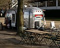
 Airstream Café, London - geograph.org.uk - 3875412.jpg 4,000 × 2,666; 7.2 MB
-
 Airstream Café, London - geograph.org.uk - 3875415.jpg 4,000 × 3,200; 7.44 MB
-
 Akerman Health Centre - geograph.org.uk - 4858982.jpg 640 × 360; 52 KB
-
-
-
 Albert Avenue, SW8 - geograph.org.uk - 2435176.jpg 640 × 480; 88 KB
-
 Albert Carr Gardens, Streatham - geograph.org.uk - 3676036.jpg 2,048 × 1,536; 1.59 MB
-
 Albert Embankment, Lambeth - geograph.org.uk - 3778872.jpg 1,024 × 682; 172 KB
-
 Albion Avenue, SW8 - geograph.org.uk - 2435354.jpg 640 × 480; 101 KB
-
 Alderton Road, Herne Hill - geograph.org.uk - 4628152.jpg 2,090 × 1,703; 691 KB
-
 Alex and Janet - geograph.org.uk - 2192484.jpg 2,560 × 1,920; 2.37 MB
-
 Alexandra Drive, London SE19 - geograph.org.uk - 5323080.jpg 1,600 × 899; 235 KB
-
 Alexandra Walk, London SE19 - geograph.org.uk - 5323084.jpg 1,600 × 899; 270 KB
-
 All change on York Road - geograph.org.uk - 4877372.jpg 1,024 × 768; 136 KB
-
 All Nations Christian Centre, west Norwood - geograph.org.uk - 2636398.jpg 4,288 × 3,216; 6.61 MB
-
 All Saints church, Rosendale Road - geograph.org.uk - 6026072.jpg 5,202 × 3,465; 3.71 MB
-
 Alley between Pathfield and Barrow Roads - geograph.org.uk - 2699752.jpg 640 × 480; 131 KB
-
 Alley near Herne Hill station - geograph.org.uk - 2435570.jpg 480 × 640; 73 KB
-
 Alleyway by Dorchester Court - geograph.org.uk - 5815358.jpg 1,024 × 681; 221 KB
-
 Allotments, Knight's Hill - geograph.org.uk - 4329984.jpg 640 × 480; 120 KB
-
-

-
 Amesbury Avenue - geograph.org.uk - 5836783.jpg 1,024 × 681; 180 KB
-
 Amesbury Avenue - geograph.org.uk - 5836788.jpg 1,024 × 681; 171 KB
-
 Amesbury Tower and Durrington Tower, SW8 - geograph.org.uk - 5981687.jpg 1,024 × 768; 341 KB
-
 An Englishman's home is his castle, Bromfelde Road - geograph.org.uk - 3766179.jpg 1,536 × 1,152; 963 KB
-

-
 Annoying Audience^ - geograph.org.uk - 2928422.jpg 480 × 640; 71 KB
-
 Apartment Block - geograph.org.uk - 5663498.jpg 3,122 × 2,342; 1.35 MB
-
 Apartment block on Muller Road - geograph.org.uk - 2640495.jpg 4,288 × 3,216; 7.33 MB
-
 Apartment block, Clapham Common North Side - geograph.org.uk - 5199468.jpg 1,600 × 1,200; 843 KB
-
 Apartment Block, Hillside Rd - geograph.org.uk - 5836737.jpg 1,024 × 681; 128 KB
-
 Apartments and La Fonda de Maria bar - geograph.org.uk - 5201339.jpg 1,600 × 1,200; 770 KB
-
 Apartments on Broadwall - geograph.org.uk - 6259473.jpg 4,032 × 3,024; 2.92 MB
-
 Approach to London Eye - geograph.org.uk - 4981183.jpg 640 × 480; 118 KB
-

-

-
 Approaching Royal Festival Hall, Waterloo, London SE1 - geograph.org.uk - 3805907.jpg 1,024 × 683; 1,009 KB
-

-

-

-

-
 Approaching The Oval - geograph.org.uk - 3120327.jpg 1,024 × 763; 1.02 MB
-

-
 Approaching Waterloo Station - geograph.org.uk - 4466230.jpg 430 × 640; 61 KB
-
 Arch Duke - geograph.org.uk - 5329815.jpg 640 × 426; 92 KB
-
 Arch One - geograph.org.uk - 2150713.jpg 640 × 480; 98 KB
-
 Archduke Bar and Restaurant - geograph.org.uk - 2030585.jpg 1,920 × 2,560; 2.38 MB
-
 Arches with advertising, Vauxhall - geograph.org.uk - 6133233.jpg 1,024 × 768; 326 KB
-
 Aristotle Rd - geograph.org.uk - 5775938.jpg 640 × 426; 70 KB
-
 Arlingford Road exit - geograph.org.uk - 4975848.jpg 640 × 427; 106 KB
-
 Armistice celebration 1918, Herne Hill, London - geograph.org.uk - 5963399.jpg 1,024 × 768; 585 KB
-
 Army Centre, Kings Avenue - geograph.org.uk - 5795209.jpg 640 × 425; 56 KB
-
 Arodene Rd - geograph.org.uk - 5800180.jpg 640 × 426; 83 KB
-
 Art class, Hungerford Bridge - geograph.org.uk - 3598116.jpg 640 × 368; 76 KB
-
 Art Deco lamp standards, Vauxhall - geograph.org.uk - 5527641.jpg 1,067 × 1,600; 360 KB
-
 Art on the 'Beach' - geograph.org.uk - 2967401.jpg 4,200 × 2,800; 5.62 MB
-
 As the Tide Comes in - geograph.org.uk - 3875379.jpg 4,000 × 2,249; 7 MB
-
 As You Like It^ - geograph.org.uk - 2030488.jpg 1,920 × 2,560; 2.14 MB
-
 Ashlake Rd - geograph.org.uk - 3656597.jpg 640 × 430; 64 KB
-
 Assembly Hall, Lambeth Town Hall - geograph.org.uk - 5806393.jpg 640 × 426; 74 KB
-
 ATS on Brixton Hill - geograph.org.uk - 3755462.jpg 2,560 × 1,920; 1.99 MB
-
 Auckland Hill from the train - geograph.org.uk - 2369792.jpg 1,024 × 768; 179 KB
-
 Auckland Road, West Norwood - geograph.org.uk - 5154533.jpg 1,024 × 768; 148 KB
-
 Auckland Street and Spring Gardens, Vauxhall - geograph.org.uk - 2733830.jpg 4,000 × 3,000; 3.21 MB
-
 Autumnal oak, Crown Lane - geograph.org.uk - 3238221.jpg 640 × 481; 254 KB
-
 Autumnal park, Norwood Grove (7) - geograph.org.uk - 3238205.jpg 640 × 401; 213 KB
-
 Autumnal Streatham Common (12) - geograph.org.uk - 5984231.jpg 528 × 640; 344 KB
-
 Avenue Park Rd - geograph.org.uk - 5831607.jpg 1,024 × 681; 118 KB
-

-
 B221 - geograph.org.uk - 5836810.jpg 1,024 × 681; 138 KB
-
 B221 - geograph.org.uk - 5836824.jpg 1,024 × 681; 172 KB
-
 B221 divides - join - geograph.org.uk - 5836808.jpg 1,024 × 681; 146 KB
-
 B221 Drewstead Road, westbound - geograph.org.uk - 6131069.jpg 1,024 × 768; 263 KB
-
 B221, Streatham Hill - geograph.org.uk - 5836800.jpg 1,024 × 681; 127 KB
-
 B222, A215 junction - geograph.org.uk - 5815366.jpg 1,024 × 681; 197 KB
-
 B222, Herne Hill - geograph.org.uk - 5815256.jpg 1,024 × 681; 182 KB
-
 B224 - geograph.org.uk - 5780888.jpg 640 × 426; 88 KB
-
 B303, A3 junction - geograph.org.uk - 5781295.jpg 640 × 426; 81 KB
-
 B303, B244 junction - geograph.org.uk - 5780928.jpg 640 × 425; 99 KB


.jpg)


_-_geograph.org.uk_-_3238205.jpg)
_-_geograph.org.uk_-_5984231.jpg)


