Category:Long Island Rail Road maps

Media in category "Long Island Rail Road maps"
The following 80 files are in this category, out of 80 total.
-

-

-
-

-
 1878 Manhattan Beach Railway.jpg 557 × 951; 111 KB
-
 1882 map of Long Island Railroad.jpg 6,294 × 2,232; 4.15 MB
-

-

-

-
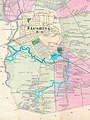
 Atlantic Branch Map.PNG 808 × 569; 78 KB
-
 Atlantic Branch Map.svg 808 × 569; 181 KB
-

-

-

-

-

-

-
 East Side Access.svg 546 × 396; 18 KB
-
 Flushing and North Side Railroad, with its leased branches (contd.).) NYPL1527261.tiff 5,428 × 7,230; 112.31 MB
-
 FNS back.jpg 2,544 × 3,048; 1.15 MB
-
 FNS front.jpg 2,560 × 3,056; 1.15 MB
-
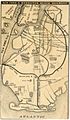
 FNS map only.jpg 1,160 × 483; 124 KB
-
 Garden City Mitchel Field Secondary Final.jpg 1,291 × 1,075; 234 KB
-
 GCM Opening - 52649084066.jpg 4,922 × 3,481; 2.62 MB
-

-
 Jamaica stations 1873.jpg 3,004 × 948; 470 KB
-
 LIRR 1873 East New York station.jpg 1,930 × 1,530; 744 KB
-
 LIRR 1891 Bridge Street station.jpg 427 × 502; 84 KB
-
 LIRR 1891 City Line station.jpg 300 × 220; 26 KB
-
 LIRR 1891 Clarenceville station.jpg 292 × 248; 36 KB
-
 LIRR 1891 Corona station.jpg 433 × 411; 70 KB
-
 LIRR 1891 Creedmoor station.jpg 627 × 448; 76 KB
-
 LIRR 1891 Cypress Avenue station.jpg 187 × 248; 30 KB
-
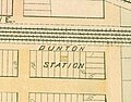 LIRR 1891 Dunton station.jpg 376 × 293; 43 KB
-
 LIRR 1891 Flushing Main Street station.jpg 603 × 489; 119 KB
-
 LIRR 1891 Flushing.jpg 1,840 × 2,008; 672 KB
-
 LIRR 1891 Fresh Pond Junction.jpg 295 × 442; 42 KB
-
 LIRR 1891 Fresh Pond station.jpg 502 × 408; 64 KB
-
 LIRR 1891 Hollis station.jpg 732 × 572; 113 KB
-
 LIRR 1891 Jamaica station.jpg 1,753 × 913; 321 KB
-
 LIRR 1891 Laurel Hill station.jpg 679 × 594; 114 KB
-
 LIRR 1891 Long Island City.jpg 2,524 × 1,536; 860 KB
-
 LIRR 1891 Maple Grove station.jpg 547 × 651; 75 KB
-
 LIRR 1891 Morris Park facility.jpg 3,332 × 1,644; 965 KB
-
 LIRR 1891 Morris Park station.jpg 368 × 312; 44 KB
-
 LIRR 1891 Murray Hill station.jpg 275 × 192; 34 KB
-
 LIRR 1891 Newtown station.jpg 254 × 274; 36 KB
-
 LIRR 1891 Ozone Park station.jpg 244 × 328; 43 KB
-
 LIRR 1891 Queens Village station.jpg 501 × 352; 67 KB
-
 LIRR 1891 Richmond Hill station.jpg 562 × 493; 87 KB
-
 LIRR 1891 Union Course station.jpg 523 × 435; 80 KB
-
 LIRR 1891 Winfield station.jpg 744 × 440; 112 KB
-
 LIRR 1891 Woodhaven Junction station.jpg 430 × 475; 77 KB
-
 LIRR 1891 Woodside station.jpg 550 × 448; 101 KB
-
 LIRR 1909 Bellaire station.jpg 524 × 756; 103 KB
-
 LIRR 1909 Hollis station.jpg 1,150 × 630; 198 KB
-
 LIRR 1909 Queens station.jpg 736 × 658; 135 KB
-
 LIRR 1909 Rockaway Junction station.jpg 1,316 × 932; 217 KB
-
 LIRR CTZ.svg 893 × 1,100; 76 KB
-
 LIRR Diesel Regions Map.jpg 7,800 × 4,800; 1.81 MB
-
 LIRR map 1876.svg 1,152 × 684; 532 KB
-
 LIRR map.svg 512 × 304; 370 KB
-
 LIRR schematic.svg 3,985 × 1,687; 500 KB
-

-

-
 NYAR map.svg 512 × 304; 288 KB
-

-

-

-
 Rockaway Branches.jpg 971 × 473; 144 KB
-
 Sanborn Fire Insurance Map from Jamaica, Queens County, New York. LOC sanborn06010 001-5.jpg 6,450 × 7,650; 3.46 MB
-
 Sanborn Fire Insurance Map from Jamaica, Queens County, New York. LOC sanborn06010 001-5.tif 6,450 × 7,650; 141.17 MB
-
 Sanborn Fire Insurance Map from Jamaica, Queens County, New York. LOC sanborn06010 002-9.tif 6,450 × 7,650; 141.17 MB
-

-
 Sanborn Fire Insurance Map from Jamaica, Queens County, New York. LOC sanborn06010 003-11.tif 6,450 × 7,650; 141.17 MB
-
 The Flushing and North Side Railroad, with its leased branches. NYPL1527260.tiff 5,428 × 7,230; 112.31 MB
-

-
 The Street railway journal (1903) (14758305321).jpg 1,306 × 3,674; 399 KB
-
 The street railway review (1891) (14757425094).jpg 1,694 × 1,504; 351 KB
-
 The Transportation system - New York City - Brooklyn and Manhattan(GN03662).jpg 2,448 × 3,264; 857 KB


_-_Queens_County_-_Queens_-_ED_41-1_to_2176_-_NARA_-_24519584_(page_8).jpg)
.jpg)


_(14755089431).jpg)
_(14755160801).jpg)
_(14757960362).jpg)
_(14758024062).jpg)
_(14758045692).jpg)
_(14778146273).jpg)


_(14595245600).jpg)


_(14573132588).jpg)
_(14757425094).jpg)
_(14758305321).jpg)
.jpg)