Category:Long Newnton
village and civil parish in Gloucestershire, UK  | |||||
| Upload media | |||||
| Instance of | |||||
|---|---|---|---|---|---|
| Location | Cotswold, Gloucestershire, South West England, England | ||||
| Population |
| ||||
 | |||||
Subcategories
This category has only the following subcategory.
L
Media in category "Long Newnton"
The following 111 files are in this category, out of 111 total.
-
 A crossing of footpaths - geograph.org.uk - 4795853.jpg 800 × 531; 151 KB
-
 A cul-de-sac in Long Newnton - geograph.org.uk - 2841985.jpg 2,592 × 1,944; 1.9 MB
-
 A footpath from Long Newnton - geograph.org.uk - 2841981.jpg 2,592 × 1,944; 2.04 MB
-
 A gate in Preston Park Tetbury - geograph.org.uk - 3815189.jpg 1,280 × 960; 1.14 MB
-
 A view west along The Monarch's Way, Long Newnton - geograph.org.uk - 2101101.jpg 1,440 × 1,080; 906 KB
-

-
 Approach to Long Newnton - geograph.org.uk - 1747321.jpg 640 × 480; 73 KB
-
 Arable farmland - geograph.org.uk - 4794525.jpg 1,024 × 680; 355 KB
-
 Arable field north of Newnton - geograph.org.uk - 1747357.jpg 640 × 480; 112 KB
-
 Barn conversion in Long Newnton - geograph.org.uk - 4795944.jpg 800 × 531; 129 KB
-
 Bridleway near Long Newnton - geograph.org.uk - 2019746.jpg 640 × 480; 78 KB
-
 Bridleway, Long Newnton - geograph.org.uk - 2019791.jpg 480 × 640; 99 KB
-
 Church Farm at Long Newnton - geograph.org.uk - 3829428.jpg 1,280 × 960; 856 KB
-
 Churchyard at Long Newnton - geograph.org.uk - 3829345.jpg 1,280 × 960; 739 KB
-
 Churchyard at Long Newnton - geograph.org.uk - 3829350.jpg 1,280 × 960; 899 KB
-
 Country road near Ashley - geograph.org.uk - 5907010.jpg 1,024 × 768; 271 KB
-
 Crudwell Lane - geograph.org.uk - 2841844.jpg 2,592 × 1,944; 1.18 MB
-
 East along The Monarch's Way, Long Newnton - geograph.org.uk - 2101086.jpg 1,440 × 1,080; 908 KB
-
 Entering the county of Gloucestershire - geograph.org.uk - 5996130.jpg 1,024 × 683; 201 KB
-
 Entrance to Newnton House - geograph.org.uk - 1747328.jpg 640 × 480; 133 KB
-
 Farm building at Long Newnton - geograph.org.uk - 3829398.jpg 1,280 × 960; 897 KB
-
 Farm Buildings at Long Newnton - geograph.org.uk - 3829393.jpg 1,280 × 960; 775 KB
-
 Farm gates at Long Newnton - geograph.org.uk - 3829404.jpg 1,280 × 960; 881 KB
-
 Farm sign at Long Newnton - geograph.org.uk - 3829409.jpg 1,233 × 957; 1.13 MB
-
 Farm vehicles on the road to Long Newnton - geograph.org.uk - 2101104.jpg 1,440 × 1,080; 1.02 MB
-
 Farmland at Long Newnton - geograph.org.uk - 5905196.jpg 1,024 × 768; 333 KB
-
 Farmland at Long Newnton - geograph.org.uk - 5905200.jpg 1,024 × 768; 298 KB
-
 Field of ancient grains(^) - geograph.org.uk - 5812264.jpg 4,000 × 3,000; 4.49 MB
-
 Fields on Tetbury Common - geograph.org.uk - 3109484.jpg 640 × 480; 81 KB
-
 Fields to the south - geograph.org.uk - 6112245.jpg 2,048 × 1,536; 837 KB
-
 Folly Farm Cottages south-east of Tetbury - geograph.org.uk - 5869518.jpg 1,600 × 1,000; 598 KB
-
 Footpath at Long Newton - geograph.org.uk - 5995993.jpg 1,024 × 683; 282 KB
-
 Footpath near Long Newnton - geograph.org.uk - 4796318.jpg 1,024 × 680; 304 KB
-
 Footpath to Ashley - geograph.org.uk - 4794573.jpg 800 × 531; 152 KB
-
 Footpath to Ashley - geograph.org.uk - 4794622.jpg 800 × 531; 158 KB
-
 Footpath to Long Newnton - geograph.org.uk - 4794582.jpg 800 × 531; 148 KB
-

-
 Former WW2 infirmary building, RAF Long Newnton - geograph.org.uk - 5811216.jpg 4,000 × 3,000; 4.62 MB
-
 Former WW2 infirmary site at RAF Long Newnton - geograph.org.uk - 5811206.jpg 4,000 × 3,000; 4.9 MB
-
 Former WW2 infirmary site, disused RAF Long Newnton - geograph.org.uk - 5811226.jpg 4,000 × 3,000; 4.88 MB
-
 Former WWII building, Long Newnton - geograph.org.uk - 4795902.jpg 800 × 531; 136 KB
-
 Former WWII buildings, Long Newnton - geograph.org.uk - 4795904.jpg 800 × 531; 204 KB
-
 Fosse Way ford - geograph.org.uk - 2479291.jpg 3,648 × 2,736; 3.27 MB
-
 Further east along The Monarch's Way, Long Newnton - geograph.org.uk - 2101094.jpg 1,440 × 1,080; 1.04 MB
-
 Great Larkhill Farm - geograph.org.uk - 4794626.jpg 800 × 531; 155 KB
-
 Headland footpath - geograph.org.uk - 4794616.jpg 1,024 × 680; 258 KB
-
 House in Long Newnton - geograph.org.uk - 4795937.jpg 800 × 531; 146 KB
-
 I hope that will be true - geograph.org.uk - 4087283.jpg 640 × 480; 104 KB
-
 Ilsom from Lark Hill - geograph.org.uk - 3828546.jpg 1,280 × 960; 832 KB
-

-
 Lark Hill Post Box near Tetbury - geograph.org.uk - 3794944.jpg 1,280 × 960; 740 KB
-
 Little Bridge Preston Park Tetbury - geograph.org.uk - 3790610.jpg 1,280 × 960; 1.06 MB
-
 Little Larkhill Farm - geograph.org.uk - 5585568.jpg 3,264 × 2,448; 3.92 MB
-
 Long Newnton House - geograph.org.uk - 4795927.jpg 1,024 × 680; 283 KB
-
 Long Newnton House - geograph.org.uk - 4795929.jpg 800 × 531; 142 KB
-
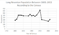 Long Newnton Population Time Series.png 458 × 271; 9 KB
-
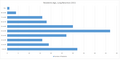 Long Newnton Residents Age, 2011.png 996 × 501; 15 KB
-
 Long Newnton road outside the church - geograph.org.uk - 3829356.jpg 1,280 × 960; 960 KB
-
 Long Newnton road outside the church - geograph.org.uk - 3829360.jpg 1,280 × 960; 831 KB
-
 Long Newnton, county boundary - geograph.org.uk - 2308391.jpg 768 × 1,024; 268 KB
-

-
 Main road at Long Newnton - geograph.org.uk - 302864.jpg 640 × 419; 51 KB
-
 Milestone near Long Newnton - geograph.org.uk - 2019649.jpg 640 × 480; 79 KB
-
 Milestone near Long Newnton - geograph.org.uk - 2019676.jpg 480 × 640; 121 KB
-
 Milestone near Long Newnton - geograph.org.uk - 2019764.jpg 640 × 480; 77 KB
-
 Milestone near Long Newnton - geograph.org.uk - 2019775.jpg 480 × 640; 95 KB
-
 Modern terraced houses at Long Newnton - geograph.org.uk - 5869520.jpg 1,600 × 1,198; 738 KB
-
 New construction Tanyard Tetbury - geograph.org.uk - 3807012.jpg 1,280 × 960; 892 KB
-
 Newnton House driveway - geograph.org.uk - 320578.jpg 640 × 453; 127 KB
-
 Newnton Road, Tetbury - geograph.org.uk - 6095434.jpg 1,840 × 1,148; 1.31 MB
-
 Newnton Road, Tetbury - geograph.org.uk - 6097158.jpg 1,920 × 1,280; 1.17 MB
-
 Old Toll House by Fox Hill, Tetbury - geograph.org.uk - 6114949.jpg 640 × 542; 242 KB
-
 Pill Box near Long Newnton - geograph.org.uk - 276707.jpg 640 × 480; 73 KB
-
 Ridge and furrow - geograph.org.uk - 4796334.jpg 800 × 531; 136 KB
-
 Rivet on milestone, Long Newnton - geograph.org.uk - 2019705.jpg 640 × 480; 103 KB
-
 Road from Long Newnton to Lark Hill - geograph.org.uk - 3829386.jpg 1,280 × 960; 745 KB
-
 Road passing through Long Newnton - geograph.org.uk - 5995998.jpg 1,024 × 683; 209 KB
-
 Road to Ashley - geograph.org.uk - 1747423.jpg 640 × 480; 63 KB
-
 Road to Long Newnton from Lark Hill - geograph.org.uk - 3829383.jpg 1,280 × 960; 682 KB
-
 Road to the east of Long Newnton - geograph.org.uk - 4796330.jpg 1,024 × 680; 256 KB
-
 Stalactites on a WWII pillbox - geograph.org.uk - 4795956.jpg 800 × 531; 162 KB
-
 Tanyard Cottage Tetbury - geograph.org.uk - 3807019.jpg 1,280 × 960; 963 KB
-
 The eastern edge of Long Newnton - geograph.org.uk - 5869522.jpg 1,600 × 1,141; 728 KB
-
 The Fosse Way - geograph.org.uk - 2841992.jpg 2,592 × 1,944; 1.63 MB
-
 The Fosse Way - geograph.org.uk - 342863.jpg 503 × 640; 128 KB
-
 The Fosse Way - geograph.org.uk - 4796344.jpg 800 × 531; 154 KB
-
 The Fosse Way - geograph.org.uk - 4797103.jpg 800 × 531; 183 KB
-
 The Fosse Way near Long Newnton - geograph.org.uk - 5996127.jpg 1,024 × 683; 280 KB
-
 The Fosse Way, Long Newnton - geograph.org.uk - 4796347.jpg 800 × 531; 127 KB
-
 The Manse, Long Newnton - geograph.org.uk - 4795940.jpg 800 × 531; 157 KB
-
 The Monarch's Way - geograph.org.uk - 4795822.jpg 1,024 × 680; 315 KB
-
 The Monarch's Way west of the road from Long Newnton - geograph.org.uk - 2101362.jpg 1,440 × 1,080; 1.08 MB
-
 The Monarch's Way, Long Newnton - geograph.org.uk - 2101063.jpg 1,440 × 1,080; 910 KB
-

-
 The road to Ashley - geograph.org.uk - 5905184.jpg 1,024 × 768; 240 KB
-
 The road to Long Newnton church - geograph.org.uk - 5869521.jpg 1,600 × 1,200; 765 KB
-
 Traffic signs at Long Newnton - geograph.org.uk - 3829421.jpg 1,280 × 960; 666 KB
-
 Trees in a field - geograph.org.uk - 4795947.jpg 531 × 800; 135 KB
-
 West along The Monarch's Way, Long Newnton - geograph.org.uk - 2101071.jpg 1,440 × 1,080; 1,017 KB
-
 Wiltshire Bridge , Tetbury - geograph.org.uk - 1657816.jpg 640 × 462; 85 KB
-
 Wiltshire Bridge taken from Tanyard Tetbury - geograph.org.uk - 3807003.jpg 1,278 × 830; 831 KB
-
 Wiltshire Bridge, Fox Hill, Tetbury - geograph.org.uk - 6321581.jpg 4,608 × 3,456; 7.45 MB
-
 Wiltshire Bridge, Tetbury - geograph.org.uk - 5451406.jpg 1,280 × 960; 439 KB
-
 Wiltshire Bridge, Tetbury - geograph.org.uk - 6095433.jpg 1,920 × 1,280; 1.29 MB
-
 Woodland by Newnton Road, Tetbury - geograph.org.uk - 6097154.jpg 1,920 × 1,280; 1.46 MB
-
 Woodland by Newnton Road, Tetbury - geograph.org.uk - 6097160.jpg 1,862 × 1,188; 1.86 MB
-
 WW2 pillbox near Long Newnton - geograph.org.uk - 5812252.jpg 4,000 × 3,000; 4.72 MB
-
 WW2 pillbox near Long Newnton - geograph.org.uk - 5812255.jpg 4,000 × 3,000; 5.08 MB
-
 WWII pillbox ^1 - geograph.org.uk - 4795949.jpg 800 × 531; 150 KB
-
 WWII pillbox ^2 - geograph.org.uk - 4795952.jpg 800 × 531; 155 KB
-
 Paddock at The Priory - geograph.org.uk - 380821.jpg 640 × 480; 115 KB


_-_geograph.org.uk_-_5812264.jpg)


