Category:Longcot
village and civil parish in Vale of White Horse district, Oxfordshire, England  | |||||
| Upload media | |||||
| Instance of | |||||
|---|---|---|---|---|---|
| Location | Vale of White Horse, Oxfordshire, South East England, England | ||||
| official website | |||||
 | |||||
English: Longcot is a small village and civil parish in the Vale of White Horse district in the south-west of Oxfordshire. In 1974 it was transferred from Berkshire. It is located 1 mile SE of the A420 road between Swindon and Oxford, 4 miles (6 km) SSW of Faringdon and 3 NE by E of Shrivenham.
Subcategories
This category has the following 3 subcategories, out of 3 total.
C
L
- Longcot War Memorial (2 F)
Media in category "Longcot"
The following 122 files are in this category, out of 122 total.
-
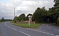
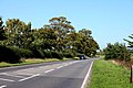
 A420 approaching turn for Tithe Farm - geograph.org.uk - 5527518.jpg 1,600 × 1,202; 737 KB
-
 Advance warning of turn for Longcot - geograph.org.uk - 5527524.jpg 1,600 × 1,200; 731 KB
-
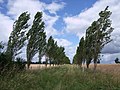 Avenue of poplars, D'Arcy Dalton Way, near Watchfield - geograph.org.uk - 3060076.jpg 4,000 × 3,000; 2.87 MB
-

-
 Bridleway near Longcot - geograph.org.uk - 4748867.jpg 3,386 × 2,540; 2.68 MB
-
 Bridleway passing Tithe Farm - geograph.org.uk - 4748861.jpg 3,972 × 2,979; 4.67 MB
-

-
 Church of St Mary, Longcot - geograph.org.uk - 3931678.jpg 640 × 480; 155 KB
-
 Coat of arms, Church of St Mary, Longcot - geograph.org.uk - 3931770.jpg 640 × 640; 118 KB
-
 Commemorative plaque, Church of St Mary, Longcot - geograph.org.uk - 3932662.jpg 1,850 × 2,730; 1.57 MB
-
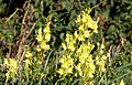 Common toadflax by the road - geograph.org.uk - 2576324.jpg 1,500 × 963; 175 KB
-
 D'Arcy Dalton Way - geograph.org.uk - 4757069.jpg 640 × 480; 57 KB
-
 D'Arcy Dalton Way - geograph.org.uk - 4757093.jpg 640 × 480; 66 KB
-
 D'Arcy Dalton Way - geograph.org.uk - 4757260.jpg 640 × 480; 105 KB
-
 D'Arcy Dalton Way - geograph.org.uk - 4757270.jpg 640 × 480; 73 KB
-

-
 Entering Longcot - geograph.org.uk - 6267664.jpg 800 × 600; 153 KB
-
 Entrance to Longcot on Fernham Road - geograph.org.uk - 6229688.jpg 2,000 × 1,305; 2.77 MB
-
 Fairground rides at Longcot Fete - geograph.org.uk - 2482273.jpg 2,816 × 2,112; 1.89 MB
-
 Farmer Gow's play farm, Longcot - geograph.org.uk - 6228115.jpg 2,000 × 1,119; 2.28 MB
-
 Farmland south of Longcot - geograph.org.uk - 3933665.jpg 640 × 480; 75 KB
-
 Fernham Road (B4508) - geograph.org.uk - 6228074.jpg 2,000 × 1,177; 2.43 MB
-
 Fernham Road (B4508) - geograph.org.uk - 6267682.jpg 640 × 480; 63 KB
-
 Fernham Road by Farmer Gow's Activity Farm - geograph.org.uk - 4215142.jpg 1,500 × 999; 107 KB
-
 Fernham Road in Longcot - geograph.org.uk - 4215139.jpg 1,500 × 999; 200 KB
-
 Fernham Road out of Longcot - geograph.org.uk - 4215141.jpg 1,500 × 999; 177 KB
-
 Fernham Road, Longcot - geograph.org.uk - 6229702.jpg 2,000 × 1,299; 2.97 MB
-
 Field and footpath near Longcot - geograph.org.uk - 4748858.jpg 3,866 × 2,899; 5.14 MB
-
 Field being harvested, Longcot - geograph.org.uk - 6228465.jpg 2,000 × 1,071; 2.24 MB
-
 Field boundary and structure near Longcot - geograph.org.uk - 3917484.jpg 4,000 × 3,000; 3.92 MB
-
 Field boundary near Longcot - geograph.org.uk - 2212841.jpg 2,816 × 2,112; 1.78 MB
-
 Field boundary near Longcot - geograph.org.uk - 4748869.jpg 4,000 × 3,000; 4.52 MB
-
 Field entrance on Old Wharf Road - geograph.org.uk - 4748889.jpg 4,000 × 3,000; 3.47 MB
-
 Field of sweetcorn near Longcot - geograph.org.uk - 2576256.jpg 1,500 × 1,000; 283 KB
-
 Fields near Longcot - geograph.org.uk - 2212838.jpg 2,816 × 2,112; 1.41 MB
-
 Fields near Longcot - geograph.org.uk - 2212839.jpg 2,816 × 2,112; 1.46 MB
-
 Fields near Longcot - geograph.org.uk - 4748864.jpg 4,000 × 2,460; 1.88 MB
-
 Font, Church of St Mary, Longcot - geograph.org.uk - 3933203.jpg 480 × 640; 65 KB
-
 Footpath across a field near Longcot - geograph.org.uk - 4748879.jpg 4,000 × 3,000; 4.21 MB
-
 Fred C Palmer Longcot Bricklayers Arms.jpg 4,236 × 2,712; 1.34 MB
-
 Gathering the harvest in the shadow of White Horse Hill - geograph.org.uk - 5872611.jpg 5,184 × 3,888; 4.72 MB
-
 Graveyard of St. Mary the Virgin Church, Longcot - geograph.org.uk - 6229715.jpg 2,000 × 1,002; 2.17 MB
-
 Graveyard of St. Mary the Virgin Church, Longcot - geograph.org.uk - 6229716.jpg 2,000 × 1,297; 2.63 MB
-
 Harvesting off Majors Road - geograph.org.uk - 6267659.jpg 800 × 530; 83 KB
-
 Harvesting the fields, Longcot - geograph.org.uk - 5192394.jpg 1,468 × 1,180; 2.4 MB
-
 Hedgerow and farmland, Longcot - geograph.org.uk - 6267668.jpg 800 × 600; 96 KB
-
 Horses and the Uffington White Horse - geograph.org.uk - 2482269.jpg 2,816 × 2,112; 1.78 MB
-
 House at Mayhow's Pond, Longcot 1993 - geograph.org.uk - 5192430.jpg 1,756 × 1,188; 2.21 MB
-
 In an avenue of poplars near Longcot - geograph.org.uk - 4748878.jpg 4,000 × 3,000; 4.54 MB
-
 Interior, Church of St Mary, Longcot - geograph.org.uk - 3933214.jpg 640 × 480; 74 KB
-
 Ivy House, King's Lane, Longcot - geograph.org.uk - 6230455.jpg 1,331 × 2,000; 3.39 MB
-
 Junction of Fernham Road and King's Lane, Longcot - geograph.org.uk - 6229705.jpg 2,000 × 1,228; 2.43 MB
-
 King ^ Queen Pub Longcot 1989 - geograph.org.uk - 5191929.jpg 1,468 × 1,172; 1.94 MB
-
 King's Lane - geograph.org.uk - 4757247.jpg 640 × 480; 66 KB
-
 King's Lane to Longcot - geograph.org.uk - 2576249.jpg 1,500 × 1,000; 230 KB
-
 King's Lane, Longcot - geograph.org.uk - 2212848.jpg 2,816 × 2,112; 1.7 MB
-
 King's Lane, Longcot - geograph.org.uk - 6229711.jpg 2,000 × 1,129; 2.72 MB
-
 King's Lane, Longcot - geograph.org.uk - 6229720.jpg 2,000 × 1,362; 2.59 MB
-
 King's Lane, Longcot - geograph.org.uk - 6230342.jpg 2,000 × 1,161; 2.46 MB
-
 King's Lane, Longcot - geograph.org.uk - 6230445.jpg 2,000 × 1,114; 2.82 MB
-
 Kings Farm Close, Longcot - geograph.org.uk - 6193842.jpg 4,000 × 3,000; 4.59 MB
-
 Kings Farmhouse, Longcot - geograph.org.uk - 2212837.jpg 2,816 × 2,112; 1.91 MB
-
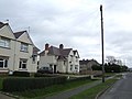 Houses at the north end of Longcot - geograph.org.uk - 306561.jpg 640 × 480; 62 KB
-
 Shrivenham Road, Longcot - geograph.org.uk - 814253.jpg 640 × 480; 77 KB
-
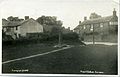
 Longcot - geograph.org.uk - 814249.jpg 640 × 480; 76 KB
-

-
 Longcot Chapel - geograph.org.uk - 6230352.jpg 2,000 × 1,331; 2.98 MB
-
 Longcot House - geograph.org.uk - 6229694.jpg 2,000 × 1,152; 2.61 MB
-
 Longcot House 1993 (geograph 5192414).jpg 1,756 × 1,184; 2.18 MB
-
 Longcot House, Mallins Lane - geograph.org.uk - 6193867.jpg 4,000 × 3,000; 4.69 MB
-
 Longcot Pump - geograph.org.uk - 814244.jpg 640 × 480; 91 KB
-
 Longcot village pump 1989 - geograph.org.uk - 5192361.jpg 1,174 × 1,443; 1.74 MB
-
 Longcot ^ Fernham C of E School 1993 - geograph.org.uk - 5192401.jpg 1,760 × 1,188; 2.08 MB
-
 Majors Road (B4508) - geograph.org.uk - 6267662.jpg 800 × 600; 99 KB
-
 Majors Road by Clevelands Farm - geograph.org.uk - 4215136.jpg 1,500 × 999; 225 KB
-
 Majors Road to Longcot - geograph.org.uk - 4215134.jpg 1,500 × 999; 174 KB
-
 Majors Road to Longcot - geograph.org.uk - 4215135.jpg 1,500 × 999; 144 KB
-
 Mallins Lane, Longcot - geograph.org.uk - 6229697.jpg 2,000 × 1,331; 3.53 MB
-
 Mead Lane, Longcot - geograph.org.uk - 6229700.jpg 2,000 × 1,331; 3.43 MB
-
 Methodist Chapel, Longcot 1993 - geograph.org.uk - 5192440.jpg 1,192 × 1,743; 1.85 MB
-
 Morris Dancing at Longcot Fete - geograph.org.uk - 2482271.jpg 2,816 × 2,112; 2.22 MB
-
 North Porch, St. Mary's Church, Longcot - geograph.org.uk - 5192377.jpg 1,472 × 1,188; 2.03 MB
-
 Old Wharf Lane - geograph.org.uk - 4757236.jpg 640 × 480; 62 KB
-
 Oxford Oak Camping and Farmer Gow's, Longcot - geograph.org.uk - 6231511.jpg 2,000 × 1,085; 2.22 MB
-
 Oxford Oak Camping, Longcot - geograph.org.uk - 6231503.jpg 2,000 × 1,016; 1.6 MB
-
 Ploughed fields near Uffington - geograph.org.uk - 4677644.jpg 4,000 × 3,000; 3.96 MB
-
 Pry Lane - geograph.org.uk - 4757284.jpg 640 × 480; 97 KB
-
 Pulpit, Church of St Mary, Longcot - geograph.org.uk - 3932569.jpg 480 × 640; 110 KB
-
 Route of the Wilts & Berks Canal near Longcot - geograph.org.uk - 4748885.jpg 4,000 × 2,608; 2.65 MB
-
 Shrivenham Road (B4508), Longcot - geograph.org.uk - 6267672.jpg 800 × 600; 97 KB
-
 Shrivenham Road in Longcot - geograph.org.uk - 4215138.jpg 1,500 × 999; 148 KB
-
 Shrivenham Road into Longcot - geograph.org.uk - 4215137.jpg 1,500 × 999; 122 KB
-
 Small field, Longcot - geograph.org.uk - 3933274.jpg 1,600 × 972; 450 KB
-
 Small field, Longcot - geograph.org.uk - 6244452.jpg 1,600 × 764; 300 KB
-
 Solitary tree at bend in A420 - geograph.org.uk - 5527535.jpg 1,600 × 1,200; 707 KB
-
 St. Mary the Virgin Church, Longcot - geograph.org.uk - 6229727.jpg 2,000 × 1,049; 2.06 MB
-
 St. Mary's Church, Longcot 1993 - geograph.org.uk - 5192407.jpg 1,760 × 1,184; 1.98 MB
-
 St. Mary, Longcot - geograph.org.uk - 2212842.jpg 2,816 × 2,112; 1.72 MB
-
 St. Mary, Longcot - geograph.org.uk - 2212844.jpg 2,816 × 2,112; 1.81 MB
-
 St. Mary, Longcot - geograph.org.uk - 3544108.jpg 3,000 × 4,000; 3.22 MB
-
 Stables at Wellington Farm - geograph.org.uk - 306556.jpg 640 × 480; 85 KB
-
 Stone Farm, Majors Road, Longcot - geograph.org.uk - 3060031.jpg 4,000 × 3,000; 2.85 MB
-
 Tents in a field near Longcot - geograph.org.uk - 4215140.jpg 1,500 × 999; 165 KB
-
 Thatched cottage on The Green Longcot 1989 - geograph.org.uk - 5191924.jpg 1,460 × 1,180; 2.1 MB
-
 The A420 to Faringdon - geograph.org.uk - 2576263.jpg 1,500 × 1,000; 294 KB
-
 The A420 to Swindon - geograph.org.uk - 4195367.jpg 1,500 × 999; 93 KB
-
 The Dash, Longcot 1989 - geograph.org.uk - 5192382.jpg 1,468 × 1,188; 2 MB
-
 The Dash, Longcot 1993 - geograph.org.uk - 5192426.jpg 1,748 × 1,184; 2.28 MB
-
 The Green, King's Lane, Longcot - geograph.org.uk - 6229718.jpg 2,000 × 965; 1.89 MB
-
 The Green, Longcot - geograph.org.uk - 6230339.jpg 2,000 × 1,331; 2.81 MB
-
 The King and Queen - geograph.org.uk - 814227.jpg 640 × 480; 84 KB
-
 The King ^ Queen, Longcot - geograph.org.uk - 6267676.jpg 800 × 492; 84 KB
-
 The Old Wharf House, Majors Road, Longcot - geograph.org.uk - 3301814.jpg 4,000 × 3,000; 2.83 MB
-
 The overgrown Wilts & Berks Canal (Longcot Branch) - geograph.org.uk - 4748882.jpg 4,000 × 3,000; 6.37 MB
-
 Tithe Farm, near Watchfield - geograph.org.uk - 3060883.jpg 4,000 × 3,000; 2.88 MB
-
 View from the D'Arcy Dalton Way, Longcot - geograph.org.uk - 6244467.jpg 1,600 × 1,177; 421 KB
-
 Water lying in a field near Longcot - geograph.org.uk - 3917486.jpg 4,000 × 3,000; 3.15 MB
-
 Wheat field, Longcot - geograph.org.uk - 6229731.jpg 2,000 × 922; 1.89 MB
-
 Pretty cottage near Broadleaze Farm - geograph.org.uk - 306567.jpg 640 × 480; 87 KB
-
 Road to Nightingale Farm - geograph.org.uk - 307332.jpg 640 × 480; 85 KB
-
 Stone Farm - geograph.org.uk - 306563.jpg 640 × 480; 66 KB
-
 Waylands - geograph.org.uk - 306569.jpg 640 × 480; 94 KB


_-_geograph.org.uk_-_6228074.jpg)
_-_geograph.org.uk_-_6267682.jpg)


.jpg)


_-_geograph.org.uk_-_6267662.jpg)


,_Longcot_-_geograph.org.uk_-_6267672.jpg)


_-_geograph.org.uk_-_4748882.jpg)


