Category:Lopikerstraat 20, Schoonhoven
| Object location | | View all coordinates using: OpenStreetMap |
|---|
 | |||||
| Upload media | |||||
| Instance of | |||||
|---|---|---|---|---|---|
| Location | Schoonhoven, Krimpenerwaard, South Holland, Netherlands | ||||
| Street address |
| ||||
| Located on street | |||||
| Heritage designation |
| ||||
 | |||||
|
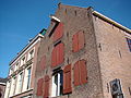
This is a category about rijksmonument number 33506
|
| Address |
|
Media in category "Lopikerstraat 20, Schoonhoven"
The following 5 files are in this category, out of 5 total.
-
 Exterieur VOORGEVEL, RECHTER ZIJGEVEL - Schoonhoven - 20301772 - RCE.jpg 955 × 1,200; 279 KB
-
 Hoek Doelenstraat - Schoonhoven - 20198680 - RCE.jpg 1,200 × 952; 269 KB
-
 RM33506 Schoonhoven - Lopikerstraat 20.jpg 1,944 × 2,592; 1.5 MB
-
 Schoonhoven 024.JPG 3,264 × 2,448; 2.06 MB
-
 Voor- en zijgevel - Schoonhoven - 20198661 - RCE.jpg 815 × 1,200; 251 KB


