Category:Low tide in Aberdeenshire
Media in category "Low tide in Aberdeenshire"
The following 34 files are in this category, out of 34 total.
-
 Balmedie Beach - geograph.org.uk - 1300510.jpg 640 × 406; 189 KB
-
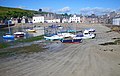
 Beached boats in the Inner Harbour - geograph.org.uk - 1372052.jpg 640 × 480; 178 KB
-
 Gardenstown Harbour - geograph.org.uk - 19028.jpg 640 × 480; 54 KB
-
 Gardenstown, low water - geograph.org.uk - 1375122.jpg 640 × 480; 526 KB
-
 Harbour beach, Stonehaven - geograph.org.uk - 1371997.jpg 640 × 480; 127 KB
-
 Knock Head - geograph.org.uk - 1298473.jpg 640 × 406; 239 KB
-
 Looking south along Balmedie Beach - geograph.org.uk - 35493.jpg 640 × 480; 34 KB
-
 Low Tide at Aberdour Bay - geograph.org.uk - 260548.jpg 640 × 434; 101 KB
-
 Low Tide at Old Portsoy Harbour - geograph.org.uk - 706923.jpg 640 × 400; 86 KB
-
 Low tide at the Stonehaven Inner Harbour - geograph.org.uk - 1434739.jpg 640 × 406; 159 KB
-
 Low tide in Stonehaven Inner Harbour - geograph.org.uk - 1372056.jpg 640 × 480; 127 KB
-
 Low tide on the Ythan Estuary. - geograph.org.uk - 569862.jpg 640 × 480; 163 KB
-
 Newburgh, the Foveran Burn - geograph.org.uk - 1615183.jpg 640 × 480; 320 KB
-
 Old Harbour, Portsoy - geograph.org.uk - 224155.jpg 640 × 367; 217 KB
-
 Patterns in the sand. Hackley Bay beach. - geograph.org.uk - 375557.jpg 640 × 419; 208 KB
-
 Portsoy harbor (30114850868).jpg 4,480 × 6,720; 18.3 MB
-
 Portsoy harbor (43077737375).jpg 6,255 × 4,170; 16.91 MB
-
 Rising tide in the Middle Harbour - geograph.org.uk - 1372044.jpg 640 × 480; 110 KB
-
 Rocks north of Macduff Harbour - geograph.org.uk - 593334.jpg 640 × 368; 187 KB
-
 Sea Cave - geograph.org.uk - 1116137.jpg 426 × 640; 103 KB
-
 Six minutes till low tide - geograph.org.uk - 2310453.jpg 3,648 × 2,736; 3.82 MB
-
 Stake Ness - geograph.org.uk - 794900.jpg 640 × 402; 261 KB
-
 Still seven minutes till low tide - geograph.org.uk - 2310440.jpg 3,648 × 2,736; 4.81 MB
-
 Stonehaven harbour 02.JPG 3,072 × 2,304; 1.38 MB
-
 Stonehaven Harbour and sundial - geograph.org.uk - 950460.jpg 640 × 480; 75 KB
-
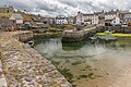
 Stonehaven harbour at low tide - geograph.org.uk - 618015.jpg 633 × 475; 160 KB
-
 Whitehills Fishing Village - geograph.org.uk - 1275686.jpg 640 × 480; 102 KB
-
 Bailiff's Skelly - geograph.org.uk - 568494.jpg 640 × 427; 247 KB
-
 Beach Between St Combs and Rattray Head - geograph.org.uk - 568470.jpg 640 × 404; 178 KB
-
 Foreshore at Bervie Bay - geograph.org.uk - 97589.jpg 640 × 428; 147 KB
-
 Shelter on the Ythan estuary - geograph.org.uk - 388669.jpg 640 × 480; 404 KB
-
 Skerries - geograph.org.uk - 224094.jpg 640 × 403; 268 KB
-

-
 Whyntie Head - geograph.org.uk - 224106.jpg 640 × 329; 221 KB


.jpg)
.jpg)


