Category:Lower Beeding (civil parish)
Lower Beeding is a civil parish in the Horsham District of West Sussex, England. Parish hamlets are Crabtree to the south of Lower Beeding village, and Ashfold Crossways and Plummer's Plain to the north-east. Lower Beeding village is situated 3.5 miles (6 km) southeast from Horsham. At Plummer's Plain there is a spring that is the official source of the River Ouse, which eventually reaches the sea at Newhaven. Between the settlements of Crabtree and Lower Beeding is the local landmark house and gardens of Leonardslee.
Main Wikipedia article: Lower Beeding.

civil parish in Horsham, West Sussex, England | |||||
| Upload media | |||||
| Instance of | |||||
|---|---|---|---|---|---|
| Location | Horsham, West Sussex, South East England, England | ||||
 | |||||
Subcategories
This category has the following 3 subcategories, out of 3 total.
C
- Crabtree, West Sussex (2 F)
Media in category "Lower Beeding (civil parish)"
The following 200 files are in this category, out of 475 total.
(previous page) (next page)-
 A fallen tree Lower Beeding West Sussex England.jpg 5,472 × 3,648; 26.98 MB
-
 Across garden to South Downs Lower Beeding West Sussex England.jpg 5,472 × 3,648; 18.73 MB
-
 Bridleway and fingerpost Lower Beeding, West Sussex, England 1.jpg 5,472 × 3,648; 20.78 MB
-
 Bridleway at Lower Beeding, West Sussex, England.jpg 5,472 × 3,648; 26.54 MB
-
 Bridleway fingerpost at Lower Beeding Lower Beeding, West Sussex, England 1.jpg 3,648 × 5,472; 25.9 MB
-
 Bridleway fingerpost at Lower Beeding Lower Beeding, West Sussex, England 2.jpg 3,648 × 5,472; 21.29 MB
-
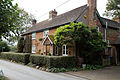 Cottage Newells Lane Lower Beeding West Sussex England.jpg 5,472 × 3,648; 21.25 MB
-
 Keeper's Cottage near Nuthurst village, West Sussex, England.jpg 5,000 × 3,333; 13.23 MB
-
 A blue carpet - geograph.org.uk - 4142841.jpg 640 × 430; 144 KB
-
 A blue slope - geograph.org.uk - 4142853.jpg 640 × 430; 150 KB
-

-
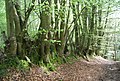 A row of Beech trees - geograph.org.uk - 4070360.jpg 640 × 430; 138 KB
-
 A sea of yellow - geograph.org.uk - 4073582.jpg 640 × 430; 85 KB
-
 A woodland swamp - geograph.org.uk - 4070361.jpg 640 × 430; 139 KB
-
 A yellow hillside - geograph.org.uk - 4070353.jpg 640 × 430; 56 KB
-
 A281 - geograph.org.uk - 4126744.jpg 640 × 430; 108 KB
-
 A281 - geograph.org.uk - 4142769.jpg 640 × 430; 109 KB
-
 A281 - geograph.org.uk - 4142776.jpg 640 × 430; 115 KB
-
 A281 north to Horsham - geograph.org.uk - 2306742.jpg 4,000 × 3,000; 3.61 MB
-
 A281 Through Monk's Gate, Sussex - geograph.org.uk - 1906130.jpg 3,872 × 2,592; 4.83 MB
-
 A281, north into Monk's Gate - geograph.org.uk - 1863957.jpg 640 × 430; 176 KB
-
 A281, south at Monk's Gate - geograph.org.uk - 1863956.jpg 640 × 430; 166 KB
-
 A281, southbound - geograph.org.uk - 4142766.jpg 640 × 430; 111 KB
-
 A281, southbound - geograph.org.uk - 4142768.jpg 640 × 430; 106 KB
-
 A281, southbound - geograph.org.uk - 4142777.jpg 640 × 430; 106 KB
-
 A281, southbound - geograph.org.uk - 4142781.jpg 640 × 430; 83 KB
-
 A281, southbound - geograph.org.uk - 4142789.jpg 640 × 430; 90 KB
-
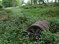 Abandoned roller in Cinderbank Copse - geograph.org.uk - 433612.jpg 640 × 480; 88 KB
-
 Airstrip - geograph.org.uk - 5146243.jpg 640 × 424; 80 KB
-
 An English woodland in May - geograph.org.uk - 4070377.jpg 640 × 430; 134 KB
-
 Anti-tank pillbox in Carterslodge Lane - geograph.org.uk - 420332.jpg 640 × 480; 109 KB
-
 Around Lower Beeding from the air (geograph 5150888).jpg 1,360 × 1,274; 759 KB
-
-
 B2110 south to its junction with the A281 - geograph.org.uk - 2310169.jpg 4,000 × 3,000; 3.66 MB
-
 B2110, A281 junction - geograph.org.uk - 4126739.jpg 640 × 430; 88 KB
-
 B2110, Leechpond Hill - geograph.org.uk - 4126729.jpg 640 × 430; 99 KB
-
 B2115 Warninglid Lane - geograph.org.uk - 2309958.jpg 4,000 × 3,000; 3.41 MB
-
 B2115 west to Pronger's Corner - geograph.org.uk - 2306780.jpg 4,000 × 3,000; 3.41 MB
-

-

-
 Barn at Stone House Farm - geograph.org.uk - 4951196.jpg 800 × 600; 145 KB
-
 Barn in field beside the A281 - geograph.org.uk - 5219480.jpg 800 × 600; 167 KB
-
 Barn, Copyhold - geograph.org.uk - 4073563.jpg 640 × 430; 85 KB
-
 Beedinglee Village Hall, Sussex - geograph.org.uk - 1928308.jpg 3,872 × 2,592; 4.37 MB
-
 Bend in the B2110 at Lower Beeding - geograph.org.uk - 4490208.jpg 640 × 480; 71 KB
-
 Bend, A281 - geograph.org.uk - 4142771.jpg 640 × 430; 110 KB
-
 Bendy stream with daffodils - geograph.org.uk - 4878635.jpg 800 × 600; 219 KB
-

-
 Bluebells by Winterpit Lane - geograph.org.uk - 1861089.jpg 640 × 428; 177 KB
-
 Bluebells, East Hanger Wood - geograph.org.uk - 4073551.jpg 640 × 430; 128 KB
-
 Bluebells, Eastland Hill - geograph.org.uk - 4126681.jpg 640 × 430; 150 KB
-
 Bluebells, Minepits Wood - geograph.org.uk - 4070106.jpg 640 × 430; 148 KB
-
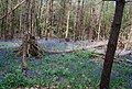
 Bluebells, Spring Wood (2) - geograph.org.uk - 1862726.jpg 640 × 430; 205 KB
-
 Bluebells, Westside Wood - geograph.org.uk - 4142838.jpg 640 × 430; 152 KB
-
 Bluebells, Westside Wood - geograph.org.uk - 4142840.jpg 640 × 430; 147 KB
-
 Boundary Oaks - geograph.org.uk - 2031902.jpg 480 × 640; 130 KB
-
 Bridge on Hammer Pond Dam - geograph.org.uk - 432971.jpg 640 × 480; 91 KB
-
 Bridge over Hammer Pond - geograph.org.uk - 4874121.jpg 800 × 600; 158 KB
-

-
 Bridleway and track to Newstead Farm - geograph.org.uk - 2309765.jpg 4,000 × 3,000; 3.46 MB
-
 Bridleway in a Green Tunnel - geograph.org.uk - 5146319.jpg 424 × 640; 122 KB
-
 Bridleway in Westside - geograph.org.uk - 569137.jpg 640 × 480; 136 KB
-
 Bridleway junction - geograph.org.uk - 4142831.jpg 430 × 640; 128 KB
-
 Bridleway junction - geograph.org.uk - 4142843.jpg 640 × 430; 132 KB
-
 Bridleway junction on Handcross Road - geograph.org.uk - 4951009.jpg 800 × 600; 165 KB
-
 Bridleway junction with Hammerpond Road - geograph.org.uk - 4873971.jpg 800 × 600; 211 KB
-
 Bridleway Near Fox Hills - geograph.org.uk - 5146301.jpg 424 × 640; 122 KB
-
 Bridleway South of Fox Hills - geograph.org.uk - 5146304.jpg 424 × 640; 119 KB
-
 Bridleway to Burnthouse Lane - geograph.org.uk - 5146325.jpg 424 × 640; 95 KB
-
 Bridleway to Old Camp Farm (geograph 5145933).jpg 424 × 640; 88 KB
-
 Bridleway west of the A281 - geograph.org.uk - 4142804.jpg 640 × 430; 133 KB
-
 Bridleway west of the A281 - geograph.org.uk - 4142805.jpg 640 × 430; 123 KB
-
 Bridleway, footpath junction - geograph.org.uk - 4142849.jpg 640 × 430; 137 KB
-
 Bridleway, Westside Wood - geograph.org.uk - 4142820.jpg 640 × 430; 124 KB
-
 Bridleway, Westside Wood - geograph.org.uk - 4142828.jpg 640 × 430; 147 KB
-
 Bridleway, Westside Wood - geograph.org.uk - 4142837.jpg 640 × 430; 133 KB
-
 Building a Brewery - geograph.org.uk - 2734666.jpg 429 × 640; 42 KB
-
 Burnthouse Lane - geograph.org.uk - 4150694.jpg 640 × 380; 81 KB
-
 Burnthouse Lane - geograph.org.uk - 4150698.jpg 640 × 430; 125 KB
-

-
 Bush in a ploughed field - geograph.org.uk - 1862785.jpg 640 × 430; 147 KB
-
 By the A281 - geograph.org.uk - 4142767.jpg 640 × 458; 125 KB
-
 Carters Lodge Farm - panoramio.jpg 2,592 × 1,944; 1.76 MB
-
 Carters Lodge Lane - panoramio (10).jpg 2,592 × 1,944; 2.3 MB
-
 Carters Lodge Lane - panoramio (11).jpg 2,592 × 1,944; 1.88 MB
-
 Carters Lodge Lane - panoramio (12).jpg 2,592 × 1,944; 1.66 MB
-
 Carters Lodge Lane - panoramio (13).jpg 2,592 × 1,944; 1.94 MB
-
 Carters Lodge Lane - panoramio (14).jpg 2,592 × 1,944; 1.53 MB
-
 Carters Lodge Lane - panoramio (15).jpg 2,592 × 1,944; 2.21 MB
-
 Carters Lodge Lane - panoramio (6).jpg 2,592 × 1,944; 1.92 MB
-
 Carters Lodge Lane - panoramio (7).jpg 2,592 × 1,944; 2.19 MB
-
 Carters Lodge Lane - panoramio (8).jpg 2,592 × 1,944; 2.03 MB
-
 Carters Lodge Lane - panoramio (9).jpg 2,592 × 1,944; 2.12 MB
-
 Carters Lodge Lane 1 - panoramio.jpg 2,592 × 1,944; 2.41 MB
-
 Carters Lodge Pond - panoramio.jpg 2,592 × 1,944; 1.97 MB
-

-

-

-
 Cartersledge Lane, West Sussex. - geograph.org.uk - 62652.jpg 640 × 525; 163 KB
-
 Carterslodge Gill - geograph.org.uk - 2994256.jpg 429 × 640; 126 KB
-
 Carterslodge Lane, Lower Beeding - geograph.org.uk - 49509.jpg 640 × 480; 77 KB
-

-
 Carterslodge Pond, St Leonard's Forest - geograph.org.uk - 3464098.jpg 1,600 × 1,067; 580 KB
-
 Colt Farm - geograph.org.uk - 4142858.jpg 640 × 430; 67 KB
-
 Colt Farm - geograph.org.uk - 4150660.jpg 640 × 430; 84 KB
-
 Colt Farm - geograph.org.uk - 4150663.jpg 640 × 430; 82 KB
-
 Conifer woodland - geograph.org.uk - 4142844.jpg 640 × 430; 121 KB
-
 Conifers, path to Monk's Gate - geograph.org.uk - 1862807.jpg 640 × 430; 145 KB
-
 Conifers, Westside Wood - geograph.org.uk - 4142824.jpg 640 × 430; 130 KB
-
 Conifers, Westside Wood - geograph.org.uk - 4142826.jpg 640 × 430; 131 KB
-
 Conifers, Westside Wood - geograph.org.uk - 4142835.jpg 640 × 430; 142 KB
-
 Converted barn, Mill Lane - geograph.org.uk - 4061518.jpg 640 × 430; 117 KB
-
 Copyhold - geograph.org.uk - 4073570.jpg 640 × 372; 97 KB
-
 Cottage in Crabtree - geograph.org.uk - 2456113.jpg 2,816 × 2,112; 1.96 MB
-
 Cowfold Stream - geograph.org.uk - 2031872.jpg 480 × 640; 164 KB
-
 Crabtree - geograph.org.uk - 4142784.jpg 640 × 430; 75 KB
-
 Crops by the path south of Monk's Gate - geograph.org.uk - 1863297.jpg 640 × 430; 119 KB
-
 Crops by the path to Monk's Gate - geograph.org.uk - 1862847.jpg 640 × 430; 125 KB
-
 Crops by the path to Monk's Gate - geograph.org.uk - 1863269.jpg 640 × 430; 134 KB
-
 Daffodil laden drive to Keepers Cottage - geograph.org.uk - 2310161.jpg 4,000 × 3,000; 3.24 MB
-
 Dam on Hawkins Pond - geograph.org.uk - 433518.jpg 640 × 480; 102 KB
-
 Deer Fence by the Gallop - geograph.org.uk - 5145956.jpg 424 × 640; 111 KB
-
 Dense woodland - geograph.org.uk - 4126712.jpg 640 × 430; 147 KB
-
 Deserted green on Mannings Heath golf course - geograph.org.uk - 2309221.jpg 4,000 × 3,000; 3.55 MB
-
 Drive to Church Lane Farm Estate - geograph.org.uk - 2734611.jpg 429 × 640; 120 KB
-
 Driveway junction with the A281 - geograph.org.uk - 5219071.jpg 800 × 600; 152 KB
-

-
 Dudwick Wood - geograph.org.uk - 4070358.jpg 640 × 430; 146 KB
-
 East Hanger Wood - geograph.org.uk - 4073553.jpg 640 × 430; 142 KB
-
 Engine Pond, Loenardslee - geograph.org.uk - 4819573.jpg 1,599 × 2,399; 573 KB
-
 Entrance to Keepers Cottage and dog kennels - geograph.org.uk - 2310136.jpg 4,000 × 3,000; 3.37 MB
-
 Entrance to Mannings Heath Hotel (geograph 2307094).jpg 4,000 × 3,000; 3.65 MB
-
 Entrance to Stone House Farm - geograph.org.uk - 4951193.jpg 4,896 × 3,672; 5.98 MB
-
 Entrance to Trinity Fields on Sandygate Lane - geograph.org.uk - 3400827.jpg 2,048 × 1,536; 1.44 MB
-
 Fallen Tree near Lower Beeding - geograph.org.uk - 2456098.jpg 2,816 × 2,112; 2.38 MB
-
 Fallen Tree on Church Lane, Plummers Plain, Sussex - geograph.org.uk - 1906354.jpg 3,872 × 2,592; 6.85 MB
-
 Farm building - geograph.org.uk - 4150682.jpg 640 × 430; 93 KB
-
 Farm buildings - geograph.org.uk - 4150690.jpg 640 × 430; 91 KB
-
 Farmland, Greenacres Farm - geograph.org.uk - 4150669.jpg 640 × 430; 65 KB
-
 Fern by the Gallop - geograph.org.uk - 5145952.jpg 640 × 424; 89 KB
-
 Field edge footpath to the A281 - geograph.org.uk - 5219477.jpg 800 × 600; 186 KB
-

-
 Field Near Lower Beeding, Sussex - geograph.org.uk - 1905590.jpg 3,872 × 2,592; 4.78 MB
-
 Field near Plummers Plain, West Sussex - geograph.org.uk - 2314731.jpg 1,600 × 1,200; 576 KB
-
 Fields beside the A281 - geograph.org.uk - 5219072.jpg 800 × 600; 138 KB
-
 Fields near Crabtree - geograph.org.uk - 2456119.jpg 2,816 × 2,112; 1.84 MB
-
 Fish Pond near South Lodge - geograph.org.uk - 2032052.jpg 640 × 480; 143 KB
-
 Footbridge crosses Newstead Gill - geograph.org.uk - 4874082.jpg 600 × 800; 205 KB
-

-
 Footbridge in Hammerhill Wood - geograph.org.uk - 4874098.jpg 600 × 800; 181 KB
-
 Footbridge Near Job's Castle - geograph.org.uk - 5146366.jpg 640 × 424; 96 KB
-
 Footbridge over Newstead Gill - geograph.org.uk - 2994241.jpg 429 × 640; 119 KB
-
 Footbridge over Newstead Gill - geograph.org.uk - 4878684.jpg 600 × 800; 240 KB
-
 Footbridge over stream - geograph.org.uk - 571118.jpg 640 × 480; 133 KB
-
 Footbridge, East Hanger Wood - geograph.org.uk - 4073534.jpg 640 × 430; 139 KB
-
 Footpath alongside Winterpick Wood - geograph.org.uk - 2307063.jpg 4,000 × 3,000; 3.27 MB
-

-

-
 Footpath crosses field to Sandygate Lane - geograph.org.uk - 5219467.jpg 800 × 600; 117 KB
-
 Footpath crosses stile to leave woodland - geograph.org.uk - 4878646.jpg 800 × 600; 195 KB
-

-

-
 Footpath goes north from the B2110 - geograph.org.uk - 4951005.jpg 800 × 600; 135 KB
-
 Footpath going east in Spring Wood - geograph.org.uk - 5219414.jpg 800 × 600; 231 KB
-
 Footpath going south between fields - geograph.org.uk - 5218847.jpg 800 × 600; 139 KB
-
 Footpath going west in Spring Wood - geograph.org.uk - 5219419.jpg 800 × 600; 240 KB
-
 Footpath heading east from Spring Wood - geograph.org.uk - 1862778.jpg 640 × 430; 129 KB
-
 Footpath heading north - geograph.org.uk - 4061488.jpg 640 × 430; 75 KB
-

-
 Footpath heads north past cottages - geograph.org.uk - 5218848.jpg 800 × 600; 137 KB
-
 Footpath in the woods - geograph.org.uk - 4061498.jpg 640 × 430; 117 KB
-

-

-

-
 Footpath junction on Cartersledge Lane - geograph.org.uk - 4878613.jpg 800 × 600; 218 KB
-
 Footpath leads eastwards from Park Lane - geograph.org.uk - 5222160.jpg 800 × 600; 224 KB
-
 Footpath north of Bushy Platt - geograph.org.uk - 4061412.jpg 640 × 430; 75 KB
-
 Footpath north to Monk's Gate - geograph.org.uk - 1862834.jpg 640 × 430; 150 KB
-
 Footpath off Mill Lane - geograph.org.uk - 4070082.jpg 640 × 430; 123 KB
-
 Footpath off Park Lane - geograph.org.uk - 4151031.jpg 640 × 430; 113 KB
-
 Footpath sign in woodland near Hyde Gill - geograph.org.uk - 4878652.jpg 800 × 600; 190 KB
-
 Footpath sign, footpath to Monk's Gate - geograph.org.uk - 1862796.jpg 640 × 430; 187 KB
-
 Footpath stile above Hyde Gill - geograph.org.uk - 4878649.jpg 800 × 600; 207 KB
-
 Footpath through small wooded area - geograph.org.uk - 5218852.jpg 800 × 600; 201 KB
-
 Footpath Through Spring Wood - geograph.org.uk - 5146252.jpg 424 × 640; 132 KB
-
 Footpath to Freechase Hill - geograph.org.uk - 4070356.jpg 640 × 430; 135 KB
-
 Footpath to Mill Lane - geograph.org.uk - 4061493.jpg 640 × 430; 73 KB
-
 Footpath to Mill Lane - geograph.org.uk - 4061508.jpg 640 × 430; 79 KB
-
 Footpath to Monk's Gate - geograph.org.uk - 1862815.jpg 640 × 430; 186 KB
-
 Footpath to Monk's Gate - geograph.org.uk - 1863303.jpg 640 × 430; 163 KB
-
 Footpath to Spring Wood - geograph.org.uk - 5146237.jpg 424 × 640; 95 KB
-
 Footpath to the A281 - geograph.org.uk - 5219068.jpg 800 × 600; 140 KB
-
 Footpath turns east - geograph.org.uk - 5219500.jpg 800 × 600; 171 KB
-
 Footpath turns left - geograph.org.uk - 5219502.jpg 800 × 600; 185 KB
-
 Footpath west of the A281 - geograph.org.uk - 4142790.jpg 640 × 430; 138 KB
-

-
 Footpath with Tulley's Rough ahead - geograph.org.uk - 4951985.jpg 800 × 600; 209 KB
-

-
 Footpath, Freechase Hill - geograph.org.uk - 4070379.jpg 640 × 430; 145 KB
-
 Footpath, Minepits Wood - geograph.org.uk - 4070091.jpg 640 × 430; 128 KB


.jpg)


_-_geograph.org.uk_-_1862726.jpg)


.jpg)


.jpg)
.jpg)
.jpg)
.jpg)
.jpg)
.jpg)
.jpg)
.jpg)
.jpg)
.jpg)


.jpg)


&filefrom=Footpath%2C+Minepits+Wood+-+geograph.org.uk+-+4070099.jpg#mw-category-media)