Category:Lower Hardres and Nackington
English: Lower Hardres and Nackington is a civil parish in the Canterbury district, in the county of Kent, England.
civil parish in Canterbury, Kent, England | |||||
| Upload media | |||||
| Instance of | |||||
|---|---|---|---|---|---|
| Location | Canterbury, Kent, South East England, England | ||||
 | |||||
Subcategories
This category has the following 3 subcategories, out of 3 total.
Media in category "Lower Hardres and Nackington"
The following 191 files are in this category, out of 191 total.
-
 A2 Road, past Stuppington - geograph.org.uk - 1972703.jpg 1,024 × 683; 191 KB
-
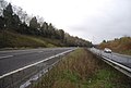 A2, Canterbury bypass - geograph.org.uk - 3383905.jpg 640 × 430; 63 KB
-
 A2, Canterbury bypass - geograph.org.uk - 3400219.jpg 640 × 430; 43 KB
-
 A2, Canterbury bypass - geograph.org.uk - 3400222.jpg 640 × 430; 47 KB
-
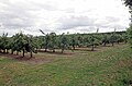
 An orchard - geograph.org.uk - 3389445.jpg 640 × 430; 77 KB
-
 Apple crates - geograph.org.uk - 3389447.jpg 640 × 430; 78 KB
-
 Apple Crates ^ Ripening Crop - geograph.org.uk - 4590741.jpg 424 × 640; 81 KB
-
 Apples on Merton farm - geograph.org.uk - 4590624.jpg 640 × 424; 73 KB
-
 Arable landscape, Chartham Downs - geograph.org.uk - 4854551.jpg 640 × 426; 62 KB
-
 Archers at Merton Farm - geograph.org.uk - 4590616.jpg 640 × 424; 77 KB
-
 B2068 - geograph.org.uk - 4854566.jpg 640 × 426; 81 KB
-
 B2068 Nackington Road towards Canterbury - geograph.org.uk - 5835983.jpg 1,024 × 684; 259 KB
-
 B2068 towards Canterbury - geograph.org.uk - 5835921.jpg 1,024 × 684; 185 KB
-
 B2068 towards Canterbury - geograph.org.uk - 5835941.jpg 1,024 × 684; 265 KB
-
 B2068 towards Canterbury - geograph.org.uk - 5835968.jpg 1,024 × 684; 280 KB
-
 B2068, Street End - geograph.org.uk - 4854569.jpg 640 × 426; 92 KB
-
 B2068, Street End - geograph.org.uk - 4854570.jpg 640 × 426; 91 KB
-
 Barn At Merton Farm - geograph.org.uk - 4590604.jpg 640 × 424; 75 KB
-
 Barn on Church Lane - geograph.org.uk - 1972738.jpg 1,024 × 768; 265 KB
-
 Barn on the edge of Nackington - geograph.org.uk - 3383913.jpg 640 × 430; 42 KB
-
 Barn, Nackington - geograph.org.uk - 3383914.jpg 640 × 430; 57 KB
-
 Barn, Stuppington Court Farm - geograph.org.uk - 3390119.jpg 640 × 430; 64 KB
-
 Benchmark, Church of St Mary - geograph.org.uk - 4864244.jpg 640 × 426; 107 KB
-
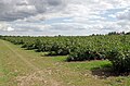 Blackcurrant Harvest - geograph.org.uk - 4590661.jpg 640 × 424; 76 KB
-

-
 Blackcurrants Near Nacklington Rd - geograph.org.uk - 4590681.jpg 424 × 640; 77 KB
-
 Bottle Stack - geograph.org.uk - 4590627.jpg 640 × 424; 71 KB
-
 Bridge Road - geograph.org.uk - 4590687.jpg 640 × 424; 62 KB
-
 Bridleway from Iffin Lane - geograph.org.uk - 4590650.jpg 424 × 640; 64 KB
-
 Bridleway in Whitehill Wood - geograph.org.uk - 4873715.jpg 640 × 426; 139 KB
-
 Bridleway in Whitehill Woods - geograph.org.uk - 4873709.jpg 640 × 426; 133 KB
-
 Bridleway in Whitehill Woods - geograph.org.uk - 4873711.jpg 640 × 426; 133 KB
-
 Bridleway in Whitehill Woods - geograph.org.uk - 4873712.jpg 640 × 426; 135 KB
-
 Bridleway in Whitehill Woods - geograph.org.uk - 4873800.jpg 640 × 426; 121 KB
-
 Bridleway off School Lane - geograph.org.uk - 4864263.jpg 640 × 426; 123 KB
-
 Bridleway off School Lane - geograph.org.uk - 4873706.jpg 640 × 426; 128 KB
-
 Bridleway to Fausett Hill - geograph.org.uk - 1969435.jpg 3,072 × 2,304; 1.21 MB
-
 Bridleway to Iffin Lane - geograph.org.uk - 4590636.jpg 424 × 640; 60 KB
-
 Bridleway, Whitehill Wood - geograph.org.uk - 4873720.jpg 640 × 426; 137 KB
-
 Bridleway, Whitehill Wood - geograph.org.uk - 4873728.jpg 640 × 426; 140 KB
-
 Bridleway, Whitehill Woods - geograph.org.uk - 4873782.jpg 640 × 426; 117 KB
-
 Bridleway, Whitehill Woods - geograph.org.uk - 4873798.jpg 640 × 426; 116 KB
-
 Canterbury Joinery Ltd, Street End - geograph.org.uk - 1931943.jpg 1,024 × 683; 188 KB
-
 Chartham Downs - geograph.org.uk - 4854348.jpg 640 × 426; 65 KB
-
 Chartham Downs - geograph.org.uk - 4854549.jpg 640 × 426; 78 KB
-
 Chartham Downs Rd - geograph.org.uk - 4854342.jpg 640 × 426; 52 KB
-
 Chartham Downs Rd - geograph.org.uk - 4854552.jpg 640 × 426; 85 KB
-
 Chartham Downs Rd - geograph.org.uk - 4854554.jpg 640 × 426; 87 KB
-
 Chartham Downs Rd - geograph.org.uk - 4854555.jpg 640 × 426; 87 KB
-
 Chartham Downs Rd meets the B2068 - geograph.org.uk - 4854561.jpg 640 × 426; 78 KB
-
 Church Lane - geograph.org.uk - 3389413.jpg 640 × 430; 64 KB
-
 Church of St Mary - geograph.org.uk - 4864241.jpg 640 × 426; 115 KB
-
 Church of St Mary - geograph.org.uk - 4864772.jpg 426 × 640; 86 KB
-
 Church of St Mary - geograph.org.uk - 4864776.jpg 423 × 640; 67 KB
-
 Church of St Mary - geograph.org.uk - 4864784.jpg 426 × 640; 78 KB
-
 Coppicing, Whitehill Woods - geograph.org.uk - 4873784.jpg 640 × 426; 122 KB
-
 Cottage, Hardres Court Rd - geograph.org.uk - 4864758.jpg 640 × 476; 140 KB
-
 Court Lodge Farmhouse - geograph.org.uk - 3389393.jpg 640 × 430; 81 KB
-
 Crop Field off School Lane - geograph.org.uk - 1931970.jpg 1,024 × 683; 228 KB
-
 Crossroads on Chartham Downs Road - geograph.org.uk - 1969439.jpg 3,072 × 2,304; 1.7 MB
-
 Dairy Cottage - geograph.org.uk - 4864767.jpg 640 × 426; 95 KB
-
 Entering Nackington - geograph.org.uk - 3383917.jpg 640 × 430; 46 KB
-
 Entrance to Merton Farm - geograph.org.uk - 3390072.jpg 640 × 430; 83 KB
-
 Entrance to North Court Farm - geograph.org.uk - 4864253.jpg 640 × 426; 111 KB
-
 Entrance to Street End Place - geograph.org.uk - 4864150.jpg 640 × 426; 97 KB
-
 Farmland by Merton Lane - geograph.org.uk - 3390100.jpg 640 × 430; 62 KB
-
 Farmland near Merton Farm - geograph.org.uk - 3390097.jpg 640 × 430; 59 KB
-
 Farmland, Chartham Downs - geograph.org.uk - 4855275.jpg 640 × 357; 56 KB
-
 Farmland, Chartham Downs - geograph.org.uk - 4855286.jpg 640 × 373; 57 KB
-
 Farmland, Chartham Downs - geograph.org.uk - 4855291.jpg 640 × 339; 49 KB
-
 Farmland, Merton Lane - geograph.org.uk - 3390115.jpg 640 × 430; 51 KB
-
 Field by School Lane - geograph.org.uk - 4873700.jpg 640 × 397; 66 KB
-
 Flat farmland - geograph.org.uk - 3383911.jpg 640 × 430; 35 KB
-
 Font, Church of St Mary - geograph.org.uk - 4864245.jpg 640 × 426; 48 KB
-
 Footpath near Cattshill Wood - geograph.org.uk - 1970839.jpg 3,072 × 2,304; 1.11 MB
-
 Footpath off Church Lane - geograph.org.uk - 3389398.jpg 640 × 430; 81 KB
-
 Footpath off School Lane - geograph.org.uk - 4864223.jpg 640 × 426; 121 KB
-
 Footpath to Lower Hardres - geograph.org.uk - 4590694.jpg 424 × 640; 99 KB
-
 For sale, Lower Hardres - geograph.org.uk - 4864168.jpg 640 × 426; 83 KB
-
 Gate in a gate, Cattshill Wood - geograph.org.uk - 1970837.jpg 3,072 × 2,304; 2.56 MB
-
 Gate on Bridleway near Iffin Lane - geograph.org.uk - 1969430.jpg 3,072 × 2,304; 2.22 MB
-
 Grasslands, Chartham Downs - geograph.org.uk - 4854349.jpg 640 × 426; 59 KB
-
 Graves, Church of St Mary - geograph.org.uk - 4864252.jpg 640 × 426; 112 KB
-
 Hardres Court Rd - geograph.org.uk - 4864054.jpg 640 × 426; 103 KB
-
 Hardres Court Rd - geograph.org.uk - 4864158.jpg 640 × 426; 110 KB
-
 Hardres Court Rd - geograph.org.uk - 4864160.jpg 640 × 426; 95 KB
-
 Hardres Court Rd - geograph.org.uk - 4864199.jpg 640 × 426; 110 KB
-

-
 Hardres Court Road - geograph.org.uk - 1931976.jpg 1,024 × 768; 181 KB
-
 Hardres Court Road - geograph.org.uk - 1970840.jpg 3,072 × 2,304; 1.91 MB
-
 Hardres Court Road, Lower Hardres - geograph.org.uk - 5939879.jpg 1,024 × 684; 225 KB
-
 Hardres Court Road, Lower Hardres - geograph.org.uk - 5939888.jpg 1,024 × 684; 428 KB
-
 Hardres Village Hall - geograph.org.uk - 4864159.jpg 640 × 426; 103 KB
-
 Heppington Farm - geograph.org.uk - 4854564.jpg 640 × 426; 99 KB
-
 Heppington Farm, Street End - geograph.org.uk - 4864047.jpg 640 × 426; 80 KB
-
 Highfield Cottage - geograph.org.uk - 4864761.jpg 640 × 426; 104 KB
-
 House by the church - geograph.org.uk - 4864233.jpg 640 × 426; 121 KB
-
 House on School Lane - geograph.org.uk - 4864216.jpg 640 × 426; 89 KB
-
 House, Hardres Court Rd - geograph.org.uk - 4864154.jpg 640 × 426; 99 KB
-

-
 Houses on Nackington Road - geograph.org.uk - 1972711.jpg 1,024 × 683; 167 KB
-
 Iffin Lane - geograph.org.uk - 1969272.jpg 3,072 × 2,304; 1.02 MB
-
 Iffin Lane - geograph.org.uk - 5939897.jpg 1,024 × 684; 397 KB
-
 Iffin Lane - geograph.org.uk - 5939924.jpg 1,024 × 684; 416 KB
-
 Interior, Church of St Mary - geograph.org.uk - 4864779.jpg 640 × 398; 50 KB
-

-
 Kent Beer Festival - geograph.org.uk - 4590610.jpg 640 × 424; 70 KB
-
 Large field of stubble - geograph.org.uk - 4873703.jpg 640 × 363; 38 KB
-
 Listed building at Merton Farm - geograph.org.uk - 3390089.jpg 640 × 430; 88 KB
-
 Little Catt's Farm - geograph.org.uk - 1931973.jpg 1,024 × 768; 217 KB
-
 Lower Hardres War Memorial - geograph.org.uk - 4864220.jpg 640 × 426; 86 KB
-
 Lower Heppington. - geograph.org.uk - 2593835.jpg 640 × 480; 129 KB
-
 Mast by Merton Lane - geograph.org.uk - 3390065.jpg 430 × 640; 42 KB
-
 Merton Farmhouse - geograph.org.uk - 3390077.jpg 640 × 430; 72 KB
-
 Merton Lane - geograph.org.uk - 3390067.jpg 640 × 430; 70 KB
-
 Merton Lane - geograph.org.uk - 3390084.jpg 640 × 430; 61 KB
-
 Merton Lane - geograph.org.uk - 3390086.jpg 640 × 430; 78 KB
-
 Merton Lane - geograph.org.uk - 3390095.jpg 640 × 430; 79 KB
-
 Merton Lane - geograph.org.uk - 3390104.jpg 640 × 430; 92 KB
-
 Merton Lane - geograph.org.uk - 3390111.jpg 640 × 430; 70 KB
-
 Mount Pleasant - geograph.org.uk - 4864768.jpg 640 × 408; 57 KB
-
 Mount Pleasant, Lower Hardres - geograph.org.uk - 4864197.jpg 640 × 426; 74 KB
-
 Muddy track off Merton Lane - geograph.org.uk - 3390107.jpg 640 × 430; 62 KB
-
 Nackington - geograph.org.uk - 3383922.jpg 640 × 430; 76 KB
-
 Nackington - geograph.org.uk - 3389382.jpg 640 × 430; 74 KB
-
 Nackington Farmhouse - geograph.org.uk - 3389379.jpg 640 × 430; 64 KB
-
 Nackington Rd - geograph.org.uk - 3389425.jpg 640 × 430; 95 KB
-
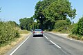
 Nackington Road (B2068) - geograph.org.uk - 3387994.jpg 2,256 × 1,504; 1.97 MB
-
 Nackington Road Bridge, A2 - geograph.org.uk - 5203447.jpg 640 × 421; 40 KB
-
 Nackington War Memorial - geograph.org.uk - 3389431.jpg 640 × 430; 93 KB
-
 North Court Farm - geograph.org.uk - 4864261.jpg 640 × 426; 72 KB
-
 Old barn, Nackington - geograph.org.uk - 3389389.jpg 640 × 430; 81 KB
-
-
 Orchard and shelterbelt - geograph.org.uk - 3389452.jpg 640 × 430; 78 KB
-
 Orchard and shelterbelt - geograph.org.uk - 3390059.jpg 640 × 430; 87 KB
-
 Orchard by Merton Lane - geograph.org.uk - 3390113.jpg 640 × 430; 67 KB
-
 Orchard by Stuppington Lane - geograph.org.uk - 3400210.jpg 640 × 430; 51 KB
-
 Orchard off Nackington Rd - geograph.org.uk - 3389434.jpg 640 × 430; 52 KB
-
 Orchard, Nackington - geograph.org.uk - 3389442.jpg 640 × 430; 56 KB
-
 Parsonage Farm - geograph.org.uk - 3389404.jpg 640 × 430; 72 KB
-
 Parsonage Farm - geograph.org.uk - 3389410.jpg 640 × 430; 69 KB
-
 Pasture by Merton Farm - geograph.org.uk - 4590641.jpg 640 × 424; 51 KB
-
 Plum Orchard on Merton Farm - geograph.org.uk - 4590621.jpg 640 × 424; 87 KB
-
 Poppies on the way to Lower Hardres - geograph.org.uk - 4590716.jpg 424 × 640; 85 KB
-
 Pylon, Whitehill Woods - geograph.org.uk - 4873787.jpg 426 × 640; 76 KB
-
 Pylon, Whitehill Woods - geograph.org.uk - 4873796.jpg 387 × 640; 57 KB
-
 Redhouse Lane joins Stone Street - geograph.org.uk - 1969444.jpg 3,072 × 2,304; 1.99 MB
-
 Ride, Whitehill Woods - geograph.org.uk - 4873794.jpg 640 × 426; 82 KB
-
 Ripening Crop - geograph.org.uk - 4590747.jpg 424 × 640; 87 KB
-
 Rough grazing - geograph.org.uk - 3383906.jpg 640 × 430; 58 KB
-
 School Lane - geograph.org.uk - 4864221.jpg 640 × 426; 97 KB
-
 School Lane - geograph.org.uk - 4864226.jpg 640 × 426; 113 KB
-
 School Lane - geograph.org.uk - 4864259.jpg 640 × 426; 94 KB
-
 School Lane - geograph.org.uk - 4864262.jpg 640 × 426; 118 KB
-
 School Lane - geograph.org.uk - 4873684.jpg 640 × 426; 128 KB
-
 School Lane - geograph.org.uk - 4873699.jpg 640 × 426; 137 KB
-
 Sextries Farmhouse - geograph.org.uk - 3383918.jpg 640 × 430; 65 KB
-
 Shelterbelt and orchard - geograph.org.uk - 3390062.jpg 640 × 430; 73 KB
-
 Shelterbelt in an orchard - geograph.org.uk - 3389439.jpg 640 × 430; 73 KB
-
 Spinney in a Meadow - geograph.org.uk - 4590706.jpg 640 × 424; 64 KB
-
 Spot the footpath - geograph.org.uk - 3383910.jpg 640 × 430; 47 KB
-
 St Mary's Church - geograph.org.uk - 3383919.jpg 640 × 430; 73 KB
-
 St Mary's Church - geograph.org.uk - 3383921.jpg 640 × 430; 66 KB
-
 St Mary's Church - geograph.org.uk - 3389377.jpg 640 × 430; 55 KB
-

-
 Storage barn, Nackington - geograph.org.uk - 3383915.jpg 640 × 430; 65 KB
-
 Street End - geograph.org.uk - 4854557.jpg 640 × 426; 80 KB
-
 Stuppington Cottages - geograph.org.uk - 3390131.jpg 640 × 430; 77 KB
-
 Stuppington Court Farmhouse - geograph.org.uk - 3390121.jpg 640 × 430; 64 KB
-
 Stuppington Lane - geograph.org.uk - 3400205.jpg 640 × 430; 56 KB
-
 Stuppington Lane Bridge - geograph.org.uk - 3400212.jpg 640 × 430; 79 KB
-
 Stupplington Lane Bridge, A2 - geograph.org.uk - 5203442.jpg 640 × 426; 43 KB
-
 Sylvan Cottage - geograph.org.uk - 2771690.jpg 1,024 × 769; 193 KB
-
 The Granville - geograph.org.uk - 4864050.jpg 640 × 426; 84 KB
-
 The Granville sign - geograph.org.uk - 2347462.jpg 480 × 640; 112 KB
-
 The Granville, Street End - geograph.org.uk - 1931945.jpg 1,024 × 683; 181 KB
-
 The Old Rectory - geograph.org.uk - 4864229.jpg 640 × 426; 111 KB
-
 The Old Rectory, Nackington - geograph.org.uk - 3389417.jpg 640 × 430; 104 KB
-
 Towards Lower Hardres - geograph.org.uk - 4590722.jpg 640 × 424; 82 KB
-
 Track along field boundary - geograph.org.uk - 3383908.jpg 640 × 430; 73 KB
-
 Track off Hardres Court Rd - geograph.org.uk - 4864166.jpg 640 × 426; 95 KB
-
 Track to Nackington - geograph.org.uk - 3383912.jpg 640 × 430; 54 KB
-
 Trees along a bridleway - geograph.org.uk - 4854571.jpg 640 × 426; 58 KB
-
 View NE from Hardres Court Road - geograph.org.uk - 5939869.jpg 1,024 × 684; 205 KB
-
 View of field near Catts Road - geograph.org.uk - 1970832.jpg 3,072 × 2,304; 1.97 MB
-
 Whitehill Wood - geograph.org.uk - 4873695.jpg 640 × 426; 119 KB
-
 Whitehill Wood - geograph.org.uk - 4873718.jpg 640 × 426; 143 KB
-
 Whitehill Wood - geograph.org.uk - 4873729.jpg 640 × 426; 142 KB
-
 Whitehill Woods - geograph.org.uk - 4873780.jpg 640 × 426; 127 KB
-
 Winter's Farm - geograph.org.uk - 3383897.jpg 640 × 430; 65 KB
-
 Young's Farm - geograph.org.uk - 2349215.jpg 640 × 480; 123 KB


_-_geograph.org.uk_-_3387994.jpg)


