Category:Lower Queen Anne, Seattle, Washington
Lower Queen Anne, Seattle, Washington, also known as "Uptown".
Subcategories
This category has the following 16 subcategories, out of 16 total.
1
- 101 Elliott Avenue W (9 F)
A
- Alvena Vista Apartments (4 F)
C
- Counterbalance Park (9 F)
D
H
M
- Mecca Cafe (3 F)
O
S
- Sacred Heart Church (Seattle) (10 F)
- SIFF Cinema Uptown (78 F)
U
W
- West Thomas Street Overpass (3 F)
Media in category "Lower Queen Anne, Seattle, Washington"
The following 91 files are in this category, out of 91 total.
-
-
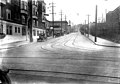
 1st Ave, with streetcar, Seattle (CURTIS 1550).jpeg 768 × 599; 61 KB
-
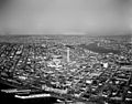 Aerial view of Century 21 Exposition grounds and environs, 1962.jpg 1,200 × 944; 325 KB
-
 Anderson's 1890 map - 'North Seattle' to Smith Cove.jpg 1,019 × 1,275; 372 KB
-
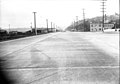
 Broad St from 5th Ave, ca 1920 (SEATTLE 1676).jpg 768 × 536; 53 KB
-
 Broad Street and 5th Avenue, ca 1920 (SEATTLE 456).jpg 768 × 543; 42 KB
-
 Broad Street, ca 1920 (SEATTLE 798).jpg 768 × 529; 70 KB
-
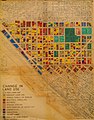 Change in land use in lower Queen Anne, Seattle, 1920-1953.jpg 2,485 × 3,185; 1.23 MB
-
 Collier Brothers Saloon, Seattle, circa 1900 (MOHAI 9973).jpg 700 × 504; 55 KB
-

-

-

-
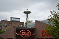 Dick's (Seattle, Washington).jpg 4,608 × 3,072; 4.13 MB
-
 Dick's Drive In (3251764194).jpg 2,448 × 3,264; 4.09 MB
-
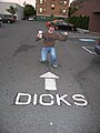
 DicksQueenAnne.jpg 3,320 × 1,994; 1.98 MB
-
 Eastlake, Wallingford, Westlake, Downtown (11681145236).jpg 5,184 × 3,456; 3.88 MB
-

-
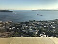 Elliot bay from Needle.jpeg 4,032 × 3,024; 2.46 MB
-
 Elliott Ave, March 18, 1926 (SEATTLE 970).jpg 768 × 539; 54 KB
-
 Elliott Avenue at West Mercer Place, 1921 (4190204209).jpg 3,364 × 2,523; 3.62 MB
-
 Elliott Bay from Lower Queen Anne, Seattle.jpg 3,072 × 2,304; 2.06 MB
-
-
 Frost on Flat Cars (8376084304).jpg 2,770 × 4,154; 3.47 MB
-

-
-
 Hooverville on Seattle waterfront, 1933 (51206921728).jpg 3,053 × 2,426; 2.07 MB
-

-

-

-
 Kroll's Seattle 1920 plate 35W - A - raw.jpg 2,592 × 1,944; 864 KB
-
-

-

-

-
 Lower Queen Anne, Seattle, WA, USA - panoramio (13).jpg 4,000 × 2,672; 4.37 MB
-
 Lower Queen Anne, Seattle.jpg 3,072 × 2,304; 2.39 MB
-
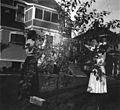
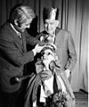
 Mayor Uhlman at senior citizens' Valentines Day dance, 1973 (25394541697).jpg 974 × 1,200; 279 KB
-

-

-
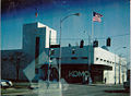 Old KOMO building 3 2 1995.jpg 1,024 × 751; 270 KB
-
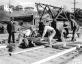 Paving streetcar tracks, 1934 (3365336561).gif 400 × 312; 114 KB
-
 Penske Trucks on Thomas St (41916508544).jpg 5,184 × 3,456; 7.8 MB
-

-
 Port of Seattle (16803440368).jpg 2,048 × 1,477; 2.23 MB
-
 Poster for Seattle City Light dance, 1929 (44630155172).jpg 3,282 × 2,514; 3.01 MB
-
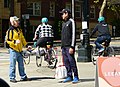 Protest against Covid-19 closures in Seattle - 2020-04-25 - 01 (cropped).jpg 1,724 × 1,257; 1.36 MB
-
 Protest against Covid-19 closures in Seattle - 2020-04-25 - 01.jpg 6,000 × 4,000; 14.42 MB
-
 Protest against Covid-19 closures in Seattle - 2020-04-25 - 02 (cropped).jpg 1,718 × 999; 1.35 MB
-
 Protest against Covid-19 closures in Seattle - 2020-04-25 - 02.jpg 6,000 × 4,000; 12.79 MB
-
 Queen Anne Ave N, near Republican, Seattle 1997.jpg 3,125 × 2,037; 1.38 MB
-
 REFLECTIONS - panoramio.jpg 3,263 × 1,835; 386 KB
-
 Route 1 Artic (26202858410).jpg 5,184 × 3,456; 8.41 MB
-
 Seattle - Aerial of lower Queen Anne, 1962.gif 3,015 × 2,422; 6.63 MB
-
 Seattle - Aurora Avenue near Mercer, 1956 (26849544741).jpg 1,200 × 929; 293 KB
-
 Seattle - Counterbalance Park 01.jpg 3,264 × 2,448; 2.35 MB
-
 Seattle - Counterbalance Park 02.jpg 3,264 × 2,448; 2.37 MB
-
 Seattle - Edgewater Inn from Elliott Bay 02.jpg 4,288 × 2,848; 5.76 MB
-
 Seattle - Elliott Avenue, 1922 (52341552400).jpg 3,140 × 2,400; 2.66 MB
-
 Seattle - entrance to 715 2nd Ave N (Corona Apartments).jpg 2,848 × 4,288; 5.74 MB
-
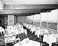 Seattle - Les Teagle's Restaurant, 1954 (35195234563).jpg 1,200 × 952; 291 KB
-
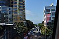
 Seattle - looking northeast on former Broad Street from Seattle Center Monorail.jpg 4,288 × 2,848; 6.1 MB
-
 Seattle - looking west on Denny Way from Seattle Center Monorail 01.jpg 4,288 × 2,848; 5.46 MB
-
 Seattle - looking west on Mercer St. from 6th Ave. N., 1956.gif 1,200 × 947; 980 KB
-
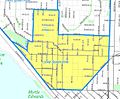 Seattle - Lower Queen Anne map.jpg 1,083 × 893; 184 KB
-
 Seattle - Lower Queen Anne skyline from Elliott Bay 01.jpg 4,288 × 2,848; 4.6 MB
-
 Seattle - MarQueen Hotel 01.jpg 4,288 × 2,848; 6.62 MB
-
 Seattle - Mercer School - 1900.jpg 607 × 429; 88 KB
-
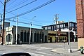
 Seattle - parklet outside Uptown Cinema 01.jpg 4,288 × 2,848; 5.98 MB
-
 Seattle - rear of old apartments on Queen Anne Ave N, being renovated in 2018.jpg 4,288 × 2,848; 5.99 MB
-
 Seattle - Restaurants in the 600 block of Queen Anne Ave N, April 2020.jpg 6,000 × 4,000; 12.03 MB
-
 Seattle - restaurants on 5th Ave N.jpg 3,264 × 2,448; 1.95 MB
-
 Seattle - Sorry Charlie's sign.jpg 6,000 × 4,000; 11.49 MB
-
 Seattle - Taller's Charcoal Broiler, 1954 (50878410087).jpg 3,000 × 3,554; 2.24 MB
-

-
 Seattle Downtown and Elliott Bay.jpg 3,456 × 2,592; 2.49 MB
-

-

-
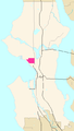 Seattle Map - Lower Queen Anne.png 394 × 698; 14 KB
-

-
 Seattle's Aurora Avenue under construction, 1954 (28601405186).jpg 1,200 × 943; 308 KB
-
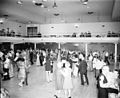 Senior Citizen's Valentine Day dance, Seattle, 1973.jpg 1,200 × 981; 375 KB
-
 Senior citizens' Valentine's Day Dance, 1973.jpg 1,004 × 1,200; 455 KB
-
 Sound north - panoramio.jpg 3,264 × 2,448; 1.99 MB
-
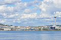
 Space Needle (5225769745).jpg 3,824 × 2,540; 3.66 MB
-
 Space Needle seen from Wenatchee Ferry on Puget Sound.jpg 4,272 × 2,848; 1.33 MB
-
 Strathmore Apartments, Seattle (CURTIS 1671).jpeg 768 × 612; 83 KB
-

-
 Teatro Zinzanni 03.jpg 3,264 × 2,448; 2.32 MB
-
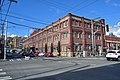
 Trinity Methodist Episcopal Church, Seattle, ca 1911 (MOHAI 992).jpg 640 × 488; 38 KB
-
 View from F5 office window -) - panoramio.jpg 2,560 × 1,920; 966 KB
-
 Wrecked streetcar No 24, Seattle, June 30, 1919 (MOHAI 5462).jpg 700 × 526; 59 KB
.jpg)
.jpeg)


.jpg)
.jpg)
.jpg)

.jpg)
.jpg)
,_Seattle,_circa_late_1880s-1890s_(SEATTLE_5050).jpg)
.jpg)
.jpg)
.jpg)

.jpg)
.jpg)

.jpg)
.jpg)

.jpeg)
.jpg)

.jpeg)
.jpg)
.jpeg)
.jpeg)
.jpeg)

.jpeg)
.jpeg)
.jpeg)
.jpeg)
.jpg)

.jpg)
.jpeg)
.jpeg)

.gif)
.jpg)
.jpg)
.jpg)
.jpg)
.jpg)

.jpg)


.jpg)

.jpg)


.jpg)
.jpg)
.jpg)


.jpg)
.jpg)

.jpg)
.jpg)

.jpg)
.jpg)


.jpg)

.jpeg)
.jpeg)

.jpg)
_-_panoramio.jpg)
.jpg)