Category:Luddenden Foot
village in United Kingdom   | |||||
| Upload media | |||||
| Instance of | |||||
|---|---|---|---|---|---|
| Location | Calderdale, West Yorkshire, Yorkshire and the Humber, England | ||||
 | |||||
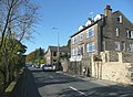
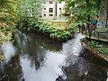
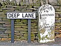
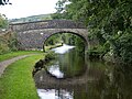
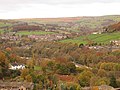
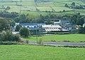
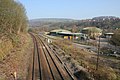
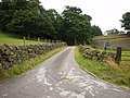
English: Luddenden Foot or Luddendenfoot is a community in Calderdale, West Yorkshire, England. It lies along the Upper Calder Valley below the village of Luddenden, between Sowerby Bridge and Hebden Bridge .
Subcategories
This category has the following 11 subcategories, out of 11 total.
B
H
K
- Kershaw, West Yorkshire (1 F)
L
- Luddenden Foot War Memorial (2 F)
R
- River Calder, Luddenden Foot (4 F)
S
T
W
- West Royd Wood (2 F)
Media in category "Luddenden Foot"
The following 136 files are in this category, out of 136 total.
-
 "Hope it does not rain" - geograph.org.uk - 1336793.jpg 640 × 480; 121 KB
-

-
 Approach to the stepping stones in Willow Wood - geograph.org.uk - 4932471.jpg 2,048 × 1,536; 1.39 MB
-

-
 Belmont Terrace and Beulah Place, Luddendenfoot - geograph.org.uk - 2641855.jpg 2,000 × 1,470; 684 KB
-
 Blackwood Hall Lane - geograph.org.uk - 1009367.jpg 640 × 480; 221 KB
-
 Blackwood Hall Lane, Luddenden Foot - geograph.org.uk - 2195104.jpg 2,000 × 1,392; 855 KB
-
 Bricked-up window by the Rochdale Canal, Brearley (5212774004).jpg 2,100 × 1,654; 4.26 MB
-
 Bridleway off Danny Lane, Luddenden Foot - geograph.org.uk - 1170040.jpg 640 × 467; 140 KB
-
 Brocks (8238989494).jpg 2,660 × 3,596; 6.76 MB
-
 Brocks - geograph.org.uk - 1055924.jpg 640 × 480; 205 KB
-
 Brocks, Luddenden Foot - geograph.org.uk - 990656.jpg 640 × 480; 75 KB
-
 Broken down field boundary, off Moor Bottom Lane - geograph.org.uk - 2838874.jpg 1,024 × 768; 161 KB
-
 Building houses, Luddendenfoot - geograph.org.uk - 21766.jpg 800 × 600; 192 KB
-
 Burnley Road A646, Luddenden Foot - geograph.org.uk - 1039816.jpg 640 × 472; 85 KB
-

-
 Burnley Road, Luddenden Foot - geograph.org.uk - 1336782.jpg 640 × 480; 78 KB
-
 Canal boundary (^) stone, Luddendenfoot - geograph.org.uk - 2445323.jpg 1,463 × 2,000; 1.43 MB
-
 Canal Bridge, Luddenden Foot.jpg 2,000 × 1,500; 925 KB
-
 Coach and Horses, Luddenden Foot - geograph.org.uk - 1009373.jpg 640 × 480; 220 KB
-
 Coach and Horses, Luddenden Foot, Lamp - geograph.org.uk - 1009374.jpg 480 × 640; 186 KB
-
 Confluence - geograph.org.uk - 1009366.jpg 640 × 480; 203 KB
-
 Cooper House Bridge 5, Rochdale Canal - geograph.org.uk - 761987.jpg 640 × 408; 93 KB
-
 Cooper House Bridge, Luddenden Foot.jpg 2,000 × 1,500; 871 KB
-
 Cooper House Flickr 16 April 2023.jpg 2,457 × 1,876; 4.28 MB
-
 Cricket Club - geograph.org.uk - 4950707.jpg 5,173 × 3,227; 1.65 MB
-
 Disused lorry in council yard, Luddendenfoot - geograph.org.uk - 2884641.jpg 2,000 × 1,497; 1.37 MB
-
 Division of Luddendenfoot and Warley (3306510677).jpg 2,035 × 1,547; 2.6 MB
-
 Drinking fountain, Luddenden Foot Park - geograph.org.uk - 1336790.jpg 480 × 640; 124 KB
-

-

-
 Ellen Holme Bridge, Luddenden Foot - geograph.org.uk - 391727.jpg 640 × 459; 127 KB
-
 Ellen Royd Bridge 7, Rochdale Canal - geograph.org.uk - 761867.jpg 640 × 408; 92 KB
-
 Ellen Royd Bridge, Luddenden Foot.jpg 3,672 × 2,761; 3.03 MB
-
 Fairlea Mill, Luddenden Foot (geograph 1810598).jpg 640 × 480; 110 KB
-
 Farmland towards the Rochdale Canal - geograph.org.uk - 3467711.jpg 640 × 480; 60 KB
-
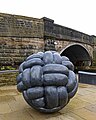 Fender, by Joss Smith, at Luddendenfoot (11937295596).jpg 3,104 × 3,880; 8.76 MB
-
 Finkle Street, Luddenden Foot - geograph.org.uk - 1182769.jpg 640 × 480; 110 KB
-
 Footpath - Greystones Road - geograph.org.uk - 4608342.jpg 640 × 480; 130 KB
-
 Footpath - Greystones Road - geograph.org.uk - 4608345.jpg 480 × 640; 110 KB
-
 Footpath - John Naylor Lane - geograph.org.uk - 4608350.jpg 480 × 640; 118 KB
-
 Footpath - Kershaw Drive - geograph.org.uk - 4607620.jpg 480 × 640; 82 KB
-
 Footpath above Luddendenfoot - geograph.org.uk - 24549.jpg 1,024 × 768; 239 KB
-

-

-
 Footpath from Shepherd House to Ive House - geograph.org.uk - 6066489.jpg 768 × 1,024; 418 KB
-

-
 Footpath in the old lane to Hand Carr Mill, Luddendenfoot - geograph.org.uk - 4935996.jpg 2,048 × 1,536; 1.12 MB
-
 Footpath off Sowerby Lane, Luddenden Foot - geograph.org.uk - 995604.jpg 640 × 532; 163 KB
-
 Former School, Morley Hall Lane - geograph.org.uk - 385014.jpg 1,024 × 683; 239 KB
-

-
 Gate on Sowerby Bridge FP28 - geograph.org.uk - 4257656.jpg 1,500 × 2,000; 903 KB
-
 Gate to nowhere - geograph.org.uk - 6066472.jpg 1,024 × 768; 342 KB
-
 Hartley Royd (5926797073).jpg 2,374 × 3,532; 6.74 MB
-
 High Lee - geograph.org.uk - 4949713.jpg 5,053 × 2,577; 1.88 MB
-
 Hollins Hall Farm - geograph.org.uk - 4950770.jpg 4,652 × 3,391; 1.72 MB
-
 Hooded Horse.jpg 1,908 × 2,804; 3.53 MB
-
 Horse by a dry stone wall - geograph.org.uk - 6066446.jpg 1,024 × 768; 206 KB
-
 Industrial Estate, Luddenden Foot - geograph.org.uk - 986113.jpg 640 × 439; 120 KB
-

-
 Kershaw (8273646108).jpg 4,165 × 2,767; 7.97 MB
-

-

-
 Longbottom Bridge 4, Rochdale Canal - geograph.org.uk - 761999.jpg 640 × 414; 93 KB
-
-

-

-
 Luddenden Brook - geograph.org.uk - 1853205.jpg 480 × 640; 122 KB
-

-
 Luddenden Foot - geograph.org.uk - 6835.jpg 640 × 387; 40 KB
-
 Luddenden Foot - geograph.org.uk - 6836.jpg 640 × 371; 41 KB
-
 Luddendenfoot (11954319554).jpg 2,785 × 3,899; 6.38 MB
-
 Luddendenfoot (12622156605).jpg 1,601 × 2,402; 3.37 MB
-
 Luddendenfoot (14091000637).jpg 3,043 × 4,564; 12.52 MB
-
 Luddendenfoot (15747555019).jpg 2,222 × 2,877; 5.8 MB
-
 Luddendenfoot (15915533891).jpg 2,485 × 3,728; 7.81 MB
-
 Luddendenfoot (17137877039).jpg 1,761 × 2,651; 4.29 MB
-
 Luddendenfoot (27821550482).jpg 3,889 × 2,593; 8.34 MB
-
 Luddendenfoot (30072562115).jpg 2,302 × 3,590; 7.93 MB
-
 Luddendenfoot (8238998402).jpg 3,811 × 2,911; 9.17 MB
-
 Luddendenfoot and Kershaw, from Sowerby (15104757778).jpg 4,608 × 3,456; 10.67 MB
-
 Luddendenfoot in the autumn.jpg 4,608 × 3,456; 4.57 MB
-
 Luddendenfoot jungle - geograph.org.uk - 825632.jpg 640 × 480; 157 KB
-
 Luddendenfoot Reflections (6709592361).jpg 2,529 × 3,887; 10.16 MB
-
 Luddendenfoot, from Sowerby (14633225949).jpg 3,640 × 2,184; 6.28 MB
-
 Luddendenfoot, Kershaw, Oats Royd Mills and Ovenden Moor, from Sowerby (8225373550).jpg 4,176 × 2,784; 7.35 MB
-
 Luddendenfoot.jpg 2,893 × 3,616; 10.19 MB
-
 Milepost, Luddenden Foot.jpg 480 × 640; 320 KB
-
 Milestone (2327639816).jpg 1,787 × 2,493; 5.98 MB
-

-

-
 Mills in the valley, Luddenden Foot - geograph.org.uk - 1009237.jpg 640 × 456; 81 KB
-
 Morley Hall Terrace - geograph.org.uk - 385005.jpg 1,024 × 683; 188 KB
-
 New development at Luddenden Foot - geograph.org.uk - 1274021.jpg 640 × 480; 95 KB
-
 New houses at Luddenden Foot - geograph.org.uk - 3559547.jpg 1,519 × 2,000; 1,017 KB
-
 Pine tree and three alpacas - geograph.org.uk - 6066423.jpg 1,024 × 768; 235 KB
-
 Postbox in the wall of Burley Road - geograph.org.uk - 6066414.jpg 1,024 × 768; 332 KB
-
 Public footpath at Roebucks, Luddendenfoot - geograph.org.uk - 4976936.jpg 2,000 × 1,478; 1.14 MB
-
 Public footpath between two demolition sites, Luddendenfoot - geograph.org.uk - 2641847.jpg 1,500 × 2,000; 1.17 MB
-
 Quarry off Cold Edge Road, Warley - geograph.org.uk - 1279864.jpg 640 × 480; 108 KB
-
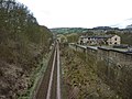
 Railway, Luddendenfoot - geograph.org.uk - 384997.jpg 1,024 × 683; 206 KB
-
 Rear of Greystones Farmhouse - geograph.org.uk - 4581467.jpg 1,024 × 683; 267 KB
-
 Refurbished house, Luddenden Foot - geograph.org.uk - 2195090.jpg 2,000 × 1,381; 709 KB
-
 Remains of Hand Carr Mill, Luddendenfoot - geograph.org.uk - 4935985.jpg 2,048 × 1,536; 1.33 MB
-

-
 Road to Hollins Farm - geograph.org.uk - 1398994.jpg 640 × 480; 86 KB
-
 Rose Grove Lane, Luddenden Foot - geograph.org.uk - 1193894.jpg 640 × 480; 166 KB
-
 Rose Place, Luddenden Foot - geograph.org.uk - 1810659.jpg 640 × 480; 137 KB
-
 Row End, Sowerby Lane, Sowerby - geograph.org.uk - 995598.jpg 640 × 476; 126 KB
-
 Sheep at Little Longbottom - geograph.org.uk - 6066416.jpg 1,024 × 768; 189 KB
-
 Shop and London House, Luddenden Foot - geograph.org.uk - 1183265.jpg 640 × 493; 126 KB
-
 Smiths Motors after the fire - geograph.org.uk - 1853211.jpg 640 × 480; 163 KB
-
 Sowerby Bridge Bridleway 27 above Greave House Fields - geograph.org.uk - 4242699.jpg 2,000 × 1,500; 1.21 MB
-
 Sowerby bridge FP28 along the edge of a recreation ground - geograph.org.uk - 4257654.jpg 2,000 × 1,500; 1.03 MB
-
 Sowerby Lane - geograph.org.uk - 1055925.jpg 640 × 480; 158 KB
-
 Spring chamber at Shepherd House - geograph.org.uk - 6066463.jpg 1,024 × 768; 268 KB
-

-

-
 Stile on footpath approaching Roebucks, Luddendenfoot - geograph.org.uk - 4976876.jpg 2,304 × 3,072; 2.16 MB
-
 Stile on Sowerby Bridge FP28 - geograph.org.uk - 4257661.jpg 1,500 × 2,000; 1.51 MB
-
 Stile on Sowerby Bridge FP28 - geograph.org.uk - 4257663.jpg 2,000 × 1,500; 1.1 MB
-
 Stile, Luddenden Foot.jpg 2,128 × 2,128; 4.23 MB
-
 Styes Lane, Luddenden Foot - geograph.org.uk - 1182748.jpg 640 × 474; 112 KB
-
 Suspension tester - geograph.org.uk - 1055923.jpg 640 × 480; 202 KB
-
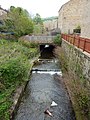
 The aqueduct, Luddenden Foot - geograph.org.uk - 1183237.jpg 640 × 480; 171 KB
-
 Three alpacas at Luddendenfoot - geograph.org.uk - 6066427.jpg 1,024 × 768; 251 KB
-

-
 View from Birch Lane, Warley - geograph.org.uk - 4977273.jpg 2,000 × 1,500; 1.03 MB
-
 View from Sowerby (8201146562).jpg 4,176 × 2,784; 8.5 MB
-
 View of Luddendenfoot, from Styes Lane, Sowerby (4572562654).jpg 2,012 × 1,509; 2.64 MB
-

-

-
 Weavers Arms, Luddenden Foot - geograph.org.uk - 1009372.jpg 640 × 480; 214 KB
-
 West Royd (4768960300).jpg 2,056 × 1,648; 3.03 MB
-
 Foxglove and meadow, Luddendenfoot - geograph.org.uk - 21761.jpg 450 × 600; 117 KB
-
 Roofline of former school, Morley Hall Lane - geograph.org.uk - 385020.jpg 1,024 × 683; 279 KB


.jpg)

.jpg)


_stone,_Luddendenfoot_-_geograph.org.uk_-_2445323.jpg)


.jpg)


.jpg)

.jpg)


.jpg)


.jpg)


.jpg)
.jpg)
.jpg)
.jpg)
.jpg)
.jpg)
.jpg)
.jpg)
.jpg)
.jpg)


.jpg)
.jpg)
.jpg)


.jpg)


.jpg)
.jpg)


.jpg)

