Category:Lugton

English: Lugton is a small village or hamlet in East Ayrshire, Scotland with a population of 80 people. The A736 road runs through on its way from Glasgow, to the north, to Irvine in North Ayrshire. Uplawmoor is the first settlement on this 'Lochlibo Road' to the north and Burnhouse is to the south. The settlement lies on the Lugton Water which forms the boundary between East Ayrshire and East Renfrewshire as well as that of the parishes of Dunlop and Beith.
hamlet in East Ayrshire, Scotland, UK  | |||||
| Upload media | |||||
| Instance of | |||||
|---|---|---|---|---|---|
| Location |
| ||||
| Different from | |||||
 | |||||
Subcategories
This category has the following 12 subcategories, out of 12 total.
B
- Barrmill to Lugton branch (8 F)
- Bowhouse Farm (3 F)
D
- Dunlop Road railway bridge (2 F)
G
- Gree goods station (6 F)
H
- Horse trough, Lugton (2 F)
K
L
- Lugton limeworks (3 F)
M
- Muirshiel Farm (2 F)
T
- Tennoch Hill (2 F)
W
- Waterland Mill (11 F)
Media in category "Lugton"
The following 38 files are in this category, out of 38 total.
-
 A736, Lugton to Barrhead road - geograph.org.uk - 1579944.jpg 640 × 480; 76 KB
-
 Abandoned Workshops, Lugton - geograph.org.uk - 1223120.jpg 640 × 480; 139 KB
-
 Atrichum angustatum or Star Moss, Lugton.JPG 3,657 × 3,016; 7.24 MB
-
 Atrichum angustatum with sporophytes and splash cups.JPG 4,608 × 3,456; 7.73 MB
-
 Beech Tree - geograph.org.uk - 77074.jpg 640 × 479; 95 KB
-
 Bridge Over Disused Railway Line - geograph.org.uk - 276988.jpg 640 × 334; 23 KB
-
 Country Lane - geograph.org.uk - 170961.jpg 640 × 480; 98 KB
-
 Country Road - geograph.org.uk - 1148831.jpg 640 × 480; 78 KB
-
 Craighead Farm - geograph.org.uk - 170958.jpg 640 × 480; 84 KB
-
 Drainage Ditch - geograph.org.uk - 77068.jpg 640 × 479; 75 KB
-
 End of the road - geograph.org.uk - 1420419.jpg 640 × 480; 96 KB
-
 Farm - geograph.org.uk - 77058.jpg 640 × 479; 66 KB
-
 Farm Field - geograph.org.uk - 1150107.jpg 640 × 480; 97 KB
-
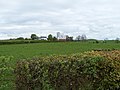
 Farmland , Lugton - geograph.org.uk - 1278636.jpg 640 × 480; 66 KB
-
 Farmland - geograph.org.uk - 77064.jpg 640 × 479; 71 KB
-
 Field Gates - geograph.org.uk - 77080.jpg 640 × 479; 82 KB
-
 Frozen Trough - geograph.org.uk - 1150155.jpg 640 × 480; 121 KB
-
 Goat Willow - Salix caprea at Lugton.JPG 4,608 × 3,456; 3.52 MB
-
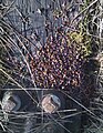 Hawthorn haws larder collected by small mammals.jpg 1,339 × 1,726; 1.55 MB
-
 Hylotelephium telephium near Lugton, East Ayrshire.JPG 3,074 × 2,783; 3.75 MB
-
 Hylotelephium telephium, Orpine.JPG 4,134 × 2,855; 6.45 MB
-
 Lochridgehills Farm - geograph.org.uk - 170946.jpg 640 × 480; 64 KB
-
 Lugton - geograph.org.uk - 1150127.jpg 640 × 480; 82 KB
-
 Lugton Bogs - geograph.org.uk - 5258007.jpg 640 × 427; 164 KB
-
 Lugton from the West - geograph.org.uk - 1412289.jpg 640 × 480; 101 KB
-
 Lugton Inn, 19th century.jpg 1,768 × 788; 504 KB
-
 Lugton1.JPG 2,288 × 1,712; 1.33 MB
-
 Lugton2.JPG 2,288 × 1,712; 1.28 MB
-
 Lugtontollhouse.JPG 2,288 × 1,712; 1.17 MB
-
 Newhouse - geograph.org.uk - 171546.jpg 640 × 480; 131 KB
-
 Paraffin Lamp, Lugton - geograph.org.uk - 30292.jpg 640 × 480; 118 KB
-
 Petasites hybridus - Butterbur at Lugton.JPG 2,877 × 3,888; 6.3 MB
-
 Rolled Field - geograph.org.uk - 1277341.jpg 640 × 480; 83 KB
-
 Seeded Field - geograph.org.uk - 1277364.jpg 640 × 480; 120 KB
-

-
 Site of the Lugton Inn - geograph.org.uk - 4096529.jpg 3,264 × 2,448; 2.62 MB
-
 South Biggart Farm - geograph.org.uk - 1150098.jpg 640 × 484; 104 KB
-
 William Covert - geograph.org.uk - 1150170.jpg 480 × 640; 112 KB


