Category:Lugwardine
Polski: Lugwardine – wieś w Anglii, w hrabstwie Herefordshire. Leży 5 km na wschód od miasta Hereford i 185 km na zachód od Londynu.

village in the United Kingdom  | |||||
| Upload media | |||||
| Instance of | |||||
|---|---|---|---|---|---|
| Location | Herefordshire, West Midlands, England | ||||
 | |||||
Subcategories
This category has the following 2 subcategories, out of 2 total.
L
- Lugwardine War Memorial (2 F)
P
Media in category "Lugwardine"
The following 200 files are in this category, out of 242 total.
(previous page) (next page)-
 'River Lugg' Sign at Lugwardine - geograph.org.uk - 6165790.jpg 3,648 × 2,736; 4.15 MB
-
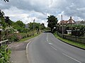
 A465 towards Hereford - geograph.org.uk - 4696887.jpg 800 × 451; 201 KB
-
 Ad for Godwin tiles 1863.jpg 1,000 × 1,398; 350 KB
-
 An orchard near Lugg Bridge Farm - geograph.org.uk - 3386924.jpg 1,024 × 680; 253 KB
-
 Barn conversion, Lugwardine - geograph.org.uk - 143476.jpg 640 × 426; 115 KB
-
 Bartestree Convent - geograph.org.uk - 5357491.jpg 1,024 × 768; 326 KB
-
 Bartestree Convent - geograph.org.uk - 5357494.jpg 1,024 × 768; 307 KB
-

-
 Black Hole Lane - geograph.org.uk - 2200565.jpg 4,048 × 3,040; 2.5 MB
-
 Black Hole Lane - geograph.org.uk - 969537.jpg 640 × 480; 112 KB
-
 Bridleway across New Court - geograph.org.uk - 2045376.jpg 640 × 480; 256 KB
-

-
 Cattle Near Hampton Meadow - geograph.org.uk - 1355900.jpg 640 × 480; 177 KB
-
 Converted farm at Lugwardine - geograph.org.uk - 2472819.jpg 640 × 480; 62 KB
-
 Cotts Farm - geograph.org.uk - 1635693.jpg 640 × 480; 234 KB
-
 Cotts Lane joining the A438 - geograph.org.uk - 1635692.jpg 640 × 480; 135 KB
-
 Cotts Lane passing The Crown and Anchor - geograph.org.uk - 1635688.jpg 640 × 480; 185 KB
-
 Country road passing Longworth Hall - geograph.org.uk - 5357483.jpg 1,024 × 768; 182 KB
-
 Croft Cottage (Lugwardine) - geograph.org.uk - 6165775.jpg 3,648 × 2,736; 3.65 MB
-
 Cultivation, cultivation, cultivation - geograph.org.uk - 969548.jpg 640 × 480; 164 KB
-
 Drain on Hampton Meadow - geograph.org.uk - 1219184.jpg 439 × 640; 134 KB
-
 Drainage channel, Hampton Meadow - geograph.org.uk - 1219253.jpg 480 × 640; 134 KB
-
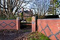
 Entrance signage - geograph.org.uk - 5644503.jpg 800 × 451; 116 KB
-
 Entrance to Quarry Field (Lugwardine) - geograph.org.uk - 6165734.jpg 3,648 × 2,736; 4.57 MB
-
 Entrance to Quarry Field (Lugwardine) - geograph.org.uk - 6165735.jpg 3,648 × 2,736; 4.4 MB
-
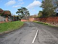
 Entrance to Rock Farm, Lugwardine - geograph.org.uk - 723460.jpg 640 × 480; 145 KB
-

-

-
 Field by Lugwardine - geograph.org.uk - 6165901.jpg 3,648 × 2,736; 4.46 MB
-
 Field by Lugwardine - geograph.org.uk - 6165904.jpg 3,648 × 2,736; 4.38 MB
-
 Field by Lugwardine - geograph.org.uk - 6165930.jpg 3,648 × 2,736; 4.71 MB
-
 Flag inside St. Peter's Church (North Aisle ^ Lugwardine) - geograph.org.uk - 6163653.jpg 3,648 × 2,736; 2.75 MB
-
 Floor at St. Peter's Church (Chancel ^ Lugwardine) - geograph.org.uk - 6163574.jpg 3,648 × 2,736; 3.58 MB
-

-
 Footpath onto the Lugg marshes - geograph.org.uk - 5644511.jpg 1,600 × 901; 685 KB
-

-
 Godwin Tile and Brickworks, former office building - geograph.org.uk - 5228954.jpg 3,255 × 2,163; 2.31 MB
-
 Godwin's former offices - geograph.org.uk - 5231509.jpg 3,293 × 2,169; 1.18 MB
-
 Grand Piano inside St. Peter's Church (Lugwardine) - geograph.org.uk - 6162948.jpg 3,648 × 2,736; 3.37 MB
-
 Grazing land by flooded gravel pits - geograph.org.uk - 4696881.jpg 800 × 451; 200 KB
-
 Group of Salix alba - geograph.org.uk - 841570.jpg 640 × 480; 97 KB
-
 Hagley Hall, Barterstree - geograph.org.uk - 5215474.jpg 3,248 × 2,160; 1.85 MB
-
 Hagley House, Bartestree - geograph.org.uk - 5216437.jpg 3,281 × 2,181; 2.19 MB
-
 Hagley House, Bartestree - geograph.org.uk - 5216503.jpg 3,288 × 2,185; 1.41 MB
-
 Hagley House, Hagley - geograph.org.uk - 5462149.jpg 537 × 640; 230 KB
-
 Half-timbered cottage, Lugwardine - geograph.org.uk - 969519.jpg 640 × 471; 151 KB
-
 Hedge icicles - geograph.org.uk - 3386908.jpg 1,024 × 680; 269 KB
-
 Hedge icicles - geograph.org.uk - 3386912.jpg 1,024 × 680; 243 KB
-
 High House, Lugwardine - geograph.org.uk - 969492.jpg 640 × 480; 125 KB
-
 Hillside NE of Lugwardine Chapel - geograph.org.uk - 722714.jpg 640 × 480; 135 KB
-
 Horse and Tree at Lugwardine - geograph.org.uk - 6165920.jpg 3,648 × 2,736; 4.15 MB
-
 House and lane in Lugwardine - geograph.org.uk - 2472830.jpg 640 × 480; 88 KB
-

-
 Lane junction near Sheepcote - geograph.org.uk - 2472865.jpg 640 × 480; 81 KB
-

-
 Larport Lane, looking south east - geograph.org.uk - 2472859.jpg 640 × 480; 56 KB
-
 Lay-by on the A4103 near Cotts Farm - geograph.org.uk - 1635696.jpg 640 × 480; 172 KB
-

-
 London Bound - geograph.org.uk - 1367020.jpg 480 × 640; 199 KB
-
 Longworth Bridge, Lugwardine - geograph.org.uk - 61000.jpg 640 × 423; 93 KB
-
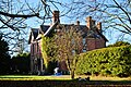
 Longworth Hall - geograph.org.uk - 1355909.jpg 640 × 480; 197 KB
-
 Longworth Hall - geograph.org.uk - 3615425.jpg 1,024 × 680; 232 KB
-
 Longworth Hall - geograph.org.uk - 3951506.jpg 800 × 531; 110 KB
-
 Longworth Hall - geograph.org.uk - 5357468.jpg 1,024 × 576; 167 KB
-
 Longworth Hall - geograph.org.uk - 5357501.jpg 800 × 600; 128 KB
-
 Longworth Hall - geograph.org.uk - 5686244.jpg 3,849 × 1,907; 2.85 MB
-
 Longworth Hall - geograph.org.uk - 722647.jpg 640 × 449; 162 KB
-
 Longworth Hall, Lugwardine - geograph.org.uk - 3385656.jpg 640 × 427; 193 KB
-
 Longworth Lane - geograph.org.uk - 4639972.jpg 4,000 × 3,000; 3.06 MB
-
 Longworth Lane, Bartestree - geograph.org.uk - 2472896.jpg 640 × 480; 63 KB
-

-
 Longworth Mill And River Frome Bridge - geograph.org.uk - 1355918.jpg 640 × 480; 199 KB
-

-
 Lower Lodge (Lugwardine) - geograph.org.uk - 6165844.jpg 3,648 × 2,736; 4.38 MB
-
 Lugg Bridge - geograph.org.uk - 641581.jpg 640 × 480; 116 KB
-
 Lugg Bridge Farm - geograph.org.uk - 4165574.jpg 4,608 × 2,349; 4.12 MB
-
 Lugg Bridge Mill - geograph.org.uk - 2353414.jpg 640 × 480; 80 KB
-
 Lugg Bridge Mill - geograph.org.uk - 2353432.jpg 640 × 480; 93 KB
-
 Lugg Bridge Mill - geograph.org.uk - 641723.jpg 640 × 480; 72 KB
-
 Lugg Bridge Mill - geograph.org.uk - 641724.jpg 640 × 480; 94 KB
-
 Lugg meadows - geograph.org.uk - 841539.jpg 640 × 480; 131 KB
-
 Lugg meadows at Tidnor - geograph.org.uk - 841579.jpg 640 × 494; 87 KB
-
 Lugg meadows, 1 - geograph.org.uk - 5644518.jpg 1,600 × 901; 719 KB
-
 Lugg meadows, 2 - geograph.org.uk - 5644520.jpg 800 × 451; 75 KB
-
 Lugwardine - A438 Near Tidnor Lane - geograph.org.uk - 1355892.jpg 640 × 480; 181 KB
-
 Lugwardine - Lumber Lane - geograph.org.uk - 1355877.jpg 640 × 480; 188 KB
-

-

-

-

-

-
 Lugwardine Bridge - geograph.org.uk - 144622.jpg 640 × 426; 134 KB
-
 Lugwardine Bridge - geograph.org.uk - 3800777.jpg 1,024 × 680; 281 KB
-
 Lugwardine Bridge - geograph.org.uk - 6131858.jpg 3,648 × 2,736; 4.66 MB
-
 Lugwardine Chapel - geograph.org.uk - 5216564.jpg 3,299 × 2,388; 2.74 MB
-
 Lugwardine Chapel - geograph.org.uk - 5228940.jpg 3,306 × 2,199; 1.74 MB
-
 Lugwardine Chapel - geograph.org.uk - 722711.jpg 640 × 480; 135 KB
-
 Lugwardine Court - geograph.org.uk - 6165838.jpg 3,648 × 2,736; 3.06 MB
-
 Lugwardine House - geograph.org.uk - 6165884.jpg 3,648 × 2,736; 4.79 MB
-
 Lugwardine House - geograph.org.uk - 6165910.jpg 3,648 × 2,056; 3.46 MB
-
 Lumber Lane - geograph.org.uk - 4286050.jpg 800 × 451; 195 KB
-
 Lumber Lane - geograph.org.uk - 969523.jpg 640 × 480; 209 KB
-
 Lumber Lane - geograph.org.uk - 970737.jpg 640 × 484; 190 KB
-
 Lumber Lane junction with St.Peters Close - geograph.org.uk - 723462.jpg 480 × 640; 147 KB
-
 Lumber Lane, Eau Withington - geograph.org.uk - 3388114.jpg 1,024 × 680; 189 KB
-
 Lumber Lane, Lugwardine - geograph.org.uk - 4286053.jpg 800 × 451; 210 KB
-
 Lumber Lane, Lugwardine - geograph.org.uk - 723461.jpg 640 × 480; 143 KB
-
 Malt House (Lugwardine) - geograph.org.uk - 6165743.jpg 3,648 × 2,736; 4.96 MB
-
 Map Lugwardine 1886.jpg 2,000 × 1,105; 586 KB
-
 Memorial to William Reed - geograph.org.uk - 2718669.jpg 681 × 1,024; 170 KB
-
 Metal milepost by the A438 at Lugwardine - geograph.org.uk - 723465.jpg 470 × 640; 117 KB
-
 Milestone Opposite Lugwardine Church - geograph.org.uk - 1355884.jpg 480 × 640; 241 KB
-
 Monks' Orchard Farm, Lugwardine - geograph.org.uk - 5228890.jpg 782 × 520; 91 KB
-
 New Inn, Bartestree - geograph.org.uk - 5215850.jpg 3,248 × 2,160; 2.21 MB
-
 New Inn, Bartrestree - geograph.org.uk - 5215777.jpg 3,286 × 2,153; 1.63 MB
-
 New Inn, Hagley - geograph.org.uk - 5462145.jpg 640 × 480; 194 KB
-
 Old Tap at Lugwardine - geograph.org.uk - 6165783.jpg 3,648 × 2,736; 4.84 MB
-
 Pastoral scene north of Lugwardine - geograph.org.uk - 2045364.jpg 640 × 480; 225 KB
-
 Penelope Cottage, Rhystone Lane - geograph.org.uk - 5228874.jpg 3,248 × 2,160; 1.24 MB
-
 Penkelly, Hagley Hill - geograph.org.uk - 5231520.jpg 3,248 × 2,160; 2.97 MB
-
 Penkelly, Hagley Hill - geograph.org.uk - 5231527.jpg 3,248 × 2,160; 2.7 MB
-
 Penkelly, Hagley Hill - geograph.org.uk - 5231622.jpg 3,248 × 2,160; 2.37 MB
-
 Penkelly, Hagley Hill - geograph.org.uk - 5231623.jpg 3,154 × 2,039; 1.9 MB
-
 Penkelly, Hagley Hill - geograph.org.uk - 5231626.jpg 3,241 × 2,357; 2.23 MB
-
 Penkelly, Hagley Hill - geograph.org.uk - 5231631.jpg 3,130 × 2,033; 2.25 MB
-
 Plaque on Lugwardine Bridge - geograph.org.uk - 6165827.jpg 3,648 × 2,736; 5.16 MB
-
 Plaque on Lugwardine Bridge - geograph.org.uk - 969510.jpg 640 × 480; 225 KB
-
 Porch House (Lugwardine) - geograph.org.uk - 6165691.jpg 3,648 × 2,736; 4.39 MB
-
 Porch House, Lugwardine - geograph.org.uk - 5225637.jpg 3,300 × 2,022; 1.05 MB
-
 Power lines passing through - geograph.org.uk - 1219259.jpg 640 × 480; 89 KB
-
 Quarry Field (Lugwardine) - geograph.org.uk - 6165737.jpg 3,648 × 2,736; 4.56 MB
-
 Quarry Field (Lugwardine) - geograph.org.uk - 6165779.jpg 3,648 × 2,736; 4.28 MB
-
 Quarry Field (Lugwardine) - geograph.org.uk - 6165780.jpg 3,648 × 2,736; 3.81 MB
-
 Quarry Field, Lugwardine - geograph.org.uk - 3954170.jpg 1,024 × 680; 310 KB
-
 Railway Overbridge, A465 - geograph.org.uk - 1366911.jpg 640 × 480; 207 KB
-
 Rear of Lugwardine Chapel - geograph.org.uk - 723463.jpg 640 × 480; 97 KB
-
 Rhystone Lane, Lugwardine - geograph.org.uk - 723457.jpg 640 × 480; 121 KB
-
 Rhystone Lane (Lugwardine) - geograph.org.uk - 6165925.jpg 3,648 × 2,736; 3.89 MB
-
 Rhystone Lane (Lugwardine) - geograph.org.uk - 6165940.jpg 3,648 × 2,736; 4.25 MB
-
 Rhystone Lane - geograph.org.uk - 5644513.jpg 1,600 × 901; 663 KB
-

-

-
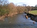
 River Lugg - downstream - geograph.org.uk - 841551.jpg 640 × 480; 106 KB
-
 River Lugg - view upstream - geograph.org.uk - 841548.jpg 640 × 480; 123 KB
-
 Road to Withington - geograph.org.uk - 1852360.jpg 640 × 480; 252 KB
-
 Route of Roman road - geograph.org.uk - 970730.jpg 640 × 395; 98 KB
-

-

-
 Semi-detached cottages, Lugwardine - geograph.org.uk - 969498.jpg 640 × 480; 117 KB
-
 Sheep grazing in rich pasture - geograph.org.uk - 841553.jpg 640 × 480; 116 KB
-
 Sheep in the fields at Lugwardine - geograph.org.uk - 1635676.jpg 640 × 480; 110 KB
-
 Sign at St. Peter's Church (Lugwardine) - geograph.org.uk - 6162923.jpg 3,648 × 2,736; 4.26 MB
-
 Sign at St. Peter's Church (Lugwardine) - geograph.org.uk - 6165713.jpg 3,648 × 2,736; 4.46 MB
-
 Small tributary of the Lugg - geograph.org.uk - 4286052.jpg 800 × 451; 201 KB
-
 SMHS.png 360 × 451; 116 KB
-
 Soft red earth - geograph.org.uk - 970742.jpg 640 × 480; 165 KB
-
 St Peter, Lugwardine - geograph.org.uk - 5216544.jpg 3,282 × 2,386; 2.59 MB
-
 St Peter, Lugwardine - geograph.org.uk - 5223403.jpg 3,294 × 2,190; 1.59 MB
-
 St Peter, Lugwardine - geograph.org.uk - 5223406.jpg 2,160 × 3,248; 2.38 MB
-
 St Peter, Lugwardine - geograph.org.uk - 5223413.jpg 3,285 × 2,184; 1.41 MB
-
 St Peter, Lugwardine - geograph.org.uk - 5223569.jpg 3,263 × 2,170; 1.4 MB
-
 St Peter, Lugwardine - geograph.org.uk - 5223596.jpg 2,190 × 3,295; 1.9 MB
-
 St Peter, Lugwardine - geograph.org.uk - 5223601.jpg 2,488 × 3,277; 1.58 MB
-
 St Peter, Lugwardine - geograph.org.uk - 5223624.jpg 2,446 × 3,276; 2.6 MB
-
 St Peter, Lugwardine - geograph.org.uk - 5223649.jpg 3,248 × 2,160; 1.89 MB
-
 St Peter, Lugwardine - geograph.org.uk - 5223706.jpg 2,194 × 3,300; 2.06 MB
-
 St Peter, Lugwardine - geograph.org.uk - 5223801.jpg 1,979 × 3,277; 1.52 MB
-
 St Peter, Lugwardine - geograph.org.uk - 5224855.jpg 3,302 × 2,238; 1.52 MB
-
 St Peter, Lugwardine - geograph.org.uk - 5225628.jpg 2,160 × 3,248; 1.79 MB
-
 St. Mary's Roman Catholic High School (Lugwardine) - geograph.org.uk - 6165932.jpg 3,648 × 2,736; 4.71 MB
-
 St. Peter's Church (Altar ^ Lugwardine) - geograph.org.uk - 6163615.jpg 3,648 × 2,736; 3.16 MB
-
 St. Peter's Church (Bell Tower ^ Lugwardine) - geograph.org.uk - 6150545.jpg 2,736 × 3,648; 4.57 MB
-
 St. Peter's Church (Bell Tower ^ Lugwardine) - geograph.org.uk - 6163704.jpg 3,648 × 2,736; 3.73 MB
-
 St. Peter's Church (Chancel ^ Lugwardine) - geograph.org.uk - 6163626.jpg 3,648 × 2,736; 3.1 MB
-
 St. Peter's Church (Cross ^ Lugwardine) - geograph.org.uk - 6150512.jpg 3,648 × 2,736; 4.72 MB
-
 St. Peter's Church (Cross ^ Lugwardine) - geograph.org.uk - 6163705.jpg 3,648 × 2,736; 3.71 MB
-
 St. Peter's Church (Font ^ Lugwardine) - geograph.org.uk - 6165701.jpg 3,648 × 2,736; 3.06 MB
-
 St. Peter's Church (Lugwardine) - geograph.org.uk - 6150314.jpg 3,648 × 2,056; 3.54 MB
-
 St. Peter's Church (Lugwardine) - geograph.org.uk - 6150496.jpg 3,648 × 2,736; 4.59 MB
-
 St. Peter's Church (Lugwardine) - geograph.org.uk - 6162942.jpg 3,648 × 2,056; 2.51 MB
-
 St. Peter's Church (Lugwardine) - geograph.org.uk - 6163712.jpg 3,648 × 2,736; 4.7 MB
-
 St. Peter's Church (Lugwardine) - geograph.org.uk - 6163714.jpg 3,648 × 2,736; 4.87 MB
-
 St. Peter's Church (Lugwardine) - geograph.org.uk - 6165709.jpg 3,648 × 2,736; 4.36 MB
-
 St. Peter's Church (Lugwardine) - geograph.org.uk - 6165719.jpg 3,648 × 2,736; 4.87 MB
-
 St. Peter's Church (Lugwardine) - geograph.org.uk - 6165720.jpg 3,648 × 2,736; 3.85 MB
-
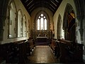
 St. Peter's Church (Nave ^ Lugwardine) - geograph.org.uk - 6163029.jpg 3,648 × 2,736; 3.13 MB
-
 St. Peter's Church (North Aisle ^ Lugwardine) - geograph.org.uk - 6163650.jpg 3,648 × 2,736; 3.1 MB
-
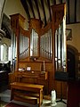 St. Peter's Church (Organ ^ Lugwardine) - geograph.org.uk - 6163019.jpg 2,736 × 3,648; 3.42 MB
-
 St. Peter's Church (Pulpit ^ Lugwardine) - geograph.org.uk - 6163636.jpg 3,648 × 2,736; 3.2 MB
-
 St. Peter's Church (South Aisle ^ Lugwardine) - geograph.org.uk - 6163680.jpg 3,648 × 2,736; 3.41 MB
-
 St. Peter's Church (South Chapel ^ Lugwardine) - geograph.org.uk - 6163064.jpg 3,648 × 2,736; 3.43 MB
-
 St. Peter's Church (War Memorial ^ Lugwardine) - geograph.org.uk - 6163697.jpg 3,648 × 2,736; 3.02 MB
-
 St. Peter's Church (War Memorial ^ Lugwardine) - geograph.org.uk - 6165716.jpg 3,648 × 2,736; 4.78 MB
-
 Stable block, Porch House - geograph.org.uk - 5228913.jpg 3,280 × 1,945; 1.6 MB
-
 Swans on the swollen River Lugg - geograph.org.uk - 143479.jpg 640 × 426; 99 KB
-
 The A456 Road (Lugwardine) - geograph.org.uk - 6165740.jpg 3,648 × 2,736; 4.79 MB
-
 The Crown and Anchor - geograph.org.uk - 3978461.jpg 800 × 531; 121 KB
-

-
 The Lugg at Lugwardine - geograph.org.uk - 1635685.jpg 640 × 480; 186 KB
-
 The Lugg at Lugwardine - geograph.org.uk - 1635686.jpg 640 × 480; 169 KB


_-_geograph.org.uk_-_6165775.jpg)


_-_geograph.org.uk_-_6165734.jpg)
_-_geograph.org.uk_-_6165735.jpg)

_-_geograph.org.uk_-_6165731.jpg)


_-_geograph.org.uk_-_6163653.jpg)
_-_geograph.org.uk_-_6163574.jpg)


_-_geograph.org.uk_-_6162948.jpg)


_-_geograph.org.uk_-_6165844.jpg)


_-_geograph.org.uk_-_6165743.jpg)


_-_geograph.org.uk_-_6165691.jpg)


_-_geograph.org.uk_-_6165737.jpg)
_-_geograph.org.uk_-_6165779.jpg)
_-_geograph.org.uk_-_6165780.jpg)


_-_geograph.org.uk_-_6165925.jpg)
_-_geograph.org.uk_-_6165940.jpg)


_-_geograph.org.uk_-_6163036.jpg)
_-_geograph.org.uk_-_6163691.jpg)


_-_geograph.org.uk_-_6162923.jpg)
_-_geograph.org.uk_-_6165713.jpg)


_-_geograph.org.uk_-_6165932.jpg)
_-_geograph.org.uk_-_6163615.jpg)
_-_geograph.org.uk_-_6150545.jpg)
_-_geograph.org.uk_-_6163704.jpg)
_-_geograph.org.uk_-_6163626.jpg)
_-_geograph.org.uk_-_6150512.jpg)
_-_geograph.org.uk_-_6163705.jpg)
_-_geograph.org.uk_-_6165701.jpg)
_-_geograph.org.uk_-_6150314.jpg)
_-_geograph.org.uk_-_6150496.jpg)
_-_geograph.org.uk_-_6162942.jpg)
_-_geograph.org.uk_-_6163712.jpg)
_-_geograph.org.uk_-_6163714.jpg)
_-_geograph.org.uk_-_6165709.jpg)
_-_geograph.org.uk_-_6165719.jpg)
_-_geograph.org.uk_-_6165720.jpg)
_-_geograph.org.uk_-_6163029.jpg)
_-_geograph.org.uk_-_6163650.jpg)
_-_geograph.org.uk_-_6163019.jpg)
_-_geograph.org.uk_-_6163636.jpg)
_-_geograph.org.uk_-_6163680.jpg)
_-_geograph.org.uk_-_6163064.jpg)
_-_geograph.org.uk_-_6163697.jpg)
_-_geograph.org.uk_-_6165716.jpg)


_-_geograph.org.uk_-_6165740.jpg)


