Category:Lundie (civil parish)
Scottish parish in Angus, Scotland, UK | |||||
| Upload media | |||||
| Instance of | |||||
|---|---|---|---|---|---|
| Named after |
| ||||
| Location |
| ||||
| Population |
| ||||
| Area |
| ||||
 | |||||
Media in category "Lundie (civil parish)"
The following 200 files are in this category, out of 201 total.
(previous page) (next page)-
 Adam Duncan Gravestone - geograph.org.uk - 3035632.jpg 640 × 480; 75 KB
-
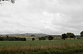
 Agricultural land - geograph.org.uk - 3882271.jpg 640 × 480; 60 KB
-
 Ardgarth - geograph.org.uk - 2066742.jpg 640 × 427; 247 KB
-
 Ardgarth and the Craigs of Lundie - geograph.org.uk - 3718210.jpg 1,024 × 681; 147 KB
-
 Ardgarth from Lundie Craigs - geograph.org.uk - 3722677.jpg 1,024 × 681; 181 KB
-
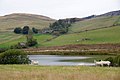
 Ardgarth Loch - geograph.org.uk - 3049268.jpg 640 × 480; 64 KB
-

-
 Autumnal beech leaves, Ledcrieff Wood - geograph.org.uk - 3722738.jpg 1,024 × 681; 293 KB
-
 Autumnal birch leaves, Pitcur Wood - geograph.org.uk - 3726978.jpg 1,024 × 682; 197 KB
-
 Autumnal colours near Lundie - geograph.org.uk - 2176385.jpg 640 × 480; 85 KB
-
 Autumnal elm leaves, Pitcur Wood - geograph.org.uk - 3726991.jpg 1,024 × 681; 369 KB
-
 Autumnal larch, Pitcur Wood - geograph.org.uk - 3722411.jpg 1,024 × 680; 373 KB
-
 Bales in a field at Easter Keith, near Lundie - geograph.org.uk - 3715380.jpg 1,024 × 681; 252 KB
-
 Balshando - geograph.org.uk - 2066749.jpg 640 × 427; 243 KB
-
 Balshando Farm - geograph.org.uk - 3450214.jpg 640 × 480; 56 KB
-
 Balshando Farm House - geograph.org.uk - 2066753.jpg 640 × 389; 234 KB
-
 Balshando, Lundie - geograph.org.uk - 3718256.jpg 1,024 × 682; 204 KB
-
 Bare sycamores, Pitcur Wood - geograph.org.uk - 3722423.jpg 682 × 1,024; 286 KB
-
 Below Lundie Craigs - geograph.org.uk - 3035806.jpg 640 × 480; 52 KB
-
 Below Lundie Craigs - geograph.org.uk - 3035824.jpg 640 × 480; 75 KB
-
 Brown Trout (Salmo trutta), Ledcrieff Loch - geograph.org.uk - 3722459.jpg 1,024 × 681; 51 KB
-
 Burn in Pitcur Wood - geograph.org.uk - 3722397.jpg 682 × 1,024; 360 KB
-
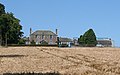
 Castle Farm - geograph.org.uk - 2066647.jpg 640 × 427; 239 KB
-
 Castle Farm - geograph.org.uk - 4578345.jpg 640 × 479; 115 KB
-
 Castle Farm House - geograph.org.uk - 2066653.jpg 640 × 427; 274 KB
-
 Cattle near Lundie - geograph.org.uk - 2176547.jpg 640 × 481; 103 KB
-
 Children's pond at Ledyatt - geograph.org.uk - 4640604.jpg 640 × 480; 58 KB
-
 Converted Building - geograph.org.uk - 2066737.jpg 640 × 427; 249 KB
-
 Cottages at Pitermo - geograph.org.uk - 2066698.jpg 640 × 408; 227 KB
-
 Cottages at Pitermo, Lundie - geograph.org.uk - 3932644.jpg 1,024 × 682; 193 KB
-
 Cottages near Lundie - geograph.org.uk - 2066641.jpg 640 × 406; 237 KB
-
 Country Avenue - geograph.org.uk - 2066726.jpg 427 × 640; 277 KB
-
 Cow path near Lundie - geograph.org.uk - 4819770.jpg 800 × 600; 137 KB
-
 Drumsuldry Wood from the Lundie Craigs - geograph.org.uk - 3722638.jpg 1,024 × 681; 272 KB
-
 Dry stane dyke - geograph.org.uk - 3241657.jpg 2,048 × 1,536; 1.3 MB
-
 Farm at Ardgarth, Lundie - geograph.org.uk - 3718206.jpg 1,024 × 681; 193 KB
-
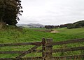
 Farm track near West Mains Farm - geograph.org.uk - 3264938.jpg 1,200 × 797; 692 KB
-
 Farmhouse at Castle Farm - geograph.org.uk - 3882269.jpg 640 × 480; 99 KB
-
 Farmland and moorland below Blacklaw - geograph.org.uk - 4575182.jpg 640 × 479; 58 KB
-
 Farmland at Kirkton of Lundie - geograph.org.uk - 4624996.jpg 640 × 449; 55 KB
-
 Farmland at Ledyatt Farm - geograph.org.uk - 4570570.jpg 640 × 480; 34 KB
-
 Farmland below West Mains - geograph.org.uk - 4640671.jpg 640 × 480; 53 KB
-
 Farmland near the village of Lundie - geograph.org.uk - 4625001.jpg 640 × 480; 54 KB
-
 Farmland to the north of the A923 - geograph.org.uk - 5151945.jpg 640 × 422; 36 KB
-
 Field at Lochindores - geograph.org.uk - 5152306.jpg 640 × 456; 53 KB
-
 Field by Ledyatt - geograph.org.uk - 4819585.jpg 800 × 600; 176 KB
-
 Field near Ledyatt - geograph.org.uk - 4819588.jpg 800 × 600; 159 KB
-
 Field of Barley - geograph.org.uk - 2066634.jpg 640 × 427; 262 KB
-
 Fields at Clushmill, near Lundie - geograph.org.uk - 3715387.jpg 1,024 × 681; 188 KB
-
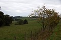
 Fields below Pitcur Wood - geograph.org.uk - 3722402.jpg 1,024 × 681; 135 KB
-
 Fields beside Lundie Loch - geograph.org.uk - 3718230.jpg 1,024 × 681; 227 KB
-
 Fields near Kirkton of Lundie - geograph.org.uk - 3932638.jpg 1,024 × 682; 173 KB
-
 Fishermans' Huts at Ledcrieff Loch - geograph.org.uk - 1265028.jpg 640 × 427; 69 KB
-
 Fishing at Ledyatt Loch - geograph.org.uk - 3882259.jpg 640 × 480; 62 KB
-
 Five-tube gate - geograph.org.uk - 4214804.jpg 2,048 × 1,536; 1.57 MB
-
 From the top of Lundie Craigs - geograph.org.uk - 5415360.jpg 5,184 × 3,888; 4.97 MB
-

-

-
 Grassland in Ledyatt Wood - geograph.org.uk - 4572696.jpg 640 × 480; 53 KB
-
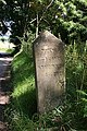
 Gravestone of Admiral Duncan - geograph.org.uk - 3035160.jpg 640 × 480; 99 KB
-
 Highland cattle on Westerkeith Hill - geograph.org.uk - 6241446.jpg 4,822 × 3,468; 3.61 MB
-
 Hill path above Ledcrieff Loch - geograph.org.uk - 3560158.jpg 640 × 480; 52 KB
-
 Kirkton of Lundie - geograph.org.uk - 3718071.jpg 1,024 × 682; 141 KB
-
 Kirkton of Lundie Farm - geograph.org.uk - 2066702.jpg 640 × 427; 255 KB
-
 Kirkton of Lundie Farm House - geograph.org.uk - 2066711.jpg 640 × 398; 208 KB
-
 Kirkton of Lundie from Ledyatt - geograph.org.uk - 3932632.jpg 1,024 × 682; 149 KB
-
 Kirkton of Lundie from Lundie Craigs - geograph.org.uk - 3722719.jpg 1,024 × 681; 142 KB
-
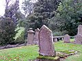 Kirkyard, Lundie Parish Kirk - geograph.org.uk - 2176529.jpg 640 × 480; 81 KB
-

-
 Ledcrieff from the east - geograph.org.uk - 5415392.jpg 5,184 × 3,888; 6.31 MB
-
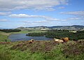
 Ledcrieff Loch - geograph.org.uk - 2338744.jpg 1,600 × 1,200; 456 KB
-
 Ledcrieff Loch - geograph.org.uk - 3005759.jpg 640 × 480; 53 KB
-
 Ledcrieff Loch - geograph.org.uk - 3722440.jpg 1,024 × 682; 178 KB
-
 Ledcrieff Loch - geograph.org.uk - 3722462.jpg 1,024 × 681; 145 KB
-
 Ledcrieff Loch - geograph.org.uk - 6241355.jpg 5,152 × 3,864; 6.32 MB
-
 Ledcrieff Loch from Lundie Craigs - geograph.org.uk - 3049265.jpg 640 × 480; 64 KB
-
 Ledcrieff Loch from Lundie Craigs - geograph.org.uk - 3722693.jpg 1,024 × 681; 195 KB
-
 Ledyatt Farm - geograph.org.uk - 3264922.jpg 1,200 × 797; 567 KB
-
 Ledyatt Loch - geograph.org.uk - 3625775.jpg 640 × 480; 55 KB
-
 Ledyatt Loch - geograph.org.uk - 3882254.jpg 640 × 480; 55 KB
-
 Ledyatt Loch - geograph.org.uk - 4575176.jpg 640 × 480; 75 KB
-
 Ledyatt, Lundie - geograph.org.uk - 3932624.jpg 1,024 × 682; 227 KB
-
-
 Lochindores, near Lundie - geograph.org.uk - 3718270.jpg 1,024 × 681; 240 KB
-
 Lone wind turbine - geograph.org.uk - 3882277.jpg 640 × 480; 26 KB
-
 Long Loch - geograph.org.uk - 4214781.jpg 2,048 × 1,536; 1.5 MB
-
 Long Loch from Keillor Hill - geograph.org.uk - 5415381.jpg 5,184 × 3,888; 6.49 MB
-
 Looking east near Balshando - geograph.org.uk - 2066748.jpg 640 × 427; 248 KB
-
 Looking Towards West Mains - geograph.org.uk - 2066621.jpg 427 × 640; 257 KB
-
 Lundie - geograph.org.uk - 4819754.jpg 800 × 600; 241 KB
-
 Lundie Craigs - geograph.org.uk - 3241622.jpg 2,048 × 1,536; 726 KB
-
 Lundie Craigs - geograph.org.uk - 3925688.jpg 2,304 × 1,728; 780 KB
-
 Lundie Craigs - geograph.org.uk - 4214793.jpg 2,048 × 1,536; 1.49 MB
-
 Lundie Craigs from Ledcrieff Loch - geograph.org.uk - 3726972.jpg 1,024 × 681; 123 KB
-
 Lundie Craigs from Ledyatt - geograph.org.uk - 3933484.jpg 1,024 × 682; 159 KB
-
 Lundie Loch and Ardgarth - geograph.org.uk - 3718243.jpg 1,024 × 681; 172 KB
-

-
 Lundie Loch from Lundie Craigs - geograph.org.uk - 3722669.jpg 1,024 × 681; 212 KB
-
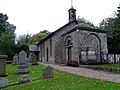 Lundie Parish Kirk - geograph.org.uk - 2176527.jpg 640 × 480; 69 KB
-
 Lundie Parish Kirk - geograph.org.uk - 3035068.jpg 640 × 480; 100 KB
-
 Mallards (Anas platyrhynchos), Lundie - geograph.org.uk - 3718214.jpg 1,024 × 680; 256 KB
-
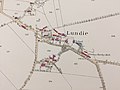 Map of Lundie.jpg 3,264 × 2,448; 1.51 MB
-
 Mast on Lundie Craigs - geograph.org.uk - 3722651.jpg 1,024 × 682; 140 KB
-
 Mast on Lundie Craigs from the trig point - geograph.org.uk - 3722704.jpg 1,024 × 681; 129 KB
-
 Milestone, Balshando - geograph.org.uk - 2176386.jpg 480 × 640; 82 KB
-
 Milestone, Balshando, near Lundie - geograph.org.uk - 3718263.jpg 1,024 × 681; 307 KB
-
 Minor road at Castle Wood (felled) - geograph.org.uk - 3264936.jpg 797 × 1,200; 665 KB
-
 Minor road at Pitermo - geograph.org.uk - 3264934.jpg 1,200 × 797; 718 KB
-
 Minor road from Ledyatt to Lundie - geograph.org.uk - 3264919.jpg 1,200 × 797; 657 KB
-
 Minor road near Auchterhouse - geograph.org.uk - 3264940.jpg 1,200 × 797; 690 KB
-
 Minor road near Lundie - geograph.org.uk - 4819767.jpg 800 × 600; 312 KB
-
 Moorland near Ledcrieff Loch - geograph.org.uk - 3560155.jpg 640 × 480; 43 KB
-
 Moorland north of the Lundie Craigs - geograph.org.uk - 3722635.jpg 1,024 × 681; 258 KB
-
 Moss-covered sycamore, Ledcrieff Wood - geograph.org.uk - 3722742.jpg 682 × 1,024; 368 KB
-
 Moss-covered sycamore, Ledcrieff Wood - geograph.org.uk - 3722755.jpg 1,024 × 682; 359 KB
-
 Moss-covered sycamore, Ledcrieff Wood - geograph.org.uk - 3722760.jpg 682 × 1,024; 356 KB
-
 Mossy trunks - geograph.org.uk - 3241641.jpg 1,536 × 2,048; 1.25 MB
-
 Near Balshando - geograph.org.uk - 2066761.jpg 640 × 427; 281 KB
-
 North end of Lundie Loch - geograph.org.uk - 3718238.jpg 1,024 × 681; 218 KB
-
 Old alignment, A923 - geograph.org.uk - 4819592.jpg 800 × 600; 201 KB
-
 Old Direction sign - Signpost - geograph.org.uk - 6050312.jpg 428 × 959; 209 KB
-
 Old Milestone - geograph.org.uk - 2066756.jpg 427 × 640; 301 KB
-
 Old milestone, Balshando - geograph.org.uk - 6241323.jpg 3,655 × 4,873; 4.62 MB
-
 Once a bridge^ - geograph.org.uk - 1266545.jpg 640 × 427; 99 KB
-
-
 Pheasant feeder in woodland near Lundie - geograph.org.uk - 3715406.jpg 1,024 × 682; 272 KB
-
 Piperdam from Lundie Craigs - geograph.org.uk - 3722706.jpg 1,024 × 681; 143 KB
-
 Pitermo - geograph.org.uk - 2066662.jpg 640 × 427; 217 KB
-
 Pitermo Cottages - geograph.org.uk - 2066694.jpg 640 × 423; 243 KB
-
 Pitermo Farm - geograph.org.uk - 3450220.jpg 640 × 480; 85 KB
-
 Pitermo Farm House - geograph.org.uk - 2066673.jpg 450 × 640; 277 KB
-
 Pitlyal Loch, Thriepley, near Auchterhouse - geograph.org.uk - 3715369.jpg 1,024 × 681; 199 KB
-
 Pitlyal Loch, Thriepley, near Auchterhouse - geograph.org.uk - 3715376.jpg 1,024 × 681; 231 KB
-

-

-
-
 Power Lines in Ledyatt Wood - geograph.org.uk - 3882265.jpg 640 × 480; 60 KB
-
 Pylons and farmland by Ledyatt Wood - geograph.org.uk - 4876268.jpg 640 × 480; 63 KB
-
 Reeds by the Round Loch - geograph.org.uk - 2177109.jpg 640 × 480; 85 KB
-
 Reflections in Ledcrieff Loch - geograph.org.uk - 3722443.jpg 1,024 × 682; 187 KB
-
 Regenerating woodland in Ledcrieff Wood - geograph.org.uk - 3722497.jpg 1,024 × 681; 290 KB
-
 Road at Thriepley, near Auchterhouse - geograph.org.uk - 3715341.jpg 1,024 × 682; 216 KB
-
 Road junction at Lundie - geograph.org.uk - 3264924.jpg 1,200 × 797; 518 KB
-
 Road to Lundie - geograph.org.uk - 4819773.jpg 800 × 600; 296 KB
-
 Rose-hips, Round Loch - geograph.org.uk - 2177132.jpg 640 × 480; 125 KB
-
 Rossie Hill - geograph.org.uk - 3241697.jpg 2,048 × 1,536; 386 KB
-
 Rough grazing near Ledyatt Loch - geograph.org.uk - 4876278.jpg 640 × 480; 59 KB
-
 Rowing boats at Ledcrieff Loch - geograph.org.uk - 6241374.jpg 4,769 × 3,577; 4.96 MB
-
 Shady Track - geograph.org.uk - 2066628.jpg 640 × 427; 252 KB
-
 Shaft of light in the gloom of Ledcrieff Wood - geograph.org.uk - 3722482.jpg 1,024 × 682; 240 KB
-
 Sheep grazing near Lundie - geograph.org.uk - 3264927.jpg 1,200 × 797; 487 KB
-
 Strathmore from Tullybaccart - geograph.org.uk - 3049262.jpg 640 × 480; 39 KB
-
 Stratus behind lattice - geograph.org.uk - 3241609.jpg 1,536 × 2,048; 404 KB
-
 The edge of Drumsuldry Wood - geograph.org.uk - 5415376.jpg 5,184 × 3,888; 7.18 MB
-
 The Round Loch, Lundie - geograph.org.uk - 2177270.jpg 640 × 480; 78 KB
-

-
 Track in Ledcrieff Wood - geograph.org.uk - 3722474.jpg 1,024 × 682; 195 KB
-
 Track in Ledyatt Wood - geograph.org.uk - 3634699.jpg 640 × 480; 47 KB
-
 Track in Pitcur Wood - geograph.org.uk - 3562704.jpg 640 × 480; 94 KB
-
 Track into Ledcrieff Wood - geograph.org.uk - 3722430.jpg 1,024 × 682; 250 KB
-
 Track leading to Burnside Quarry - geograph.org.uk - 2413801.jpg 1,600 × 1,200; 367 KB
-
 Track near Lundie - geograph.org.uk - 2413764.jpg 1,600 × 1,200; 421 KB
-
 Track near Lundie - geograph.org.uk - 2413769.jpg 1,600 × 1,200; 449 KB
-
 Track near Lundie - geograph.org.uk - 2413775.jpg 1,600 × 1,200; 584 KB
-
 Track near Lundie - geograph.org.uk - 2413785.jpg 1,600 × 1,200; 653 KB
-
 Track near The Neuk - geograph.org.uk - 2413796.jpg 1,600 × 1,200; 471 KB
-
 Track through cleared forestry, Ledcrieff Wood - geograph.org.uk - 3722491.jpg 1,024 × 681; 221 KB
-
 Track through gloomy Ledcrieff Wood - geograph.org.uk - 3726960.jpg 1,024 × 681; 241 KB
-
 Track through gloomy Ledcrieff Wood - geograph.org.uk - 3726964.jpg 682 × 1,024; 254 KB
-
 Track through Pitcur Wood - geograph.org.uk - 3006967.jpg 640 × 415; 57 KB
-
 Trees along a lane near Pitermo, Lundie - geograph.org.uk - 3715422.jpg 682 × 1,024; 311 KB
-
 Trees along Clushmill Burn, near Lundie - geograph.org.uk - 3715384.jpg 1,024 × 682; 171 KB
-

-
 Trees, The Neuk - geograph.org.uk - 2177306.jpg 640 × 480; 95 KB
-
 Trig Point on Lundie Craigs - geograph.org.uk - 3049266.jpg 640 × 480; 56 KB
-
 Upland farming near Lundie - geograph.org.uk - 4625008.jpg 640 × 480; 55 KB
-
 Valley above Ledcrieff Loch - geograph.org.uk - 3722665.jpg 1,024 × 681; 246 KB
-
 View to Craigowl Hill from Ledyatt - geograph.org.uk - 3933486.jpg 1,024 × 681; 192 KB
-
 View to Craigowl Hill from Lundie Craigs - geograph.org.uk - 3722661.jpg 1,024 × 682; 146 KB
-
 View to Craigs of Lundie from Ledyatt - geograph.org.uk - 3932628.jpg 1,024 × 682; 221 KB
-
 View to Kinpurney Hill from Lundie Craigs - geograph.org.uk - 3722643.jpg 1,024 × 681; 215 KB
-
 View to Kinpurney Hill from Lundie Craigs - geograph.org.uk - 3722691.jpg 1,024 × 681; 148 KB
-
 View to West Mains from near Pitermo, Lundie - geograph.org.uk - 3715415.jpg 1,024 × 682; 132 KB
-
-
 View towards Wester Keith - geograph.org.uk - 6241415.jpg 5,149 × 3,432; 3.38 MB
-
 Weather cock, Lundie Parish Kirk - geograph.org.uk - 2176531.jpg 479 × 640; 38 KB
-
 West Mains, Auchterhouse, from Lundie Castle - geograph.org.uk - 3932658.jpg 1,024 × 682; 167 KB
-
 Wester Keith from Westerkeith Hill - geograph.org.uk - 3722725.jpg 1,024 × 681; 229 KB
-
 Westerkeith farm - geograph.org.uk - 4214785.jpg 2,048 × 1,536; 1.53 MB
-
 Westerkeith from Westerkeith Hill - geograph.org.uk - 3722730.jpg 1,024 × 681; 194 KB
-
 Westerkeith hill - geograph.org.uk - 3241637.jpg 2,048 × 1,536; 654 KB
-
 Westerkeith Hill Trig Pillar - geograph.org.uk - 5415370.jpg 5,184 × 3,888; 6.29 MB
-
 Whitewashed House - geograph.org.uk - 2066732.jpg 640 × 418; 247 KB
-
 Wind turbine, near Auchterhouse - geograph.org.uk - 3932666.jpg 1,024 × 682; 148 KB
-
 Windblown tree in Pitcur Wood - geograph.org.uk - 3722390.jpg 682 × 1,024; 364 KB
-
 Wooded roadside, Balshando - geograph.org.uk - 4819762.jpg 800 × 600; 277 KB
-

-
 Woodland edge - geograph.org.uk - 3241602.jpg 2,048 × 1,536; 1.19 MB
-
 Woodland north of Lundie Craigs - geograph.org.uk - 3722711.jpg 1,024 × 681; 154 KB
-
 Woodland road in Ledyatt Wood - geograph.org.uk - 4572700.jpg 640 × 464; 64 KB


,_Ledcrieff_Loch_-_geograph.org.uk_-_3722459.jpg)


_in_Pitcur_Wood_-_geograph.org.uk_-_3726997.jpg)


,_Lundie_-_geograph.org.uk_-_3718214.jpg)


_-_geograph.org.uk_-_3264936.jpg)


,_Thriepley,_near_Auchterhouse_-_geograph.org.uk_-_3715350.jpg)


&filefrom=Yellow+road%2C+Ledyatt+-+geograph.org.uk+-+4819584.jpg#mw-category-media)