Category:Lurgashall
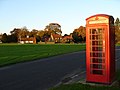
English: Lurgashall is a village and civil parish in the Chichester district of West Sussex, England. It is north east of Midhurst. The church of St Laurence, The Noah's Ark pub, the old school and several old houses are built around a picturesque village green which is the village cricket pitch. In the 2001 census the parish covered 21 km² and had 220 households with a total population of 581. 271 residents were economically active.
village in the United Kingdom  | |||||
| Upload media | |||||
| Instance of | |||||
|---|---|---|---|---|---|
| Location | Chichester, West Sussex, South East England, England | ||||
| Area |
| ||||
| Said to be the same as | Lurgashall (Wikimedia duplicated page, civil parish) | ||||
| official website | |||||
 | |||||
Subcategories
This category has the following 7 subcategories, out of 7 total.
A
- Aldworth House (5 F)
C
- Lurgashall Cricket Club (4 F)
L
- Lurgashall war memorial (4 F)
N
- Noah's Ark, Lurgashall (7 F)
V
- Valewood Farm (9 F)
- Valewood Park (11 F)
Media in category "Lurgashall"
The following 200 files are in this category, out of 662 total.
(previous page) (next page)-
 "Blackdown Beacon" - geograph.org.uk - 1141181.jpg 640 × 360; 84 KB
-
 "Crossways" at Lurgashall - geograph.org.uk - 1141052.jpg 640 × 360; 78 KB
-
 'Galloway Beltie' on Black Down - geograph.org.uk - 6162332.jpg 1,024 × 768; 350 KB
-
 'Serpent Trail' on Black Down - geograph.org.uk - 6162323.jpg 1,024 × 768; 212 KB
-
 2020 vision, Day 65 - geograph.org.uk - 6406056.jpg 640 × 480; 59 KB
-
 A bunch of brownies near Ramsfold Farm - geograph.org.uk - 2496859.jpg 4,000 × 3,000; 3.58 MB
-
 A fine milestone - geograph.org.uk - 3912371.jpg 640 × 430; 140 KB
-
 A Hilltop Barn - geograph.org.uk - 337503.jpg 640 × 428; 71 KB
-
 A shaded Sussex Border Path SE to Roundhurst Common - geograph.org.uk - 2081449.jpg 2,592 × 1,944; 1.79 MB
-
 A wet Tennyson's Lane - geograph.org.uk - 3038484.jpg 640 × 480; 155 KB
-
 Afternoon Sunlight at Lurgashall - geograph.org.uk - 280742.jpg 640 × 480; 85 KB
-
 Approach to Lurgashall - geograph.org.uk - 1731441.jpg 1,600 × 1,200; 523 KB
-
 Approaching Crossways - geograph.org.uk - 6119783.jpg 1,600 × 1,200; 777 KB
-
 Approaching Gentles Copse - geograph.org.uk - 6101934.jpg 1,600 × 1,200; 721 KB
-
 Approaching Hillgrove - geograph.org.uk - 6123765.jpg 1,600 × 1,200; 519 KB
-
 Approaching Jobson’s Lane - geograph.org.uk - 6118785.jpg 1,024 × 768; 413 KB
-
 Approaching Mill Pond - geograph.org.uk - 6006088.jpg 1,600 × 1,200; 623 KB
-
 Approaching the viewpoint - geograph.org.uk - 6117633.jpg 2,048 × 1,536; 1.78 MB
-
 At the Temple of the Winds on Black Down - geograph.org.uk - 6111981.jpg 4,608 × 3,456; 4.77 MB
-
 Avenue by Rickfield Copse - geograph.org.uk - 5261858.jpg 2,560 × 1,920; 2.94 MB
-
 Avenue of trees, west of Northchapel - geograph.org.uk - 2450170.jpg 640 × 480; 99 KB
-
 Badger weather vane on stables - geograph.org.uk - 1479412.jpg 640 × 478; 51 KB
-
 Barn at Bulrush Farm - geograph.org.uk - 6123817.jpg 1,024 × 768; 334 KB
-
 Barn at Cotchet Farm, Fernden Lane.jpg 4,000 × 3,000; 4.3 MB
-
 Barn at Hookhams Farm - geograph.org.uk - 1502894.jpg 640 × 360; 82 KB
-
 Barn at Sods Farm - geograph.org.uk - 2665457.jpg 640 × 428; 65 KB
-
 Becketts Farm - geograph.org.uk - 3883460.jpg 1,024 × 795; 240 KB
-
 Bell Vale Lane north to Valewood Farm House - geograph.org.uk - 2491557.jpg 4,000 × 3,000; 3.17 MB
-
 Bend on the A283 - geograph.org.uk - 1479421.jpg 640 × 480; 74 KB
-
 Bend, Quell Lane - geograph.org.uk - 3912364.jpg 640 × 430; 130 KB
-
 Birchy Copse - geograph.org.uk - 3897163.jpg 640 × 430; 148 KB
-
 Black Down - geograph.org.uk - 2581138.jpg 640 × 430; 49 KB
-
 Black Down - geograph.org.uk - 2581147.jpg 640 × 392; 42 KB
-
 Black Down - geograph.org.uk - 2581185.jpg 640 × 430; 104 KB
-
 Black Down - geograph.org.uk - 3338377.jpg 2,592 × 1,944; 2 MB
-
 Black Down - geograph.org.uk - 5062378.jpg 4,000 × 2,666; 6.66 MB
-
 Black Down - geograph.org.uk - 5062382.jpg 4,000 × 2,666; 7.58 MB
-
 Black Down - geograph.org.uk - 5062390.jpg 4,000 × 2,666; 6.18 MB
-
 Black Down - geograph.org.uk - 5062492.jpg 4,000 × 2,666; 7.47 MB
-
 Black Down - geograph.org.uk - 5062500.jpg 4,000 × 2,666; 7.58 MB
-
 Black Down - geograph.org.uk - 5062511.jpg 4,000 × 2,666; 6.79 MB
-
 Black Down - geograph.org.uk - 5062514.jpg 4,000 × 2,666; 7.63 MB
-
 Black Down - geograph.org.uk - 5062518.jpg 4,000 × 2,666; 7.09 MB
-
 Black Down - geograph.org.uk - 5062535.jpg 4,000 × 2,666; 7.48 MB
-
 Black Down - geograph.org.uk - 5062536.jpg 4,000 × 2,666; 7.37 MB
-
 Black Down - geograph.org.uk - 5064266.jpg 4,000 × 2,666; 7.19 MB
-
 Black Down - geograph.org.uk - 5064276.jpg 4,000 × 2,666; 6.97 MB
-
 Black Down - geograph.org.uk - 5064288.jpg 4,000 × 2,666; 7.49 MB
-
 Black Down - geograph.org.uk - 5064318.jpg 4,000 × 2,666; 7.36 MB
-
 Black Down - geograph.org.uk - 5237447.jpg 6,000 × 4,000; 4.68 MB
-
 Black Down - geograph.org.uk - 5237451.jpg 6,000 × 4,000; 5.33 MB
-
 Black Down - geograph.org.uk - 5238219.jpg 4,000 × 2,666; 7.07 MB
-
 Black Down - geograph.org.uk - 5238231.jpg 4,000 × 2,666; 7.21 MB
-
 Black Down - geograph.org.uk - 5243175.jpg 6,000 × 4,000; 7.66 MB
-
 Black Down - geograph.org.uk - 5243184.jpg 6,000 × 4,000; 5.79 MB
-
 Black Down - geograph.org.uk - 5243192.jpg 6,000 × 4,000; 6.75 MB
-
 Black Down - geograph.org.uk - 5243206.jpg 6,000 × 4,000; 6.25 MB
-
 Black Down - geograph.org.uk - 5261839.jpg 2,560 × 1,920; 3.02 MB
-
 Black Down - geograph.org.uk - 6117636.jpg 1,600 × 1,200; 564 KB
-
 Black Down - Serpent Trail - geograph.org.uk - 5261824.jpg 2,560 × 1,920; 3.22 MB
-
 Black Down - Viewpoint - geograph.org.uk - 5261831.jpg 2,560 × 1,920; 3.03 MB
-
 Black Down from Marley Heights - geograph.org.uk - 6111956.jpg 4,608 × 3,456; 4.5 MB
-
 Black Down from the north west - geograph.org.uk - 2381743.jpg 3,968 × 2,976; 2.88 MB
-
 Black Down on a wet day - geograph.org.uk - 2581131.jpg 640 × 430; 41 KB
-
 Black Down Viewpoint - geograph.org.uk - 5273050.jpg 2,560 × 1,920; 3.17 MB
-
 Blackdown - geograph.org.uk - 3912410.jpg 640 × 430; 126 KB
-
 Blackdown - The final push^ - geograph.org.uk - 3822944.jpg 640 × 480; 96 KB
-
 Blackdown Distillery - geograph.org.uk - 6162193.jpg 1,024 × 768; 254 KB
-
 Blackdown Farm - geograph.org.uk - 3902507.jpg 640 × 430; 46 KB
-
 Blackdown Farm - geograph.org.uk - 3902544.jpg 640 × 430; 68 KB
-
 Blackdown Farm - geograph.org.uk - 3902550.jpg 640 × 430; 62 KB
-
 Blackdown House - geograph.org.uk - 6105140.jpg 1,600 × 1,200; 875 KB
-
 Blackdown House, Fernhurst - geograph.org.uk - 3486210.jpg 640 × 410; 166 KB
-
 Blauer Spatburgunder - geograph.org.uk - 6105049.jpg 1,600 × 1,200; 804 KB
-
 Boarden Door Bottom National Trust sign.jpg 3,096 × 4,128; 6.38 MB
-
 Boarden Hall Bottom - geograph.org.uk - 5238244.jpg 4,000 × 2,666; 7.53 MB
-
 Boggy forest, Lower Calham - geograph.org.uk - 3897219.jpg 640 × 430; 136 KB
-
 Bracken and woodland, Black Down - geograph.org.uk - 2581158.jpg 640 × 430; 71 KB
-
 Bridleway 2009 in Ridden Corner Copse - geograph.org.uk - 2495529.jpg 4,000 × 3,000; 3.55 MB
-
 Bridleway approaches gate on Blackdown - geograph.org.uk - 3778079.jpg 800 × 600; 216 KB
-
 Bridleway crossroads at Ridden Corner Copse - geograph.org.uk - 2495527.jpg 4,000 × 3,000; 3.37 MB
-
 Bridleway crossroads, Black Down - geograph.org.uk - 2581124.jpg 640 × 430; 118 KB
-
 Bridleway ford north of Hearne Farm - geograph.org.uk - 2081491.jpg 2,592 × 1,944; 2.06 MB
-
 Bridleway left off Jay's Lane - geograph.org.uk - 2081484.jpg 2,592 × 1,944; 2.18 MB
-
 Bridleway on Blackdown - geograph.org.uk - 3778057.jpg 800 × 600; 228 KB
-
 Bridleway on northern edge of Goffs Copse - geograph.org.uk - 2487434.jpg 4,000 × 3,000; 3.4 MB
-
 Bridleway on the eastern flank of Blackdown - geograph.org.uk - 5092013.jpg 768 × 1,024; 313 KB
-

-
 Bridleway to Bullock Lane - geograph.org.uk - 6123246.jpg 1,600 × 1,200; 670 KB
-
 Bridleway to Upperfold Farm - geograph.org.uk - 6101929.jpg 1,600 × 1,200; 927 KB
-
 Bridleway turn off near road junction at Dial Green - geograph.org.uk - 2487394.jpg 4,000 × 3,000; 3.41 MB
-
 Bridleways diverge, Black Down - geograph.org.uk - 2581169.jpg 640 × 430; 133 KB
-
 Buildings, east of Blackdown Farm - geograph.org.uk - 3902559.jpg 640 × 430; 87 KB
-
 Bullocks Lane - geograph.org.uk - 6123267.jpg 1,600 × 1,200; 1,021 KB
-
 Bullocks Lane - geograph.org.uk - 6123758.jpg 1,600 × 1,200; 785 KB
-
 Bulrush Farm - geograph.org.uk - 6123815.jpg 1,600 × 1,200; 487 KB
-
 Bushy Copse - geograph.org.uk - 3897176.jpg 640 × 430; 69 KB
-
 By Dirty Bridge Field - geograph.org.uk - 280718.jpg 640 × 480; 178 KB
-
 Caplins in Hillgrove - geograph.org.uk - 6123781.jpg 1,600 × 1,200; 689 KB
-
 Car park at the top of Tennyson's Lane - geograph.org.uk - 2079819.jpg 2,592 × 1,944; 2.25 MB
-
 Cat on bridleway near Great Brockhurst Farm - geograph.org.uk - 2487414.jpg 4,000 × 3,000; 3.23 MB
-
 Cattle across footpath - geograph.org.uk - 5495575.jpg 4,608 × 3,456; 4.13 MB
-
 Cattle grazing by Gentles Copse - geograph.org.uk - 2487448.jpg 4,000 × 3,000; 3.6 MB
-
 Change of direction for the Sussex Border Path - geograph.org.uk - 2494396.jpg 4,000 × 3,000; 3.51 MB
-
 Chase Lane - geograph.org.uk - 5062656.jpg 4,000 × 2,666; 7.64 MB
-
 Cleared woodland on Black Down - geograph.org.uk - 2494402.jpg 4,000 × 3,000; 3.36 MB
-
 Climbing Blackdown - geograph.org.uk - 5092448.jpg 1,024 × 768; 287 KB
-
 Colemans Copse - geograph.org.uk - 3897263.jpg 640 × 430; 139 KB
-
 Coming to greet me - geograph.org.uk - 3897187.jpg 640 × 430; 78 KB
-
 Communications, Dial Green - geograph.org.uk - 2939490.jpg 640 × 480; 193 KB
-
 Conifer woodland, Black Down - geograph.org.uk - 2581193.jpg 640 × 430; 107 KB
-
 Conifers, Black Down - geograph.org.uk - 2581182.jpg 640 × 430; 126 KB
-
 Converted barn, Blackdown Farm - geograph.org.uk - 3902548.jpg 640 × 430; 78 KB
-
 Cotchet Farm - geograph.org.uk - 5064333.jpg 3,994 × 2,662; 7.32 MB
-
 Cotchet Farm, Fernden Lane.jpg 4,000 × 3,000; 3.87 MB
-
 Cotchet Farmhouse, Fernden Lane 01.jpg 4,000 × 3,000; 4.1 MB
-
 Cotchet Farmhouse, Fernden Lane 02.jpg 4,000 × 3,000; 4.02 MB
-
 Cotchet Farmhouse, Fernden Lane 03.jpg 4,000 × 3,000; 3.71 MB
-
 Cottage by Wheelwrights House, Hillgrove - geograph.org.uk - 3876560.jpg 1,024 × 795; 250 KB
-
 Cottage on Jobson's Lane - geograph.org.uk - 6162365.jpg 1,024 × 768; 254 KB
-
 Cottage, East of Blackdown Farm - geograph.org.uk - 3902561.jpg 640 × 430; 106 KB
-
 Cottage, East of Blackdown Farm - geograph.org.uk - 3902563.jpg 640 × 430; 103 KB
-
 Cottage, Roundhurst Common - geograph.org.uk - 2602786.jpg 640 × 430; 107 KB
-
 Cottage, Roundhurst Common - geograph.org.uk - 2602790.jpg 640 × 430; 105 KB
-
 Cottages near Mill Farm - geograph.org.uk - 6006020.jpg 1,600 × 1,200; 592 KB
-
 Crash site on the southern slopes of Black Down - geograph.org.uk - 6109830.jpg 2,048 × 1,536; 1.64 MB
-
 Crossing Path - geograph.org.uk - 6002466.jpg 1,024 × 768; 150 KB
-
 Dappled pines off Jay's Lane - geograph.org.uk - 2496836.jpg 4,000 × 3,000; 3.39 MB
-
 Dead and Alive - geograph.org.uk - 5062385.jpg 4,000 × 2,666; 7.12 MB
-
 Dense vegetation, Black Down - geograph.org.uk - 2581112.jpg 640 × 430; 124 KB
-
 Dial House - geograph.org.uk - 6100783.jpg 1,600 × 1,200; 738 KB
-

-

-
 Dirty Bridge Field - geograph.org.uk - 6450110.jpg 1,024 × 768; 361 KB
-
 Diverging paths - geograph.org.uk - 6117703.jpg 1,600 × 1,200; 863 KB
-
 Dovecote at Stagpark Farm - geograph.org.uk - 1850779.jpg 800 × 600; 90 KB
-
 Downhill towards Hillgrove - geograph.org.uk - 3877177.jpg 1,024 × 768; 323 KB
-
 Drainage on grazing land - geograph.org.uk - 5498325.jpg 4,608 × 3,456; 6.16 MB
-
 Drive to Old Hearne Farm - geograph.org.uk - 1413741.jpg 640 × 360; 69 KB
-
 Dry gill - geograph.org.uk - 6452291.jpg 1,024 × 768; 638 KB
-
 Dummy trig point and notice board - geograph.org.uk - 2494219.jpg 4,000 × 3,000; 3.39 MB
-
 Edge of North Side Copse - geograph.org.uk - 2514177.jpg 640 × 430; 82 KB
-
 Entering the copses - geograph.org.uk - 6123252.jpg 1,600 × 1,200; 1,012 KB
-
 Entrance and Barrells at Lurgashall Winery - geograph.org.uk - 51059.jpg 640 × 480; 129 KB
-
 Entrance to Aldworth House - geograph.org.uk - 2081240.jpg 2,592 × 1,944; 1.98 MB
-
 Entrance to Aldworth House - geograph.org.uk - 2494182.jpg 4,000 × 3,000; 3.33 MB
-
 Entrance to Aldworth House - geograph.org.uk - 6117724.jpg 1,024 × 768; 391 KB
-
 Entrance to Barfold Farm - geograph.org.uk - 6117751.jpg 1,600 × 1,200; 473 KB
-
 Entrance to Blackdown Park - geograph.org.uk - 3912405.jpg 640 × 430; 94 KB
-
 Entrance to Greenland Farm - geograph.org.uk - 1722499.jpg 800 × 600; 144 KB
-
 Entrance to Greenland Farm - geograph.org.uk - 6122943.jpg 1,600 × 1,200; 859 KB
-
 Entrance to Lower Calhams (wood) - geograph.org.uk - 2487483.jpg 4,000 × 3,000; 3.41 MB
-
 Entrance to the car park at Black Down - geograph.org.uk - 6117716.jpg 1,024 × 768; 374 KB
-
 Entrance to Valewood Farm House - geograph.org.uk - 2491867.jpg 4,000 × 3,000; 3.19 MB
-
 Entry to Black Down, Tennyson's Lane - geograph.org.uk - 2581198.jpg 640 × 430; 115 KB
-
 Estate road emerging from woods - geograph.org.uk - 1480513.jpg 640 × 480; 112 KB
-
 Fairly new pond - geograph.org.uk - 6452282.jpg 1,024 × 768; 332 KB
-
 Farm buildings at Boxalland Farm - geograph.org.uk - 3892155.jpg 1,024 × 770; 237 KB
-
 Farm buildings at Mill Farm - geograph.org.uk - 6006038.jpg 1,600 × 1,200; 461 KB
-
 Farm by Fernden Lane - geograph.org.uk - 3912433.jpg 640 × 430; 120 KB
-

-
 Farm outbuildings, Boxalland Farm - geograph.org.uk - 3883063.jpg 1,024 × 790; 229 KB
-
 Farm track on the Petworth Estate - geograph.org.uk - 3267423.jpg 800 × 600; 84 KB
-

-
 Farmhouse seen past tractor and barn - geograph.org.uk - 1850740.jpg 800 × 600; 98 KB
-
 Farmland near Blackdown Farm - geograph.org.uk - 3902510.jpg 640 × 430; 52 KB
-
 Fence and hedge - geograph.org.uk - 3902501.jpg 640 × 430; 57 KB
-
 Fernden Lane - geograph.org.uk - 3912376.jpg 640 × 430; 105 KB
-
 Fernden Lane - geograph.org.uk - 3912409.jpg 640 × 430; 94 KB
-
 Fernden Lane - geograph.org.uk - 3912417.jpg 640 × 430; 123 KB
-
 Fernden Lane - geograph.org.uk - 3912418.jpg 640 × 430; 98 KB
-
 Fernden Lane below Blackdown Hill - geograph.org.uk - 3912391.jpg 640 × 430; 121 KB
-
 Field and woodland below Black Down - geograph.org.uk - 6451717.jpg 1,024 × 768; 328 KB
-
 Field by Bushy Copse - geograph.org.uk - 3897173.jpg 640 × 430; 78 KB
-
 Field by Leazer's Wood - geograph.org.uk - 3897160.jpg 640 × 430; 67 KB
-
 Field fenced for horses - geograph.org.uk - 6451512.jpg 1,024 × 768; 356 KB
-
 Field north of Coochway Ground - geograph.org.uk - 6452162.jpg 1,024 × 768; 451 KB
-
 Field with a view - geograph.org.uk - 1850859.jpg 800 × 600; 96 KB
-
 Fields near Cobden Farm - geograph.org.uk - 6006016.jpg 2,048 × 1,536; 1.04 MB
-
 Fields near Dial Green - geograph.org.uk - 6100567.jpg 2,048 × 1,536; 1.07 MB
-
 Fields near Northurst Farm - geograph.org.uk - 6100552.jpg 1,600 × 1,200; 575 KB
-
 Footbridge in Bushy Copse - geograph.org.uk - 6450319.jpg 1,024 × 768; 682 KB
-
 Footbridge in Bushy Copse - geograph.org.uk - 6451496.jpg 1,024 × 768; 746 KB
-
 Footbridge in New Copse - geograph.org.uk - 6123275.jpg 1,600 × 1,200; 787 KB
-
 Footbridge in Shop Hanger - geograph.org.uk - 2951645.jpg 640 × 480; 201 KB
-
 Footbridge near Lurgashall Church - geograph.org.uk - 6123856.jpg 1,600 × 1,200; 888 KB
-
 Footbridge on the path to River Park Farm - geograph.org.uk - 6006172.jpg 1,600 × 1,200; 797 KB
-
 Footpath 2024 through the southern slopes of Black Down - geograph.org.uk - 2495696.jpg 4,000 × 3,000; 3.4 MB
-
 Footpath along side Upper Quell Copse - geograph.org.uk - 3902567.jpg 640 × 430; 116 KB
-
 Footpath and bridleway post at Scouting Lane End - geograph.org.uk - 2495676.jpg 4,000 × 3,000; 3.54 MB
-
 Footpath and track in Ramsfold Wood - geograph.org.uk - 2496782.jpg 4,000 × 3,000; 3.53 MB
-
 Footpath at Blackdown Hill Cottages - geograph.org.uk - 2495718.jpg 4,000 × 3,000; 3.56 MB
-
 Footpath beside Jobson’s Cottage - geograph.org.uk - 6122946.jpg 1,600 × 1,200; 564 KB
-
 Footpath by Birchy Copse - geograph.org.uk - 3897164.jpg 640 × 430; 112 KB
-
 Footpath by Hill Grove - geograph.org.uk - 3897165.jpg 640 × 430; 107 KB
-
 Footpath by Mill Farm - geograph.org.uk - 280682.jpg 640 × 480; 135 KB
-
 Footpath by Upper Quell Copse - geograph.org.uk - 3902565.jpg 640 × 430; 145 KB
-
 Footpath entering Birchy Copse - geograph.org.uk - 3897161.jpg 640 × 430; 146 KB
-
 Footpath from Lower Calham - geograph.org.uk - 3897251.jpg 640 × 430; 49 KB
-
 Footpath heading east - geograph.org.uk - 3902370.jpg 640 × 430; 96 KB


_-_geograph.org.uk_-_2487483.jpg)


