Category:Mühlbergweg 16 (Neustadt an der Waldnaab)
| Object location | | View all coordinates using: OpenStreetMap |
|---|
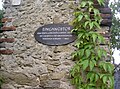
This is the category of the Bavarian Baudenkmal (cultural heritage monument) with the ID D-3-74-139-17 (Wikidata)
|
| Upload media | |||||
| Instance of | |||||
|---|---|---|---|---|---|
| Location | Neustadt an der Waldnaab, Upper Palatinate, Bavaria, Germany | ||||
| Street address |
| ||||
| Has part(s) |
| ||||
| Heritage designation | |||||
 | |||||
Media in category "Mühlbergweg 16 (Neustadt an der Waldnaab)"
The following 3 files are in this category, out of 3 total.
-
 NeustadtMuehlbergweg16Torbogen 01.jpg 2,304 × 1,704; 865 KB
-
 NeustadtMuehlbergweg16Torbogen 02.jpg 2,304 × 1,704; 828 KB
-
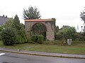 NeustadtMuehlbergweg16Torbogen 03.jpg 2,304 × 1,704; 823 KB


