Category:M6 motorway in the West Midlands
| Counties (M6): | |
|---|---|
| (M6 Toll): | |
| Services (M6): |
|
| (M6 Toll): | |
| Connections: | |
| Coordinates: | |
Subcategories
This category has the following 4 subcategories, out of 4 total.
C
F
- Forgers Walk, Birmingham (11 F)
G
- Gravelly Hill Interchange (25 F)
M
- M6 Motorway Bridge Perry Barr (19 F)
Media in category "M6 motorway in the West Midlands"
The following 53 files are in this category, out of 53 total.
-
 A34-M6 interchange Great Barr - geograph.org.uk - 1490778.jpg 640 × 339; 126 KB
-
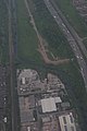
 Birmingham aerial view II.jpg 1,167 × 738; 124 KB
-
 Birmingham Airport departure - 2018-05-08 - Andy Mabbett - 30.jpg 3,872 × 2,592; 3.08 MB
-
 Birmingham Airport departure - 2018-05-08 - Andy Mabbett - 31.jpg 2,592 × 3,872; 3.27 MB
-
 Birmingham Airport departure - 2018-05-08 - Andy Mabbett - 32.jpg 2,592 × 3,872; 3.18 MB
-
 Birmingham Airport departure - 2018-05-08 - Andy Mabbett - 35.jpg 3,872 × 2,592; 3.48 MB
-
 Castle Bromwich Aerial View.jpg 1,600 × 1,200; 678 KB
-
 Cordon Bleu-Vert - geograph.org.uk - 14514.jpg 640 × 426; 72 KB
-

-
 Fort Dunlop from the M6 - geograph.org.uk - 1887961.jpg 640 × 480; 45 KB
-
 Goodbye M5, Hello M6 - geograph.org.uk - 1630724.jpg 640 × 480; 134 KB
-
 Helicopter - Night Time Photos (8740981128).jpg 2,573 × 1,709; 2.84 MB
-
 Helicopter - Night Time Photos (8740981370).jpg 2,573 × 1,709; 3.06 MB
-
 Holbrook at Hassop Road, Birmingham - 2017-11-10 - Andy Mabbett - 04.jpg 3,872 × 2,592; 4.83 MB
-
 Holly Wood Nature Reserve kissing gate - 2023-08-02 - Andy Mabbett - 02.jpg 3,264 × 2,448; 3.99 MB
-
 Junction 10 - geograph.org.uk - 1197514.jpg 640 × 480; 65 KB
-
 Junction 16 M6 motorway roundabout - geograph.org.uk - 1765902.jpg 640 × 430; 41 KB
-

-

-
 M6 Bridge - geograph.org.uk - 1198676.jpg 640 × 480; 74 KB
-
 M6 Bridge - geograph.org.uk - 1265728.jpg 640 × 480; 91 KB
-
 M6 Castle Bromwich, Holiday Inn - geograph.org.uk - 1772713.jpg 922 × 692; 119 KB
-
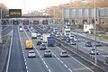
 M6 gridlock - geograph.org.uk - 959611.jpg 640 × 480; 51 KB
-
 M6 j10 southbound 'Managed Motorway'.jpg 4,368 × 2,912; 2.1 MB
-
 M6 Junction 7 from Walsall Road - geograph.org.uk - 1139836.jpg 640 × 480; 50 KB
-

-

-

-
 M6 Motorway Bridge - Walsall Canal - geograph.org.uk - 906327.jpg 640 × 480; 82 KB
-

-

-

-

-

-
 M6 Motorway Near Alderman's Green - geograph.org.uk - 1636487.jpg 640 × 480; 127 KB
-
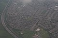
 M6 Near Birmingham from the Air (geograph 4216853).jpg 2,784 × 1,568; 2.09 MB
-
 M6 North - geograph.org.uk - 1197520.jpg 640 × 480; 92 KB
-
 M6 North At Churchill Road - geograph.org.uk - 1398967.jpg 640 × 480; 161 KB
-
 M6 roadworks - geograph.org.uk - 1765919.jpg 640 × 344; 37 KB
-
 M6 South - geograph.org.uk - 1197523.jpg 640 × 480; 70 KB
-
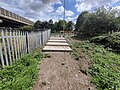
 M6 steps, Great Barr, Birmingham - 2021-01-16 - Andy Mabbett.jpg 4,000 × 3,000; 2.4 MB
-
 M6 View - geograph.org.uk - 1290295.jpg 640 × 480; 88 KB
-
 On the M6 - geograph.org.uk - 1887974.jpg 640 × 480; 59 KB
-

-
 Power Lines Cross The M6 Motorway - geograph.org.uk - 1636478.jpg 640 × 480; 62 KB
-
 River Tame and M6 Motorway near Bescot - geograph.org.uk - 233844.jpg 640 × 480; 254 KB
-
 Slip road from M6 northbound to M42 - geograph.org.uk - 381313.jpg 640 × 480; 66 KB
-
 Under the Junction - geograph.org.uk - 1593663.jpg 640 × 482; 81 KB
-
 Under the M6 - geograph.org.uk - 13916.jpg 640 × 426; 97 KB
-
 Under the M6 viaduct at Bescot - geograph.org.uk - 450979.jpg 600 × 450; 202 KB
-
 Underneath the M6 at Junction 9 - geograph.org.uk - 544006.jpg 640 × 480; 108 KB
-
 Water, rail and road at Bescot - geograph.org.uk - 75877.jpg 610 × 458; 79 KB
-
 XS647 on a low loader passing Bescot on the M6 on 25 March 1981.jpg 4,836 × 3,096; 2.41 MB


.jpg)
.jpg)


.jpg)


