Category:MBTA in 2016
Subcategories
This category has the following 3 subcategories, out of 3 total.
Media in category "MBTA in 2016"
The following 200 files are in this category, out of 774 total.
(previous page) (next page)-
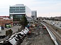
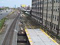
 1980s platform extensions at South Station, December 2016.JPG 4,320 × 3,240; 2.72 MB
-
 360 Newbury Street, February 2016.jpg 3,000 × 2,947; 2 MB
-
 360 Newbury Street, March 2016.jpg 2,251 × 2,429; 1.65 MB
-
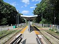
 Abington station platform facing north, November 2016.JPG 4,320 × 3,240; 3.45 MB
-
 Abington station platform facing south, November 2016.JPG 4,320 × 3,240; 2.75 MB
-
 Adams Street underpass from Milton station, January 2016.JPG 4,320 × 3,240; 1.85 MB
-

-
 Aerial view of east headhouses at Aquarium station, March 2016.jpg 1,486 × 1,159; 840 KB
-
 Alewife station platform, July 2016.jpg 5,248 × 2,952; 4.37 MB
-
 Amtrak 203 passing through Andover, March 2016.JPG 4,320 × 3,240; 2.75 MB
-
 Amtrak 90220 in Andover, March 2016.JPG 4,320 × 3,240; 2.99 MB
-
 Amtrak waiting room at Route 128 station, April 2016.JPG 4,320 × 3,240; 2.33 MB
-
 Andover station from Pearson Street, March 2016.JPG 4,320 × 3,240; 3 MB
-
 Appleton Bridge concrete and Charles MGH station, September 2016.jpg 1,600 × 1,200; 797 KB
-
 Appleton Bridge formwork and Charles MGH station, August 2016.jpg 1,306 × 980; 595 KB
-
 Arboretum Road pedestrian tunnel under Needham Line, March 2016.JPG 4,320 × 3,240; 4.96 MB
-
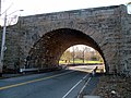
 Arch bridge over Temple Street, West Roxbury, September 2016.JPG 4,320 × 3,240; 3.78 MB
-
 Arch detail at Newton Centre station, March 2016.JPG 4,320 × 3,240; 2.52 MB
-
 Architecture detail at Roxbury Crossing station, July 2016.JPG 4,320 × 3,240; 1.88 MB
-
 Ashland station crossover ramps, April 2016.jpg 3,756 × 2,390; 2.51 MB
-
 Ashland station platforms, April 2016.JPG 4,320 × 3,240; 2.3 MB
-
 Ashmont loop from Cedar Grove station, August 2016.JPG 4,320 × 3,240; 4.42 MB
-
 Ashmont platforms from north mezzanine, January 2016.JPG 4,320 × 3,240; 3.07 MB
-
 Ashmont station busways, January 2016.JPG 4,320 × 3,240; 2.45 MB
-
 Ashmont station north end, January 2016.jpg 4,779 × 3,127; 3.3 MB
-
 Ashmont station Radford Lane ramp under viaduct, August 2016.JPG 4,320 × 3,240; 3.09 MB
-
 Ashmont station south end panorama, January 2016.jpg 4,845 × 2,834; 2.45 MB
-
 Ashmont substation on Beale Street, August 2016.JPG 4,320 × 3,240; 2.85 MB
-
 Assembly Square station from garage, February 2016.JPG 3,444 × 2,592; 2.19 MB
-
 Axles and trucks outside MBTA CRMF, June 2016.JPG 4,320 × 3,240; 2.86 MB
-
 B5 milepost on Highland Branch, June 2016.JPG 4,320 × 3,240; 5.06 MB
-
 Back of the Hill inbound shelter and view down South Huntington Avenue, December 2016.JPG 4,320 × 3,240; 3.89 MB
-
 BAT bus at Ashmont station, August 2016.JPG 4,320 × 3,240; 3.01 MB
-
 Bay Colony Rail Trail at Charles River station site, April 2016.JPG 2,722 × 2,039; 1,022 KB
-
 Bay Colony Rail Trail north of Charles River Street, April 2016.JPG 4,320 × 3,240; 3.85 MB
-
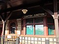 Bay window and old station sign at Canton Junction, April 2016.JPG 4,320 × 3,240; 2 MB
-
 Bay window at Sharon station, November 2016.JPG 4,320 × 3,240; 2.81 MB
-
 Beachmont station aerial photo, July 2016.JPG 4,000 × 3,000; 1.81 MB
-
 Beacon Park Yard with second mainline track construction, October 2016.JPG 4,320 × 3,240; 5.05 MB
-
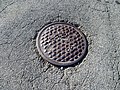 BERy manhole at former Charles River loop, September 2016.JPG 4,320 × 3,240; 6.12 MB
-
 Bicycle sheds at Eliot station, March 2016.JPG 4,320 × 3,240; 4.24 MB
-
 Bicycle shelter at Waltham station, April 2016.JPG 4,320 × 3,240; 3.62 MB
-
 Bike shed and shelter at West Roxbury station, September 2016.JPG 4,320 × 3,240; 3.16 MB
-
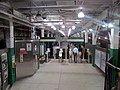
 Blue Line platform at Government Center, March 2016.JPG 4,320 × 3,240; 2.91 MB
-
 Booth at Coolidge Corner, April 2016.JPG 3,685 × 2,770; 2.06 MB
-
 Boston College inbound platform and yard, October 2016.jpg 5,248 × 2,952; 4.77 MB
-
 Boston Elevated Railway manhole cover on Mount Auburn Street, May 2016.JPG 3,945 × 2,960; 3.97 MB
-
 Boston harbor ferry and skyline.jpg 5,344 × 3,006; 5.43 MB
-
 Boston Landing bypass east 2016-1-1.jpg 4,032 × 3,024; 9.52 MB
-
 Boston Landing bypass west.jpg 4,032 × 3,024; 7.54 MB
-
 Boston Landing elevator bridge under construction, 4 August 2016.JPG 4,320 × 3,240; 2.8 MB
-
 Boston Landing station construction detail, July 2016.JPG 4,320 × 3,240; 3.19 MB
-
 Boston Landing station construction east of Everett Street, February 2016.JPG 4,320 × 3,240; 3.7 MB
-
 Boston Landing station construction from Everett Street, June 2016.JPG 4,320 × 3,240; 3.02 MB
-
 Boston Landing station construction from Everett Street, September 2016.JPG 4,320 × 3,240; 2.77 MB
-
 Boston Landing station construction in silhouette, July 2016.JPG 4,320 × 3,240; 2.14 MB
-
 Boston Landing station construction west of Everett Street (detail), February 2016.JPG 4,320 × 3,240; 4.15 MB
-
 Boston Landing station construction west of Everett Street, February 2016.JPG 4,320 × 3,240; 3.08 MB
-
 Boston Landing station construction, April 2016.JPG 4,320 × 3,240; 3.05 MB
-
 Boston Landing station construction, July 2016.JPG 4,320 × 3,240; 2.73 MB
-
 Boston Landing station construction, March 2016.JPG 4,320 × 3,240; 3.42 MB
-
 Boston Landing station pedestrian bridge under construction, October 2016.JPG 4,320 × 3,240; 3.05 MB
-
 Boston Landing station steelwork under construction, June 2016.JPG 4,320 × 3,240; 2.58 MB
-
 Boston Landing station structures under construction at Everett Street, September 2016.JPG 4,320 × 3,240; 2.71 MB
-
 Boston Landing station under construction, October 2016.JPG 4,320 × 3,240; 3.05 MB
-
 Boylston station inbound headhouse, July 2016.JPG 3,585 × 2,685; 1.7 MB
-
 Boylston station outbound fare area, July 2016.JPG 4,320 × 3,240; 2.52 MB
-
 Boylston station outbound headhouse interior, July 2016.JPG 3,240 × 4,320; 2.1 MB
-
 Boylston station outbound headhouse, July 2016.JPG 4,320 × 3,240; 3.18 MB
-
 Boylston Street pedestrian bridge at Eliot station, March 2016.JPG 4,320 × 3,240; 2.89 MB
-
 Boylston Street pedestrian bridge interior view, March 2016.JPG 4,320 × 3,240; 4.26 MB
-
 Brandon Hall station facing inbound, April 2016.JPG 3,686 × 2,764; 2.54 MB
-
 Brandon Hall station from top of steps, April 2016.JPG 4,320 × 3,240; 3.29 MB
-
 Brattle Loop and northbound train at Government Center station, March 2016.JPG 4,320 × 3,240; 2.51 MB
-
 Brattle Loop track at Government Center station, March 2016.JPG 4,320 × 3,240; 2.57 MB
-
 Broadway station mosaic, September 2016.jpg 5,248 × 2,952; 4.17 MB
-
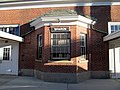
 Brookline Hills station, April 2016.JPG 3,546 × 2,662; 2.44 MB
-
 Brookline Village station from Harvard Street bridge, April 2016.JPG 4,320 × 3,240; 4.29 MB
-
 Bus in Jackson Square busway, July 2016.JPG 4,320 × 3,240; 2.72 MB
-
 Bus shelter at Wellesley Square station inbound platform, April 2016.JPG 4,320 × 3,240; 5.25 MB
-
 Bussey Bridge (1), March 2016.JPG 4,320 × 3,240; 3.68 MB
-
 Bussey Bridge (2), March 2016.JPG 4,320 × 3,240; 3.32 MB
-
 Bussey Bridge (3), March 2016.JPG 4,320 × 3,240; 3.93 MB
-
 Busway and footbridge at JFK UMass station, April 2016.JPG 3,967 × 2,646; 1.81 MB
-
 Busway at Ashmont station, August 2016.JPG 4,320 × 3,240; 2.48 MB
-
 Butler station facing east, August 2016.JPG 4,320 × 3,240; 3.97 MB
-
 Butler station facing west, January 2016.jpg 3,330 × 2,499; 1.89 MB
-
 Butler station from Medway Street, January 2016.jpg 4,320 × 3,240; 3.15 MB
-
 Butler station from mini-high, August 2016.JPG 4,320 × 3,240; 3.81 MB
-
 Butler station from Neponset Trail, August 2016.JPG 4,320 × 3,240; 3.93 MB
-
 Butler station from ramp, January 2016.jpg 4,320 × 3,240; 3.22 MB
-
 Butterfly canopy at Sharon station, November 2016.JPG 4,320 × 3,240; 3.71 MB
-
 Butterfly canopy under construction at Boston Landing station, August 2016.JPG 4,320 × 3,240; 2.13 MB
-
 Cabot bus facility from 4th Street Bridge, September 2016.jpg 4,382 × 2,743; 2.93 MB
-
 Canopy at Canton Center station, April 2016.JPG 4,320 × 3,240; 2.93 MB
-
 Canton Center station, April 2016.JPG 4,320 × 3,240; 3.91 MB
-
 Canton Junction facing south, April 2016.jpg 3,962 × 2,146; 2.4 MB
-
 Canton Junction footbridge and inbound Stoughton train, April 2016.JPG 4,320 × 2,889; 2.74 MB
-
 Canton Junction station building and mini-high platform, April 2016.JPG 4,320 × 3,240; 4.28 MB
-
 Canton Junction station building from the northwest, April 2016.JPG 3,998 × 2,662; 2.35 MB
-
 Canton Junction station building from the southwest, April 2016.JPG 3,822 × 2,551; 2.13 MB
-
 Canton Junction station facing north from middle platform, April 2016.JPG 4,320 × 3,240; 3.23 MB
-
 Canton Junction station from Beaumont Street, April 2016.JPG 2,351 × 1,566; 658 KB
-
 Canton Junction station from northbound Stoughton Branch platform, April 2016.JPG 4,320 × 3,240; 2.92 MB
-
 Canton Junction station from southbound NEC platform, April 2016.JPG 4,320 × 3,240; 3.18 MB
-
 Canton Junction station from Spauling Street, April 2016.JPG 4,077 × 3,063; 3.15 MB
-
 Capen Street inbound platform, March 2016.JPG 4,320 × 3,240; 3.6 MB
-
 Carlton Street footbridge (1), April 2016.JPG 4,320 × 3,240; 4.28 MB
-
 Carlton Street footbridge (1), March 2016.JPG 4,320 × 3,240; 4.66 MB
-
 Carlton Street footbridge (2), April 2016.JPG 4,320 × 3,240; 3.73 MB
-
 Carlton Street footbridge (2), March 2016.JPG 4,320 × 3,240; 3.58 MB
-
 Carlton Street footbridge (3), March 2016.JPG 4,320 × 3,240; 5.11 MB
-
 Cedar Grove station facing south, August 2016.JPG 4,320 × 3,240; 3.05 MB
-
 Cedar Grove station from Adams Street, August 2016.JPG 4,320 × 3,240; 4.21 MB
-
 Cedar Grove station from Fellsway Street, August 2016.JPG 4,320 × 3,240; 3.56 MB
-
 Cedar Grove station from Fellsway Street, January 2016.jpg 4,320 × 3,240; 3.25 MB
-
 Cedar Grove station platforms, January 2016.jpg 4,099 × 2,245; 2.72 MB
-
 Central Mass bumper block at Bacon Street, May 2016.JPG 4,320 × 3,240; 5.18 MB
-
 Central Mass ROW near Fiske Street, May 2016.JPG 4,320 × 3,240; 5.9 MB
-
 Central Mass ROW near Howard Street, May 2016.JPG 4,320 × 3,240; 5.08 MB
-
 Central Mass ROW near Wellington Street, May 2016.JPG 4,320 × 3,240; 5.75 MB
-
 Charles MGH station entrance, March 2016.JPG 4,320 × 3,240; 2.62 MB
-
 Charles MGH station from Longfellow Bridge, July 2016.JPG 2,666 × 1,917; 1.36 MB
-
 ChelseaMA-Aerial (25669026698).jpg 2,400 × 1,600; 3.01 MB
-
 ChelseaMA-US1curve-Aerial (25669029298).jpg 2,400 × 1,600; 3.08 MB
-
 Chestnut Hill Avenue station facing inbound, October 2016.JPG 3,763 × 2,827; 2.3 MB
-
 Chestnut Hill Avenue station facing outbound, August 2016.JPG 4,320 × 3,240; 3.19 MB
-
 Chicken Farm crossing, March 2016.JPG 4,320 × 3,240; 4.77 MB
-
 Clayton Street bridge, January 2016.JPG 4,320 × 3,240; 2.59 MB
-
 Closed entrance at North Station, January 2016.JPG 4,320 × 3,240; 2.06 MB
-
 Codman Yard building from Codman Street, January 2016.JPG 4,320 × 3,240; 4.41 MB
-
 Codman Yard building, August 2016.JPG 4,320 × 3,240; 4.37 MB
-
 Codman Yard from walkway, August 2016.JPG 4,320 × 2,880; 3.47 MB
-
 Column detail at Stoughton station, April 2016.JPG 4,320 × 3,240; 3.02 MB
-
 Commuter rail exit headhouse at Back Bay station, April 2016.JPG 4,019 × 3,011; 2.27 MB
-
 Commuter rail train near Assembly Square, February 2016.JPG 4,320 × 3,240; 3.35 MB
-
 Concord express office, March 2016.JPG 4,320 × 3,240; 3.3 MB
-
 Concord station panorama, March 2016.jpg 3,557 × 2,234; 2.36 MB
-
 Construction of Boston Landing station elevator bridge, September 2016.JPG 4,320 × 3,240; 2.11 MB
-
 Coolidge Corner inbound shelter (1), April 2016.JPG 4,092 × 3,075; 2.46 MB
-
 Coolidge Corner inbound shelter (2), April 2016.JPG 3,185 × 2,389; 1.46 MB
-
 Coolidge Corner traction power substation, April 2016.JPG 4,320 × 3,240; 4.45 MB
-
-
 Depot Street overpass at Sharon station, November 2016.JPG 4,320 × 3,240; 3.29 MB
-
 Disabled MBTA bus at Fenwood Road stop, December 2016.JPG 4,320 × 3,240; 3.5 MB
-
 Door Open button at Bowdoin, February 2016.JPG 2,589 × 1,944; 1.01 MB
-
 Draw 7 abutment under modern bridge, February 2016.JPG 4,320 × 3,240; 3.65 MB
-
 East Boston Greenway Connector near Cowper Street, February 2016.JPG 4,320 × 3,240; 3.82 MB
-
 East Boston Greenway Connector, February 2016.JPG 4,320 × 3,240; 3.36 MB
-
 East end of Boston Landing platform with ramp construction, August 2016.JPG 4,320 × 3,240; 3.76 MB
-
 East end of Boston Landing station under construction, September 2016.JPG 4,320 × 3,240; 3.74 MB
-
 East end of Wachusett station platform, September 2016.JPG 4,320 × 3,240; 2.84 MB
-
 Eastbound Blue Line track at Government Center station, March 2016.JPG 4,320 × 3,240; 2.59 MB
-
 Eastbound Blue Line train at Government Center station, March 2016.JPG 3,541 × 2,563; 2.82 MB
-
 Eastbound mini-high platform at Westborough station, September 2016.JPG 4,320 × 3,240; 4.37 MB
-
 Eastbound platform exit to Boylston Street from Eliot station, March 2016.JPG 4,320 × 3,240; 3.97 MB
-
-
 Eliot station facing outbound, March 2016.JPG 4,320 × 3,240; 4.01 MB
-
 Emergency exit doors at Government Center station, March 2016.JPG 4,320 × 3,240; 2.2 MB
-
 Emergency exit stairs at Government Center station, March 2016.JPG 4,320 × 3,240; 2.93 MB
-
 Employee platforms south of Ashmont station, August 2016.JPG 3,579 × 2,387; 2.52 MB
-
 End of ABS on Needham Line, March 2016.JPG 4,320 × 3,240; 5.26 MB
-
 End view of Needham Junction mini-high platform, March 2016.JPG 4,320 × 3,240; 4.03 MB
-
 Englewood Avenue station facing west, March 2016.JPG 4,079 × 3,062; 2.77 MB
-
 Entrance to JFK UMass station from Sidney Street, April 2016.JPG 4,320 × 3,240; 3.1 MB
-
 Entrance to Valley Road station, March 2016.JPG 4,320 × 3,240; 3.83 MB
-
 Escalator at Roxbury Crossing, July 2016.JPG 4,320 × 3,240; 2.74 MB
-

-
 Everett Street stairs at Boston Landing station under construction, October 2016.JPG 4,320 × 3,240; 2.46 MB
-
 Exit ramp at Ashmont station from Beale Street, August 2016.jpg 4,320 × 3,240; 3.25 MB
-
 Facing north at Cedar Grove station, August 2016.JPG 4,320 × 3,240; 3.72 MB
-
 Facing north at Revere Beach station, May 2016.jpg 4,896 × 3,672; 5.43 MB
-
 Facing point crossover at Brigham Circle station, December 2016.JPG 4,320 × 3,240; 4.2 MB
-
 Fairbanks station facing east, April 2016.JPG 4,320 × 3,240; 4.05 MB
-
 Fairbanks station facing west, April 2016.JPG 4,320 × 3,240; 3.7 MB
-
 Fare lobby at Quincy Adams station, January 2016.JPG 4,320 × 3,240; 2.77 MB
-
 Faregates inside Shawmut station, August 2016.JPG 4,320 × 3,240; 2.84 MB
-
 Farm Station Pond, April 2016.JPG 3,286 × 2,465; 2.38 MB
-
 Fenway station entrance from Park Drive, April 2016.JPG 4,320 × 3,240; 3.71 MB
-
 Fields Corner station busway, January 2016.JPG 4,320 × 3,240; 2.14 MB
-
 Fields Corner station facing east, January 2016.JPG 4,320 × 3,240; 1.67 MB
-
 First revenue train at Wachusett station (1), September 2016.JPG 4,320 × 3,240; 3.93 MB
-
 First revenue train at Wachusett station (2), September 2016.JPG 4,320 × 3,240; 2.25 MB
-
 First revenue train at Wachusett station (3), September 2016.JPG 4,320 × 3,240; 2.7 MB
-
 First revenue train at Wachusett station (4), September 2016.jpg 5,248 × 2,952; 3.59 MB
-
 First revenue train at Wachusett station (5), September 2016.JPG 4,320 × 3,240; 2.86 MB
-
 First revenue train at Wachusett station (6), September 2016.jpg 5,248 × 2,952; 3.65 MB
-
 Flint Street entrance to Morton Street station, August 2016.JPG 4,320 × 3,240; 2.77 MB
-
 Footbridge at Route 128 station, April 2016.JPG 3,951 × 3,074; 2.1 MB
-
 Footbridge from JFK UMass station to Columbia Road, April 2016.JPG 4,320 × 3,240; 3.51 MB
-
 Footbridge ramps at Canton Junction station, April 2016.jpg 4,172 × 1,899; 2.61 MB
-
 Footbridge under construction east of Mattapan station, August 2016.JPG 4,320 × 3,240; 3.52 MB
-
 Forest Hills upper busway construction, September 2016.JPG 4,320 × 3,240; 2.85 MB
-
 Former 1959-1981 Woburn station site, April 2016.JPG 4,320 × 3,240; 3.85 MB
-
 Former Central Mass freight house at Wayland, July 2016.jpg 1,522 × 1,144; 206 KB
-
 Former crossing at Wellesley Farms station, April 2016.JPG 4,320 × 3,240; 4.14 MB
-
 Former entrance to Blackstone station, February 2016.JPG 4,320 × 3,240; 2.76 MB
-
 Former inbound platform at Greycliff Road, October 2016.JPG 4,320 × 3,240; 3.65 MB
-
 Former location of Charles River loop, September 2016.JPG 4,320 × 3,240; 3.24 MB
-
 Former Mattapan station, March 2016.JPG 4,320 × 3,240; 2.99 MB


,_February_2016.JPG)


,_March_2016.JPG)
,_March_2016.JPG)
,_March_2016.JPG)


,_April_2016.JPG)
,_March_2016.JPG)
,_April_2016.JPG)
,_March_2016.JPG)
,_March_2016.JPG)


.jpg)
.jpg)


,_April_2016.JPG)
,_April_2016.JPG)

_(29013374556).jpg)


,_September_2016.JPG)
,_September_2016.JPG)
,_September_2016.JPG)
,_September_2016.jpg)
,_September_2016.JPG)
,_September_2016.jpg)


