Category:Maškovická lípa
| Object location | | View all coordinates using: OpenStreetMap |
|---|
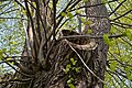
memorable tree in Ústí nad Labem District, Czech Republic  | |||||
| Upload media | |||||
| Instance of |
| ||||
|---|---|---|---|---|---|
| Located in protected area | |||||
| Location | Povrly, Ústí nad Labem District, Ústí nad Labem Region, Czechia | ||||
| Maintained by | |||||
| Height |
| ||||
 | |||||
Media in category "Maškovická lípa"
The following 4 files are in this category, out of 4 total.
-
 Památná Maškovická lípa 01.jpg 880 × 1,320; 887 KB
-
 Památná Maškovická lípa 02.jpg 1,320 × 880; 843 KB
-
 Památná Maškovická lípa 03.jpg 880 × 1,320; 815 KB
-
 Památná Maškovická lípa 04.jpg 1,320 × 880; 897 KB


