Category:Macduff, Aberdeenshire

town in Aberdeenshire, Scotland, UK  | |||||
| Upload media | |||||
| Instance of |
| ||||
|---|---|---|---|---|---|
| Part of |
| ||||
| Location |
| ||||
| Population |
| ||||
 | |||||
Subcategories
This category has the following 14 subcategories, out of 14 total.
A
- Macduff Arms (pub) (2 F)
M
- Macduff Distillery (2 F)
- Macduff Marine Aquarium (8 F)
- Macduff Pier Lighthouse (9 F)
- Macduff railway station (4 F)
- Macduff Town Hall (4 F)
- Macduff War Memorial (7 F)
O
- The Old Moray (2 F)
P
- Macduff Parish Church (19 F)
R
- Royal Tarlair Golf Club (6 F)
T
- Tarlair Swimming Pool (19 F)
Media in category "Macduff, Aberdeenshire"
The following 65 files are in this category, out of 65 total.
-
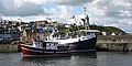 'Puffin' in Macduff Harbour - geograph.org.uk - 434405.jpg 640 × 319; 184 KB
-
 Admiralty Chart No 1442 Banff and Macduff, Published 1842.jpg 5,448 × 4,440; 3.85 MB
-
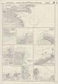 Admiralty Chart No 1462 Harbours on the (North and) East Coasts of Scotland, Published 1962.jpg 6,818 × 9,842; 21.33 MB
-
 Banff and Macduff across Boyndie Bay - geograph.org.uk - 2717027.jpg 1,600 × 483; 131 KB
-
 Banff Harbour Wall and Macduff - geograph.org.uk - 1556895.jpg 640 × 480; 80 KB
-
 Burgh Cross, Macduff - geograph.org.uk - 3533858.jpg 5,184 × 3,456; 6.87 MB
-
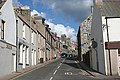
 Church Street - geograph.org.uk - 861545.jpg 640 × 404; 226 KB
-
 Coastline east of Macduff - geograph.org.uk - 3534062.jpg 5,184 × 3,456; 5.95 MB
-
 Duff Street - geograph.org.uk - 861367.jpg 640 × 427; 239 KB
-
 Dwellings at Macduff - geograph.org.uk - 712197.jpg 640 × 480; 108 KB
-
 Dwellings at Macduff - geograph.org.uk - 755815.jpg 640 × 479; 75 KB
-
 Dwellings at Macduff - geograph.org.uk - 764865.jpg 640 × 480; 74 KB
-
 Eroded Gravestone - geograph.org.uk - 861563.jpg 427 × 640; 262 KB
-
 Fernie Brae - geograph.org.uk - 685944.jpg 640 × 427; 260 KB
-
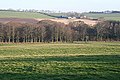
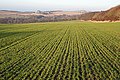 Fields at Corskie - geograph.org.uk - 685885.jpg 640 × 427; 294 KB
-
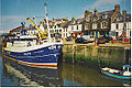 Fishing boat in Macduff Harbour - geograph.org.uk - 106549.jpg 640 × 427; 128 KB
-
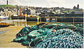
 Fishing Nets - geograph.org.uk - 1356580.jpg 640 × 426; 73 KB
-
 Green in front of Church - geograph.org.uk - 1248682.jpg 640 × 480; 75 KB
-
 House at Kirkside - geograph.org.uk - 1762634.jpg 427 × 640; 307 KB
-
 Institution Street - geograph.org.uk - 861451.jpg 561 × 640; 274 KB
-
 Kirkside - geograph.org.uk - 686080.jpg 640 × 427; 279 KB
-
 Lead on to Macduff^ - geograph.org.uk - 1608199.jpg 640 × 427; 53 KB
-
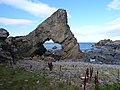
 Loch Craig Natural Arch - geograph.org.uk - 3534003.jpg 5,184 × 3,456; 7.61 MB
-
 Loch Craig sea arch - geograph.org.uk - 2782693.jpg 640 × 427; 71 KB
-
 Loch Craig, near Macduff - geograph.org.uk - 2595739.jpg 800 × 600; 113 KB
-

-
 Macduff - geograph.org.uk - 106552.jpg 640 × 430; 101 KB
-
 Macduff - panoramio.jpg 4,320 × 3,240; 5.67 MB
-
 Macduff and Harbour from the War Memorial - geograph.org.uk - 861487.jpg 640 × 413; 251 KB
-
 Macduff Arts Centre - geograph.org.uk - 3533944.jpg 800 × 1,200; 349 KB
-
 Macduff from the Doune - geograph.org.uk - 861535.jpg 640 × 427; 248 KB
-
 Macduff from the War Memorial - geograph.org.uk - 861500.jpg 640 × 378; 216 KB
-
 Macduff Harbour - geograph.org.uk - 4268206.jpg 3,072 × 2,304; 1.33 MB
-
 Macduff Harbour - geograph.org.uk - 755798.jpg 640 × 480; 70 KB
-
 Macduff Harbour - geograph.org.uk - 776699.jpg 640 × 359; 41 KB
-
 Macduff Harbour - geograph.org.uk - 861356.jpg 640 × 350; 206 KB
-
 Macduff harbour entrance and lighthouse - geograph.org.uk - 5775003.jpg 6,000 × 4,000; 6.38 MB
-
 Macduff in mist from the harbour - geograph.org.uk - 1051970.jpg 640 × 480; 49 KB
-
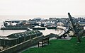
 Macduff Lifeboat - geograph.org.uk - 861465.jpg 640 × 427; 239 KB
-
 Macduff Parish Kirkyard - geograph.org.uk - 861551.jpg 640 × 427; 246 KB
-
 Macduff, a view over the harbour - geograph.org.uk - 4883159.jpg 640 × 401; 57 KB
-
 Macduff, Harbour and Town - geograph.org.uk - 251750.jpg 640 × 373; 137 KB
-
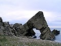
 Natural Arch in Loch Craig - geograph.org.uk - 4266185.jpg 1,600 × 918; 474 KB
-
 Ordnance Survey One-inch Sheet 30 Banff, Published 1959.jpg 8,357 × 9,893; 9.91 MB
-
 Repair Yard at Macduff Harbour - geograph.org.uk - 1463356.jpg 640 × 423; 88 KB
-
 Rocks at Loch Craig - geograph.org.uk - 2595747.jpg 800 × 600; 124 KB
-
 Rocks by Tarlair Swimming Pool - geograph.org.uk - 764832.jpg 640 × 480; 69 KB
-
 Rocks north of Macduff - geograph.org.uk - 593343.jpg 640 × 398; 205 KB
-
 Rocks north of Macduff Harbour - geograph.org.uk - 593334.jpg 640 × 368; 187 KB
-
 Rocky coastline at Macduff - geograph.org.uk - 3490392.jpg 800 × 600; 174 KB
-
 Rocky Shore at Macduff - geograph.org.uk - 1356573.jpg 640 × 426; 57 KB
-
 Scotia Depicta - Needle's Eye -Plate-.jpg 2,500 × 1,695; 3.69 MB
-
 Shelter Belt - geograph.org.uk - 685890.jpg 640 × 427; 308 KB
-
 Shore Street (A98) - Macduff, Scotland, UK - Ca. May 8, 1989.jpg 7,500 × 5,000; 26.2 MB
-
 Smiles 1876 b2192983x 0233 Tarlair.jpg 1,507 × 2,324; 1.18 MB
-
 Tarlair, Macduff, Scotland LOC 3450328560.jpg 1,024 × 765; 217 KB
-
 Tarlair, Macduff, Scotland-LCCN2002695022.jpg 3,666 × 2,738; 2.83 MB
-
 Tarlair, Macduff, Scotland-LCCN2002695022.tif 3,666 × 2,738; 28.72 MB
-
 The Anchor on the Doune - geograph.org.uk - 861512.jpg 640 × 410; 228 KB
-
 The Coast at Macduff - geograph.org.uk - 764840.jpg 640 × 480; 71 KB
-
 The Coastline at Macduff - geograph.org.uk - 764898.jpg 640 × 480; 48 KB
-

-
 The Scurr and High Shore - geograph.org.uk - 6063844.jpg 640 × 427; 369 KB
-
 Track in the Woods - geograph.org.uk - 685904.jpg 640 × 427; 339 KB
-
 Work in progress in Macduff harbour - geograph.org.uk - 1051964.jpg 640 × 480; 86 KB


_East_Coasts_of_Scotland,_Published_1962.jpg)


_-_Macduff,_Scotland,_UK_-_Ca._May_8,_1989.jpg)


