Category:Maidenhead
town and unparished area in Berkshire, England  | |||||
| Upload media | |||||
| Instance of | |||||
|---|---|---|---|---|---|
| Location | Windsor and Maidenhead, Berkshire, South East England, England | ||||
| Located in or next to body of water | |||||
| Population |
| ||||
| official website | |||||
 | |||||
Subcategories
This category has the following 15 subcategories, out of 15 total.
Media in category "Maidenhead"
The following 200 files are in this category, out of 573 total.
(previous page) (next page)-
 "Brocket" Boyn Hill Avenue - geograph.org.uk - 5769652.jpg 4,814 × 3,256; 3.41 MB
-

-
 25 Broadway, Maidenhead.jpg 2,560 × 1,920; 2.3 MB
-
 3 Mobile, Maidenhead - geograph.org.uk - 3607677.jpg 640 × 430; 58 KB
-
 3 offices on Grenfell Place, Maidenhead - geograph.org.uk - 2811983.jpg 1,600 × 1,200; 591 KB
-
 3 offices on the A308, Maidenhead - geograph.org.uk - 4615083.jpg 2,124 × 1,450; 1,005 KB
-
 90 Moorbridge Road, Maidenhead.jpg 2,560 × 1,920; 2.16 MB
-
 A closed club - geograph.org.uk - 4282859.jpg 640 × 528; 69 KB
-
 A308 - geograph.org.uk - 3529680.jpg 640 × 401; 56 KB
-
 A308 - geograph.org.uk - 3607687.jpg 640 × 430; 71 KB
-
 A308, Maidenhead - geograph.org.uk - 5377324.jpg 640 × 426; 61 KB
-
 A308, Maidenhead - geograph.org.uk - 5377332.jpg 640 × 426; 81 KB
-
 A4 - geograph.org.uk - 3607604.jpg 640 × 430; 69 KB
-
 A4 Bath Road nears Oldfield Road - geograph.org.uk - 4862407.jpg 640 × 480; 90 KB
-
 A4 Bath Road, Maidenhead - geograph.org.uk - 6423707.jpg 1,024 × 684; 291 KB
-
 A4 Bath Road, Maidenhead - geograph.org.uk - 6423710.jpg 1,024 × 684; 346 KB
-
 A4 Bath Road, Maidenhead - geograph.org.uk - 6423714.jpg 1,024 × 684; 434 KB
-
 A4 Bridge over the River Thames - geograph.org.uk - 5375133.jpg 640 × 273; 35 KB
-
 A4 Bridge Road, Maidenhead - geograph.org.uk - 6178043.jpg 1,024 × 684; 349 KB
-
 A4, Bad Godesburg Way, Maidenhead - geograph.org.uk - 6178034.jpg 1,024 × 684; 358 KB
-
 A4, Bridge Rd - geograph.org.uk - 3560050.jpg 640 × 430; 87 KB
-
 A4, Bridge Rd - geograph.org.uk - 4168698.jpg 640 × 430; 69 KB
-
 A4, Maidenhead - geograph.org.uk - 3560044.jpg 640 × 430; 61 KB
-
 A4, Maidenhead Bridge - geograph.org.uk - 4168705.jpg 640 × 430; 75 KB
-
 A4094 - geograph.org.uk - 3561381.jpg 640 × 430; 67 KB
-
 A4094 - geograph.org.uk - 3561400.jpg 640 × 430; 88 KB
-
 A4094 Lower Cookham Road - geograph.org.uk - 6178053.jpg 1,024 × 684; 425 KB
-
 A4094 Lower Cookham Road - geograph.org.uk - 6178056.jpg 1,024 × 684; 438 KB
-
 A4094 Lower Cookham Road - geograph.org.uk - 6178058.jpg 1,024 × 684; 347 KB
-
 A4094 Ray Mead Road, Maidenhead - geograph.org.uk - 6178047.jpg 1,024 × 684; 384 KB
-
 Ad hoc anti-'traveller' barrier, North Town Moor - geograph.org.uk - 3753789.jpg 1,024 × 768; 338 KB
-
 Ada Lewis Trough, Maidenhead - geograph.org.uk - 2545945.jpg 1,024 × 680; 259 KB
-
 Albert Street , Maidenhead - geograph.org.uk - 4120002.jpg 3,508 × 2,960; 2.78 MB
-
 Aldebury Road, Maidenhead - geograph.org.uk - 855570.jpg 640 × 480; 150 KB
-
 All Saints Church, Boyn Hill Road - geograph.org.uk - 5769664.jpg 5,472 × 3,648; 4.08 MB
-

-

-
 All Saints, Boyn Hill, Maidenhead - geograph.org.uk - 5896058.jpg 480 × 640; 93 KB
-
 All Saints, Boyn Hill, Maidenhead - geograph.org.uk - 5896110.jpg 640 × 480; 93 KB
-
 All Saints, Boyn Hill, Maidenhead - geograph.org.uk - 5896193.jpg 640 × 640; 116 KB
-
 All Saints, Boyn Hill, Maidenhead - geograph.org.uk - 5898170.jpg 621 × 640; 109 KB
-
 All Saints, Boyn Hill, Maidenhead - geograph.org.uk - 5898284.jpg 640 × 480; 86 KB
-

-

-

-

-

-
 Allotments, North Town, Maidenhead - geograph.org.uk - 855565.jpg 640 × 480; 172 KB
-
 ARM, Maidenhead - geograph.org.uk - 3560037.jpg 640 × 430; 80 KB
-
 Atkinson Keane - geograph.org.uk - 3555572.jpg 640 × 430; 90 KB
-
 B3028 - geograph.org.uk - 5922101.jpg 1,024 × 681; 141 KB
-

-
 Bath Road at the junction of Boyn Hill Road - geograph.org.uk - 4609598.jpg 2,304 × 1,728; 807 KB
-
 Bath Road entering Maidenhead - geograph.org.uk - 2811945.jpg 1,442 × 1,194; 564 KB
-

-

-

-
 Benchmark on garage of ^20 Braywick Road - geograph.org.uk - 2193317.jpg 600 × 800; 126 KB
-
 Benchmark on Gringer Hill railway bridge - geograph.org.uk - 2193863.jpg 632 × 800; 193 KB
-

-

-
 Benchmark on The Anchor pub, York Road - geograph.org.uk - 2193498.jpg 600 × 800; 194 KB
-
 Benchmark on the Job Centre, 3 Park Road - geograph.org.uk - 2193552.jpg 600 × 800; 167 KB
-

-
 Blackmoor Lane - geograph.org.uk - 3607498.jpg 640 × 430; 69 KB
-
 Blackmoor Lane - geograph.org.uk - 3607504.jpg 640 × 430; 66 KB
-
 Boat on the River Thames - geograph.org.uk - 3561336.jpg 640 × 430; 92 KB
-
 Boulters Court - geograph.org.uk - 3561498.jpg 640 × 430; 109 KB
-
 Boulters Meadow - geograph.org.uk - 3607506.jpg 640 × 430; 75 KB
-
 Boyn Hill's Anglican community - geograph.org.uk - 5896154.jpg 640 × 433; 75 KB
-

-
 Braywick Road at the entrance to the sports ground - geograph.org.uk - 3665528.jpg 2,048 × 1,536; 1.49 MB
-
 Braywick Road, Maidenhead - geograph.org.uk - 3665530.jpg 2,048 × 1,536; 1.41 MB
-
 Braywick Road, Maidenhead - geograph.org.uk - 6178021.jpg 1,024 × 684; 378 KB
-
 Bridge Eyot - geograph.org.uk - 4168739.jpg 640 × 430; 85 KB
-
 Bridge Gardens - geograph.org.uk - 4168703.jpg 640 × 430; 119 KB
-
 Bridge Gardens - geograph.org.uk - 4168707.jpg 640 × 430; 105 KB
-
 Bridge Rd - geograph.org.uk - 4168695.jpg 640 × 430; 94 KB
-
 Bridge Rd, A4 - geograph.org.uk - 4168697.jpg 640 × 430; 80 KB
-
 Bridgwater Lodge.jpg 4,608 × 2,592; 3.87 MB
-
 Broadway - geograph.org.uk - 3529683.jpg 640 × 430; 72 KB
-
 Broadway - geograph.org.uk - 3607653.jpg 640 × 430; 74 KB
-
 Broadway - geograph.org.uk - 4207808.jpg 640 × 430; 71 KB
-
 Broadway - geograph.org.uk - 4739989.jpg 640 × 426; 75 KB
-
 Brookwood Cottage - geograph.org.uk - 3607453.jpg 640 × 430; 69 KB
-

-
 Built in 1870 - geograph.org.uk - 5962919.jpg 5,022 × 2,749; 1.99 MB
-
 Bus stop on Braywick Road, Maidenhead - geograph.org.uk - 3665532.jpg 2,048 × 1,536; 1.5 MB
-
 Business premises - geograph.org.uk - 4168684.jpg 640 × 430; 72 KB
-
 C S Lewis Salvage Experts - geograph.org.uk - 5315717.jpg 640 × 426; 76 KB
-
 Cadet Hut, Holman Leaze - geograph.org.uk - 3607575.jpg 640 × 430; 101 KB
-
 Cannon in Grenfell Park - geograph.org.uk - 4119984.jpg 2,592 × 3,066; 2.31 MB
-
 Car park entrance, Broadway - geograph.org.uk - 4739986.jpg 640 × 426; 70 KB
-
 Carved Log beside Bray Road - geograph.org.uk - 5963733.jpg 4,712 × 3,450; 3.3 MB
-
 Carved tree trunk by Strand Water - geograph.org.uk - 5316645.jpg 5,202 × 3,465; 4.72 MB
-
 Carving and Bench - geograph.org.uk - 4116293.jpg 3,760 × 2,672; 3.41 MB
-
 Carving with a Can - geograph.org.uk - 4116642.jpg 1,067 × 1,600; 759 KB
-
 Chapel Arches Maidenhead.jpg 768 × 576; 270 KB
-
 Chapel Arches.jpg 1,600 × 1,200; 566 KB
-
 Chef Peking - geograph.org.uk - 3561378.jpg 640 × 430; 85 KB
-
 Chestnut Close - geograph.org.uk - 3607470.jpg 640 × 430; 91 KB
-
 Church Close quadrangle - geograph.org.uk - 3209827.jpg 1,900 × 1,425; 686 KB
-
 Cincom - geograph.org.uk - 4282854.jpg 640 × 430; 59 KB
-
 Cincom - geograph.org.uk - 5377330.jpg 640 × 426; 77 KB
-
 Cincom Offices - geograph.org.uk - 4739972.jpg 640 × 426; 60 KB
-
 Cincom Offices - geograph.org.uk - 4739974.jpg 640 × 426; 69 KB
-
 Cinecom - geograph.org.uk - 3607680.jpg 640 × 430; 62 KB
-
 City centre, Maidenhead - geograph.org.uk - 4207786.jpg 640 × 430; 63 KB
-
 Claires Court School - geograph.org.uk - 3607451.jpg 640 × 430; 93 KB
-
 Cliveden View Shopping Centre - geograph.org.uk - 5980596.jpg 4,902 × 3,142; 1.73 MB
-
 Clock Tower - geograph.org.uk - 4739981.jpg 426 × 640; 75 KB
-
 Colourful Tree, Walker Road - geograph.org.uk - 5962955.jpg 4,848 × 2,818; 1.97 MB
-
 Concorde Business Park, Maidenhead - geograph.org.uk - 6024765.jpg 4,510 × 2,933; 2.66 MB
-
 Cookham Road approaching Bridge Road - geograph.org.uk - 4566988.jpg 2,560 × 1,920; 2 MB
-
 Cookham Road, Maidenhead - geograph.org.uk - 5980626.jpg 4,845 × 3,048; 2.02 MB
-
 Cookham Road, Maidenhead - geograph.org.uk - 849526.jpg 640 × 480; 118 KB
-
 Cox Green , Bath Road A4 - geograph.org.uk - 6267978.jpg 4,608 × 3,456; 3.96 MB
-
 Cox Green , Junction 9B The Thicket - geograph.org.uk - 6267977.jpg 4,608 × 3,456; 4.35 MB
-
 Cox Green , The A404(M) - geograph.org.uk - 6267979.jpg 4,608 × 3,456; 4.24 MB
-
 Cox Green , The A404(M) - geograph.org.uk - 6267980.jpg 4,608 × 3,456; 5.35 MB
-
 Cox Green , The A404(M) - geograph.org.uk - 6267981.jpg 4,608 × 3,456; 4.96 MB
-
 Cresset Towers - geograph.org.uk - 122682.jpg 640 × 493; 85 KB
-
 Cul-de-sac off Holman Leaze - geograph.org.uk - 3607561.jpg 640 × 430; 62 KB
-
 Demolished buildings - geograph.org.uk - 3321008.jpg 640 × 480; 84 KB
-
 Derek Rd - geograph.org.uk - 3561412.jpg 640 × 430; 115 KB
-
 Derelict building, Queen St - geograph.org.uk - 4207824.jpg 640 × 430; 66 KB
-
 Derelict Office - geograph.org.uk - 1448018.jpg 640 × 480; 179 KB
-
 Desborough Bowling Club - geograph.org.uk - 3556034.jpg 640 × 430; 55 KB
-
 Disused building, Maidenhead station - geograph.org.uk - 4666138.jpg 1,024 × 768; 152 KB
-
 Diwa Indian Restaurant - geograph.org.uk - 4115377.jpg 3,772 × 2,744; 1.93 MB
-
 Drainage channel in Maidenhead - geograph.org.uk - 3556040.jpg 640 × 430; 112 KB
-
 Dustywing (FP HH) (23923457241).jpg 1,620 × 1,080; 368 KB
-
 Empty Premises, St Mark's Road - geograph.org.uk - 5769590.jpg 5,039 × 3,140; 3.57 MB
-
 Entering Maidenhead on Bath Road - geograph.org.uk - 2811950.jpg 1,600 × 1,200; 617 KB
-
 Entrance to Football Ground - geograph.org.uk - 3556025.jpg 640 × 430; 58 KB
-
 Entrance to pergola and panel garden at Woolley Hall near Maidenhead.png 970 × 552; 877 KB
-
 Entrance to The Bridge Clinic - geograph.org.uk - 3560051.jpg 640 × 430; 133 KB
-
 Entrance to the Haven of Rest, Bridge Street - geograph.org.uk - 3668272.jpg 3,000 × 4,000; 4.34 MB
-
 Everslet Insurance Services - geograph.org.uk - 3560038.jpg 640 × 430; 79 KB
-
 Eyot, River Thames - geograph.org.uk - 3561403.jpg 640 × 430; 90 KB
-
 Eyots on the Thames - geograph.org.uk - 3561386.jpg 640 × 378; 79 KB
-
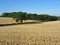 Farmland and copse, Maidenhead - geograph.org.uk - 910781.jpg 640 × 480; 151 KB
-

-
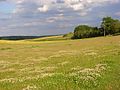 Farmland, Maidenhead - geograph.org.uk - 857228.jpg 640 × 480; 145 KB
-
 Farmland, Maidenhead - geograph.org.uk - 857233.jpg 640 × 480; 147 KB
-
 Flats backing onto the A308, Maidenhead - geograph.org.uk - 4615077.jpg 2,234 × 1,632; 1.1 MB
-
 Flooded watercourse - geograph.org.uk - 3846764.jpg 640 × 480; 79 KB
-
 Flooded watercourse - geograph.org.uk - 3846772.jpg 640 × 480; 88 KB
-
 Foot Tunnel under the Railway - geograph.org.uk - 248296.jpg 640 × 480; 68 KB
-
 Football ground - geograph.org.uk - 5922096.jpg 1,024 × 681; 222 KB
-
 Footbridge in Maidenhead - geograph.org.uk - 3556039.jpg 640 × 430; 132 KB
-
 Footbridges over White Brook - geograph.org.uk - 2178846.jpg 640 × 425; 111 KB
-
 Footbridges over White Brook - geograph.org.uk - 2178859.jpg 640 × 425; 104 KB
-
 Footpath alongside The Cut - geograph.org.uk - 3671197.jpg 4,000 × 3,000; 4.15 MB
-

-
 Footpath off Blackmoor Lane - geograph.org.uk - 3607517.jpg 640 × 430; 86 KB
-
 Footpath off Dereswood - geograph.org.uk - 3607487.jpg 640 × 430; 76 KB
-
 Footpath to Blackmoor Lane - geograph.org.uk - 3607496.jpg 640 × 430; 89 KB
-
 Footpath under the railway - geograph.org.uk - 4207596.jpg 640 × 430; 122 KB
-
 Forelease Rd - geograph.org.uk - 5922098.jpg 1,024 × 681; 178 KB
-
 Forenza, Moorbridge Rd - geograph.org.uk - 3560035.jpg 640 × 430; 76 KB
-
 Forlease Rd, Moorbridge Rd junction - geograph.org.uk - 4168683.jpg 640 × 430; 56 KB
-
 Forlease Road at the junction of Moorbridge Road - geograph.org.uk - 2811971.jpg 1,600 × 1,200; 626 KB
-
 Former Technical School, Marlow Road - geograph.org.uk - 4122993.jpg 640 × 466; 88 KB
-
 Former Technical School, Marlow Road, Maidenhead.jpg 2,560 × 1,920; 2.32 MB
-
 Frascati Way, Maidenhead - geograph.org.uk - 4867669.jpg 2,048 × 1,536; 1.5 MB
-
 Garden entrance at Woolley Hall near Maidenhead.png 712 × 970; 1.25 MB
-
 Garden house at Woolley Hall near Maidenhead.png 700 × 717; 846 KB
-
 Geological map of Maidenhead district Wellcome M0016957.jpg 2,792 × 3,924; 4.89 MB
-
 Grass Eyot - geograph.org.uk - 4168759.jpg 640 × 430; 91 KB
-
 Great Western Main Line, Maidenhead - geograph.org.uk - 4207608.jpg 640 × 430; 88 KB
-
 Great Western Main Line, Maidenhead - geograph.org.uk - 4207611.jpg 640 × 430; 72 KB
-
 Green Way - geograph.org.uk - 3206899.jpg 2,272 × 1,704; 3.53 MB
-
 Greenoaks Performance Cars on Bath Road - geograph.org.uk - 4612533.jpg 2,304 × 1,728; 1.22 MB
-
 Greggs, Maidenhead - geograph.org.uk - 4168674.jpg 640 × 430; 70 KB
-
 Grenfell Park, Maidenhead - geograph.org.uk - 89700.jpg 597 × 400; 107 KB
-
 Grenfell Road, Maidenhead - geograph.org.uk - 4252327.jpg 4,000 × 3,000; 1.96 MB
-
 Grosvenor Drive - geograph.org.uk - 3561405.jpg 640 × 430; 80 KB
-
 Grosvenor Drive - geograph.org.uk - 4168764.jpg 640 × 430; 85 KB
-
 Grove Rd - geograph.org.uk - 3556028.jpg 640 × 430; 72 KB
-
 Guards Club Park Maidenhead.jpg 768 × 576; 205 KB
-
 GW main line crossing the Jubilee River (17340495615).jpg 3,648 × 2,432; 1.9 MB
-
 Haven of Rest - geograph.org.uk - 4168694.jpg 640 × 430; 101 KB
-
 Haven of Rest Almshouses Maidenhead - geograph.org.uk - 958707.jpg 640 × 480; 65 KB
-
 Haven of Rest Almshouses.jpg 2,560 × 1,920; 2.12 MB
-
 Haven of Rest, Bridge Street - geograph.org.uk - 3668265.jpg 4,000 × 3,000; 4.28 MB
-
 Haven of Rest, Bridge Street - geograph.org.uk - 3668268.jpg 4,000 × 3,000; 4.1 MB
-
 Hay Field alongside Green Lane - geograph.org.uk - 5963727.jpg 5,184 × 3,456; 4.1 MB
-
 Headquarters of the Commonwealth War Graves Commission.jpg 2,560 × 1,920; 2.26 MB
-
 Heron in the river - geograph.org.uk - 5963721.jpg 4,604 × 3,292; 2.03 MB
-
 High St Colonnade - geograph.org.uk - 4168678.jpg 640 × 430; 76 KB
-
 High St, Maidenhead - geograph.org.uk - 4168675.jpg 640 × 430; 88 KB
-
 High Street, Maidenhead - geograph.org.uk - 664197.jpg 640 × 469; 79 KB
-
 High Street, Maidenhead.jpg 2,560 × 1,920; 2.01 MB
-
 Hindhay Lane, Maidenhead - geograph.org.uk - 857229.jpg 640 × 480; 134 KB
-
 Hindhay Lane, Maidenhead - geograph.org.uk - 857232.jpg 640 × 480; 141 KB
-

-
 Hobgoblin - geograph.org.uk - 3607632.jpg 640 × 430; 75 KB
-
 Holman Leaze - geograph.org.uk - 3607535.jpg 640 × 430; 60 KB
-
 Horses in a parched paddock near Bray - geograph.org.uk - 5871223.jpg 4,032 × 3,024; 5.32 MB

%27_(11297480765).jpg)


_-_geograph.org.uk_-_6267979.jpg)
_-_geograph.org.uk_-_6267980.jpg)
_-_geograph.org.uk_-_6267981.jpg)


_(23923457241).jpg)


.jpg)


